Clearer ratings and flood capture: two ImpactResponse enhancements

As Chief Product Officer at Nearmap, David leads the vision and delivery of property intelligence solutions that power faster, more informed decisions. He has over two decades of experience building data-driven products that transform how insurers assess risk, improve efficiency, and serve their customers.
As Chief Product Officer at Nearmap, David leads the vision and delivery of property intelligence solutions that power faster, more informed decisions. He has over two decades of experience building data-driven products that transform how insurers assess risk, improve efficiency, and serve their customers.
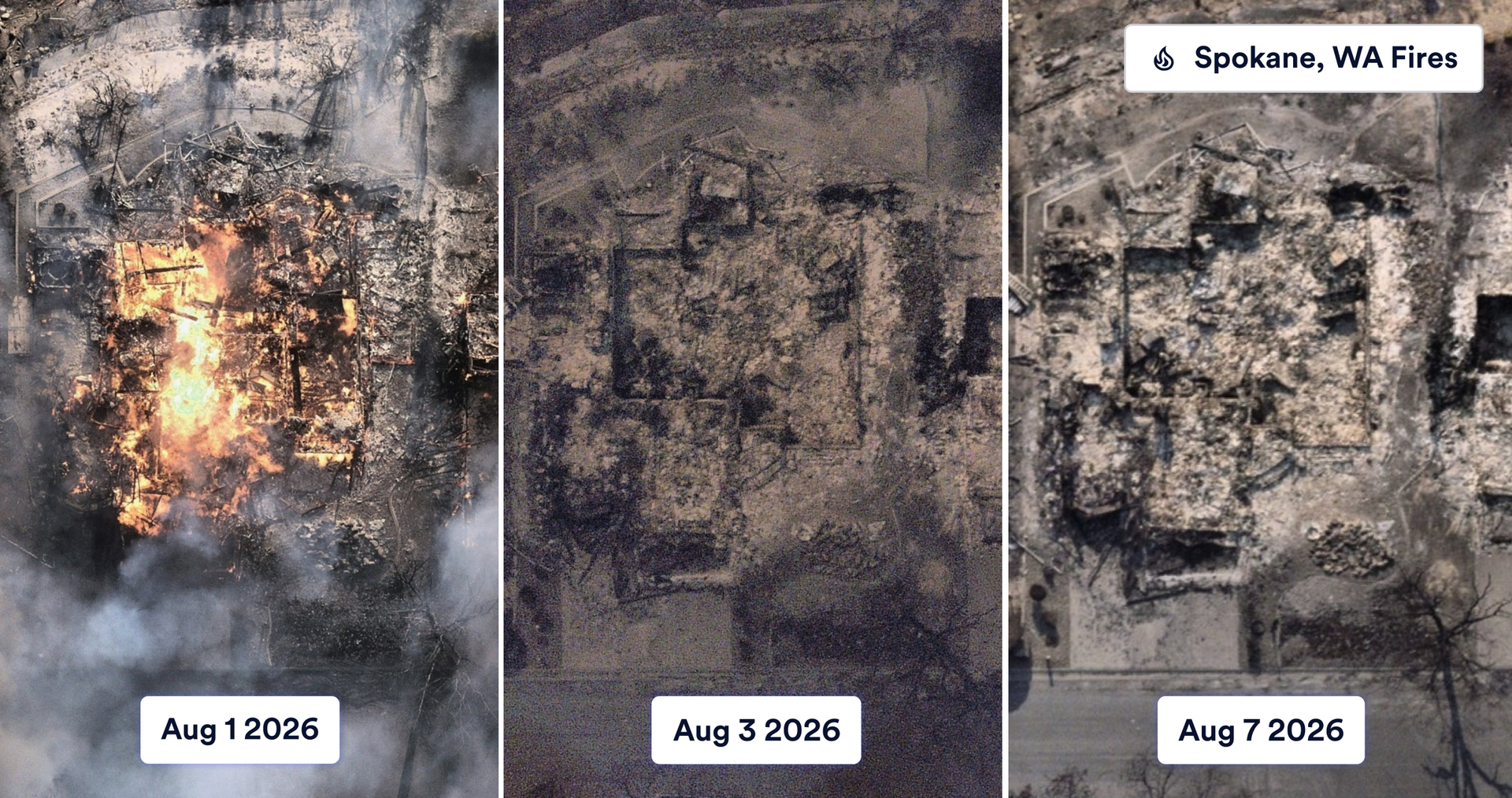
When catastrophe strikes, getting a clear picture of the damage is critical to an effective response. Nearmap ImpactResponse combines high-resolution aerial imagery with Nearmap AI damage detection to help insurers and emergency response teams quickly identify affected properties, assess damage severity, and prioritize response and recovery efforts.
Two ImpactResponse enhancements build on that foundation. The Damage Conflation API turns every flight into one answer, a single rating per building for the whole event, and flood capture extends the program to river flooding across the United States.
1. Damage Conflation API: one rating per building for the whole event
As an event unfolds, Nearmap may capture the same affected area multiple times, providing updated imagery and damage assessments as conditions change, and those repeated captures can sometimes tell different stories. A house flown over three times can carry three different ratings, No Damage on Monday through smoke, Minor on Wednesday, then Major on Friday once the air clears.
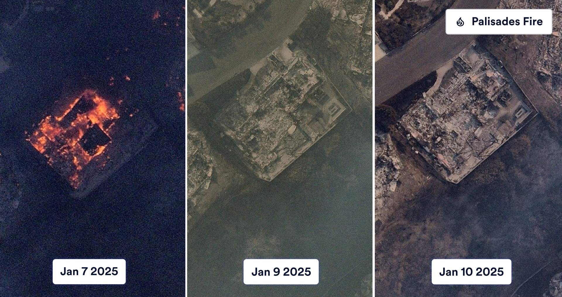
Smoke, cloud, shadow, and debris can hide parts of a roof on one pass and leave them visible on the next, so each flight can rate the same building differently. The Damage Conflation API, an enhancement to Damage Classification, combines every capture of an event into a single best-of-event rating per building. Built on the ImpactResponse capture program, it draws on our own aircraft and AI.
It uses the same five classes as real-time damage, aligned to the Federal Emergency Management Agency (FEMA) five-tier scale:
- No Damage
- Affected
- Minor
- Major
- Destroyed

The API uses the intact pre-event footprint as each building’s outline, clipped to the parcel, so the outline holds even when post-event imagery shows rubble. Where no pre-event footprint exists, it uses the best outline from the post-event captures. Model and dataset version identifiers accompany every response, so any result can be traced to the model and dataset version that produced it.
Real-time ratings remain the fastest first read in the early hours, and the Damage Conflation API returns the consolidated outcome as the event matures, so most customers use both. The house from Monday, Wednesday, and Friday now carries a single rating for the event, backed by a confidence score and the signals behind it.
The Damage Conflation API is available in the US and Australia wherever Nearmap flies a post-catastrophe event, and it is included with ImpactTriage and Damage Classification entitlements, with no separate add-on.
2. Flood capture: ImpactResponse now covers floods in the US
The second enhancement extends ImpactResponse to flooding in the United States, which joins hurricanes, wildfires, and tornadoes as a captured event type. Floods carry a distinct assessment challenge, because water recedes at different rates across a catchment and access routes stay cut long after the peak has passed, which often leaves the most severely affected properties the hardest to reach.
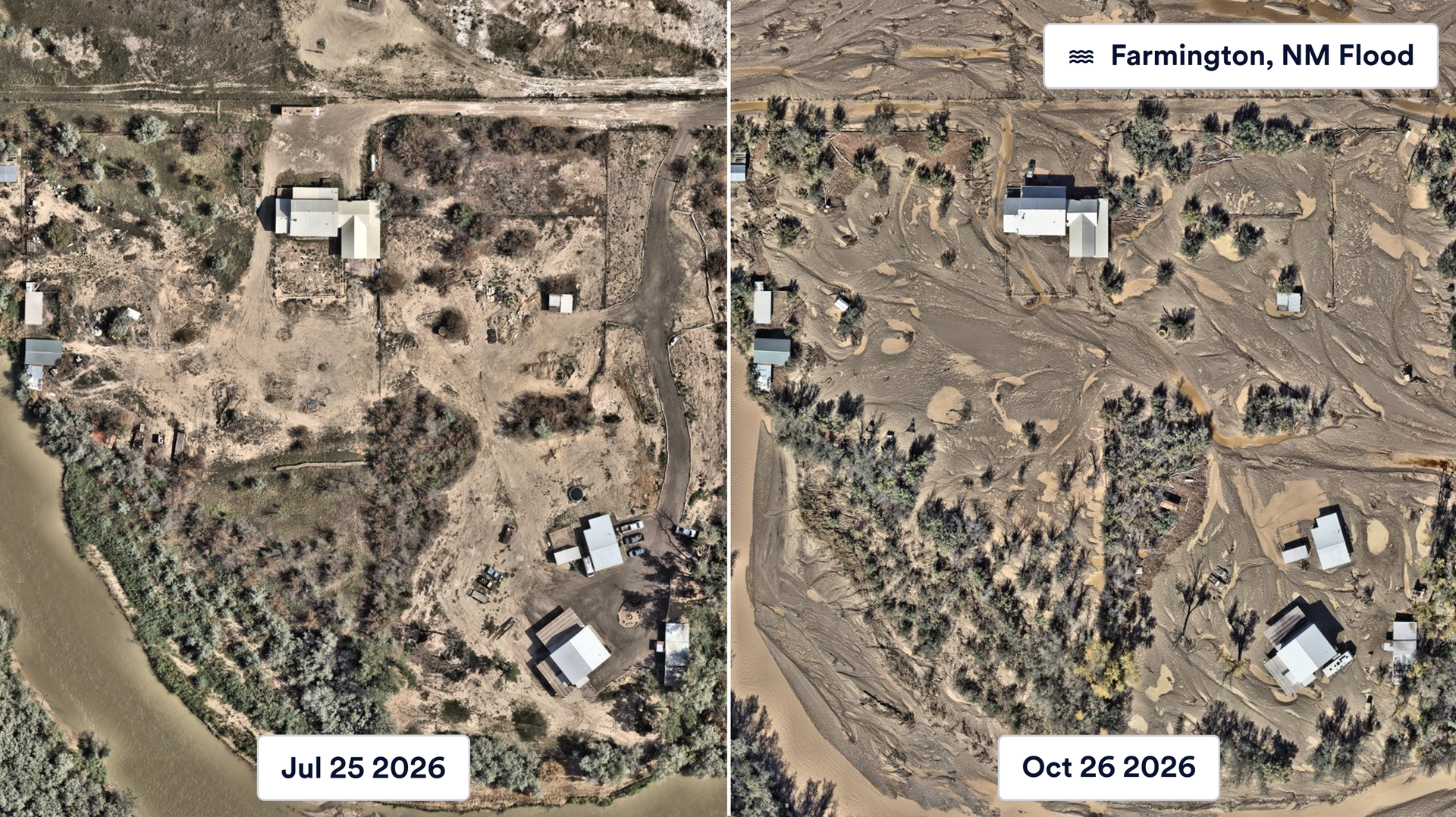
Nearmap tracks National Weather Service river forecasts year-round, and flood capture triggers when a forecast point reaches Major flood stage, the category for the NWS category for extensive inundation of structures and roads, with significant evacuations within Nearmap coverage sit inside the Major flood footprint. Rainfall totals are not the trigger, because the same rainfall produces very different flooding depending on terrain, soil and land use.
Flood capture covers river flooding, and flooding caused by a hurricane or tropical storm, including storm surge, remains part of hurricane capture.
See ImpactResponse in action
If you run catastrophe analytics at a carrier or support emergency response, talk to your Nearmap account team about the Damage Conflation API and flood capture.