Replace uncertainty with evidence
Know your environment — and your next move. Nearmap combines geospatial capture, AI-derived analytics, and validated building materials data into a single source of truth.


Explore

Assess

Compare

Predict danger at any scale
Analyze exposure to fire, cyclone, and hail with real-world data on property condition and regional hazards.

Get on top of roofing
Shape, size, pitch, materials, and condition. Detailed enough to quote on, accurate enough to predict and prevent losses.

Staying ahead of wildfire risk
Identify defensible space, vegetation density, and 3D topography around every property.
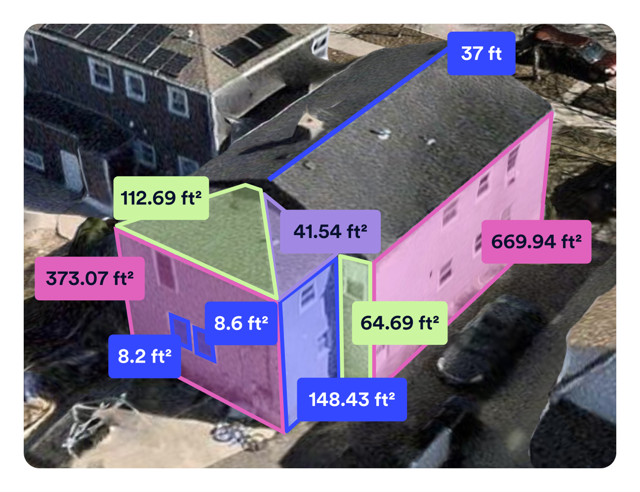
Measure properties faster, from the desk
Precise and fast Roof and Exterior measurements delivered directly into Verisk XactAnalysis®. No dependency on policyholders or on-site adjusters.

Act fast when disaster strikes
When disasters hit, response time is everything. Nearmap AI classifies damage to quickly pinpoint impacted properties.

See what standard property data doesn't
Nearmap AI detects features and conditions like surfaces, vegetation, solar panels, and more — turning imagery into decision-ready intelligence. See how we’re pushing AI further
Find your insights
Insight solutions backed by trusted imagery and data.“Sometimes, Nearmap removes the need to visit a site entirely. If we do walk a site, we can collaborate on the same project as a team and publish updates.”
Dave Walters, GIS manager, CBBEL – Christopher B. Burke Engineering, Ltd.
“If I wanted to do a single design for every home in the United States, it would take me over 2,200 years.”
Bardia Andalib, CEO and Co-Founder, Aerialytic
“We use Nearmap proactively by using passive data and the frequency of the imagery provided throughout the year to plan for our city.”
Kevin Stehle, Business Systems Analyst
“Nearmap imagery is one source of truth that allows us to understand many attributes about a property that standard data sources may not catch. Recent imagery from Nearmap allows us to review the insights against the analytics and truly understand the property’s condition.”
Adam Sturt, SVP of Data and Analytics, Kin Insurance


Insights for every industry
Insurance
Ensure confident decisions across the policy lifecycle with faster underwriting, accurate quoting, and quicker claims settlement.
MoreAECO
Assess site conditions across multiple properties, reduce manual visits, and gain shared intelligence to win more bids.
MoreGovernment
Manage growing jurisdictions, reduce field reliance, and respond faster to compliance and permit violations.
More