Aerial photogrammetry: precision mapping from above
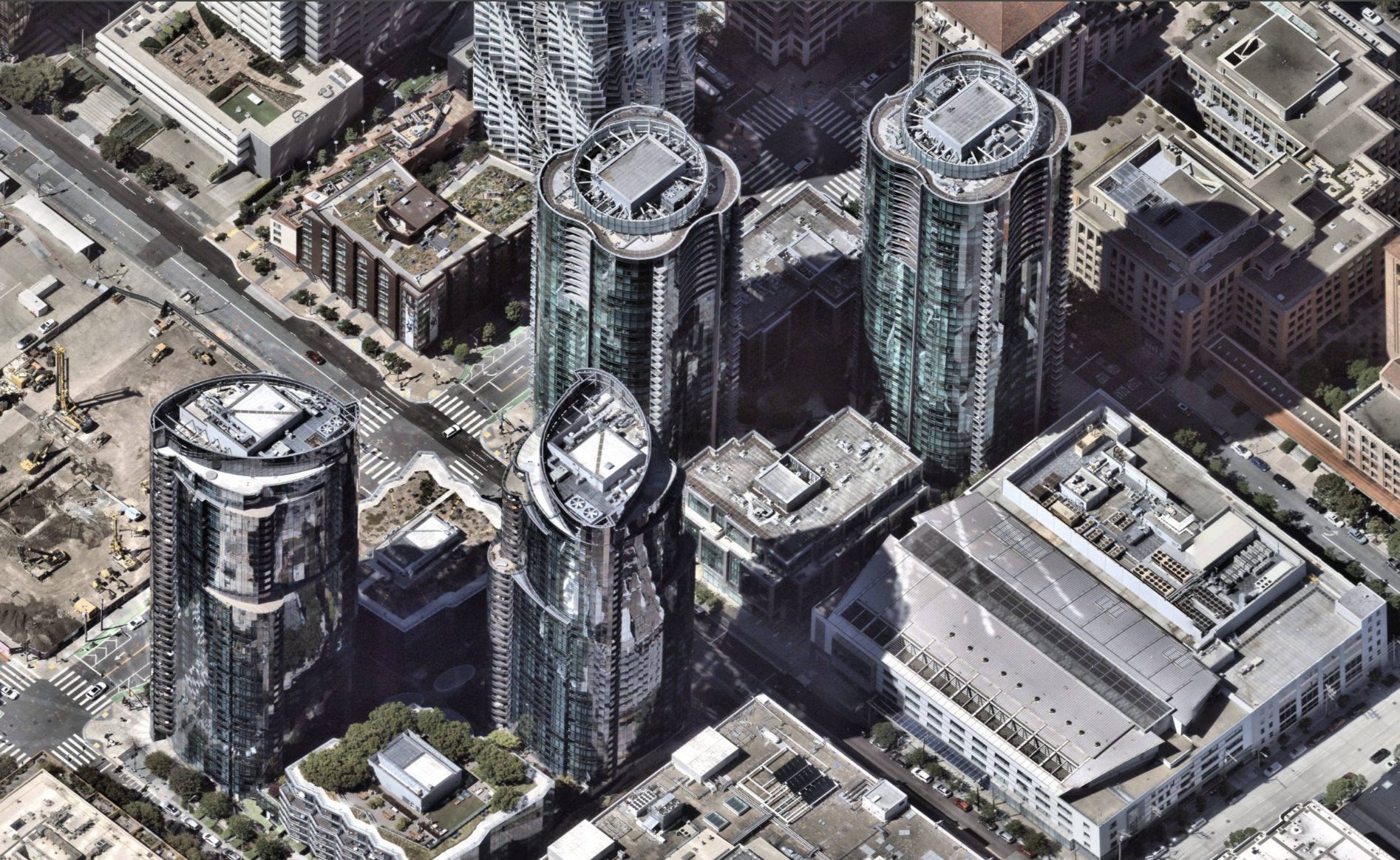
What is aerial photogrammetry?
What does aerial photogrammetry do?
- Generate detailed topographic maps
- Create 3D surface and terrain models
- Deliver volumetric measurements (e.g., stockpiles)
- Provide data for CAD, GIS, and BIM workflows
- Support inspections, compliance, and design validation
What are the techniques of aerial photogrammetry?
- Stereoscopic photogrammetry — Uses overlapping images to create 3D models
- Orthophotography — Corrects geometric distortion to produce map-accurate images
- Structure from Motion (SfM) — Processes multiple images to reconstruct geometry
- LiDAR aerial photogrammetry — Combines LiDAR sensors with imagery for enhanced elevation accuracy
- Oblique imaging — Captures angled views to reveal vertical surfaces and context
Importance of aerial photogrammetry
- Improve construction accuracy and progress tracking
- Inform planning and development decisions
- Detect landform changes or environmental shifts
- Manage infrastructure and public assets
- Monitor large or remote areas without sending field crews
What is the scope of aerial photogrammetry?
- Construction: As-built modeling, cut-fill analysis, site monitoring
- Civil engineering: Pre-design elevation studies and terrain analysis
- Utilities: Infrastructure inspection, corridor mapping, vegetation management
- Mining and aggregates: Stockpile volume calculation, site modeling
- Agriculture: Field mapping, yield forecasting, irrigation planning
- Environmental science: Coastal erosion tracking, wetland preservation, floodplain studies
What are the features of aerial photogrammetry?
- High-resolution imagery — Down to sub-5 cm per pixel
- Accurate georeferencing — GPS-tagged for map alignment
- 3D model generation — Point clouds, mesh, and textured surfaces
- Seamless integration — Compatible with CAD, GIS, and design tools
- Fast processing — Cloud-based platforms for near real-time outputs
- Automated measurements — Distance, area, height, volume
Types of aerial photogrammetry
Based on image orientation
- Vertical photogrammetry — Straight-down imagery, used for mapping and measurement
- Oblique photogrammetry — Angled images, offering elevation and context for facades
Based on the capture method
- Drone-based aerial photogrammetry — Low-altitude, high-detail capture of small areas
- Fixed-wing aircraft — Larger areas covered in high-resolution with consistent altitude and scale
- Hybrid systems — Combine photogrammetry with LiDAR and other sensors
Based on the processing approach
- Manual workflows — Human-led interpretation, QC, and editing
- Automated workflows — AI-driven stitching, modeling, and feature detection
What is the difference between aerial photogrammetry and terrestrial photogrammetry?
Feature | Aerial Photogrammetry | Terrestrial Photogrammetry |
|---|---|---|
Capture method | Aircraft or drone-mounted cameras | Ground-based cameras |
Area coverage | Large-scale (e.g., cities, corridors, assets, infrastructure) | Small-scale (e.g., buildings, statues, assets) |
Application | Mapping, surveying, and engineering | Heritage documentation, 3D scanning |
Accuracy | Sub-decimeter to centimeter | Sub-millimeter (for small objects) |
Perspective | Top-down or angled | Horizontal or vertical from the ground |
- Speed — Captures large areas in hours, not days
- Accuracy — Generates detailed and geo-aligned data
- Scalability — Works for small projects or entire regions
- Safety — Reduces need for on-site field crews
- Cost efficiency — Minimizes repeat visits and manual measurement
- Integration-ready — Usable in GIS, CAD, and modeling platforms
Limitations of aerial photogrammetry
- Weather sensitivity — Requires clear skies and stable light
- Vegetation interference — Dense canopy can block ground detail
- Ground control required — Accurate outputs depend on well-placed reference points
- Terrain distortion — Hilly or shadowed areas may require LiDAR fusion
- Regulatory constraints — Airspace permissions can limit drone operations
Future of aerial photogrammetry
- AI-enhanced modeling — Faster detection of buildings, roads, and features
- Cloud-native platforms — Real-time access and collaboration across teams
- Hybrid sensor fusion — LiDAR aerial photogrammetry + multispectral imaging
- Automated inspections — AI-guided photogrammetric analysis for compliance
- Self-updating digital twins — Live city models driven by recurring aerial data
Frequently asked questions
Your aerial photogrammetry questions answeredTo turn aerial images into measurable, map-accurate spatial data. It supports design, construction, planning, and environmental management.
Overlap, parallax, triangulation, and control. Reliable outputs rely on image redundancy and precise alignment.
Surveyors, engineers, planners, architects, environmental scientists, utilities, and anyone involved in mapping the built or natural environment.
Scales vary depending on the flight height and camera used. Typical outputs range from 1:500 to 1:5,000, with custom resolutions also achievable.
With proper planning and control points, accuracy can reach 2–5 cm for drone-based projects and under 5 cm for wide-area flights.
Software platforms process raw imagery into orthophotos, point clouds, 3D meshes, and models. Leading tools integrate with GIS, CAD, and BIM systems.