Temporal Reasoning Engine: Separate real change from noise

Eleanor McDonald is a Principal Data Scientist (Product) in the AI Map Data team at Nearmap, which produces the AI content derived from Nearmap’s aerial imagery to power the company’s property intelligence products. She focuses on understanding how customers use these data products and helps them get the most value from the data for their businesses.
Eleanor McDonald is a Principal Data Scientist (Product) in the AI Map Data team at Nearmap, which produces the AI content derived from Nearmap’s aerial imagery to power the company’s property intelligence products. She focuses on understanding how customers use these data products and helps them get the most value from the data for their businesses.
“Increasingly, the real question that needs answered is how a place has changed over time. Answering that requires a reasoning system built to work across time, not just within a single image. With that kind of system, you're no longer limited to the individual moments when a capture happened. You get a representation of a location's true state across a continuous history.”
Eleanor McDonald, PhDPrincipal Data Scientist (Product) at Nearmap
Knowing change from noise
A model reasoning across time has to track a specific object, weigh each new observation against everything it’s seen before, and shift its answer only when the evidence justifies it. A single low-confidence detection shouldn’t flip the answer. Multiple independent captures that agree probably should.
“Only then can you confidently answer property questions like ‘Is the condition of this roof deteriorating over time, and if so, what's the rate of decay?’”
Eleanor McDonald, PhDPrincipal Data Scientist (Product) at NearmapOne record, fully traceable
This kind of understanding takes a rich foundation of data — years of consistent, repeated imagery over the same location, plus non-imagery sources like insurance assessor data or building permits filed with local authorities. Combine all of it into one system, and reasoning over time becomes possible for any given location.
Already up and running
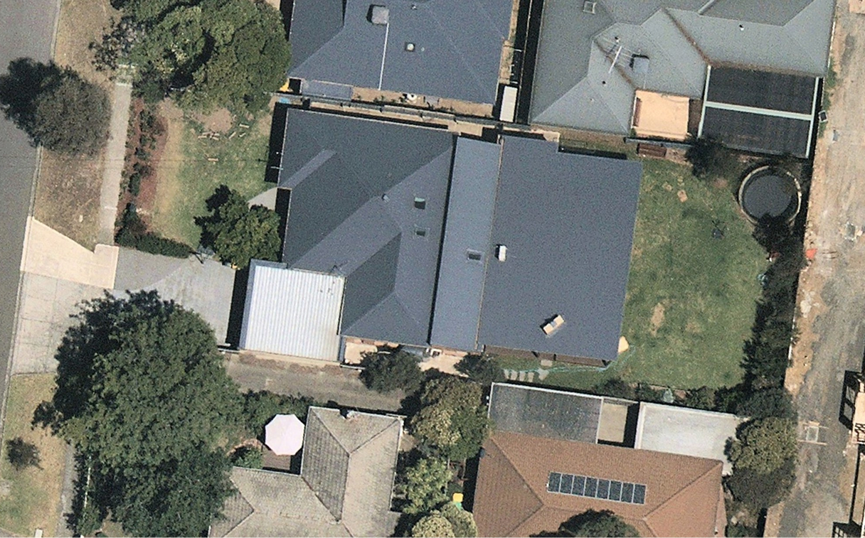
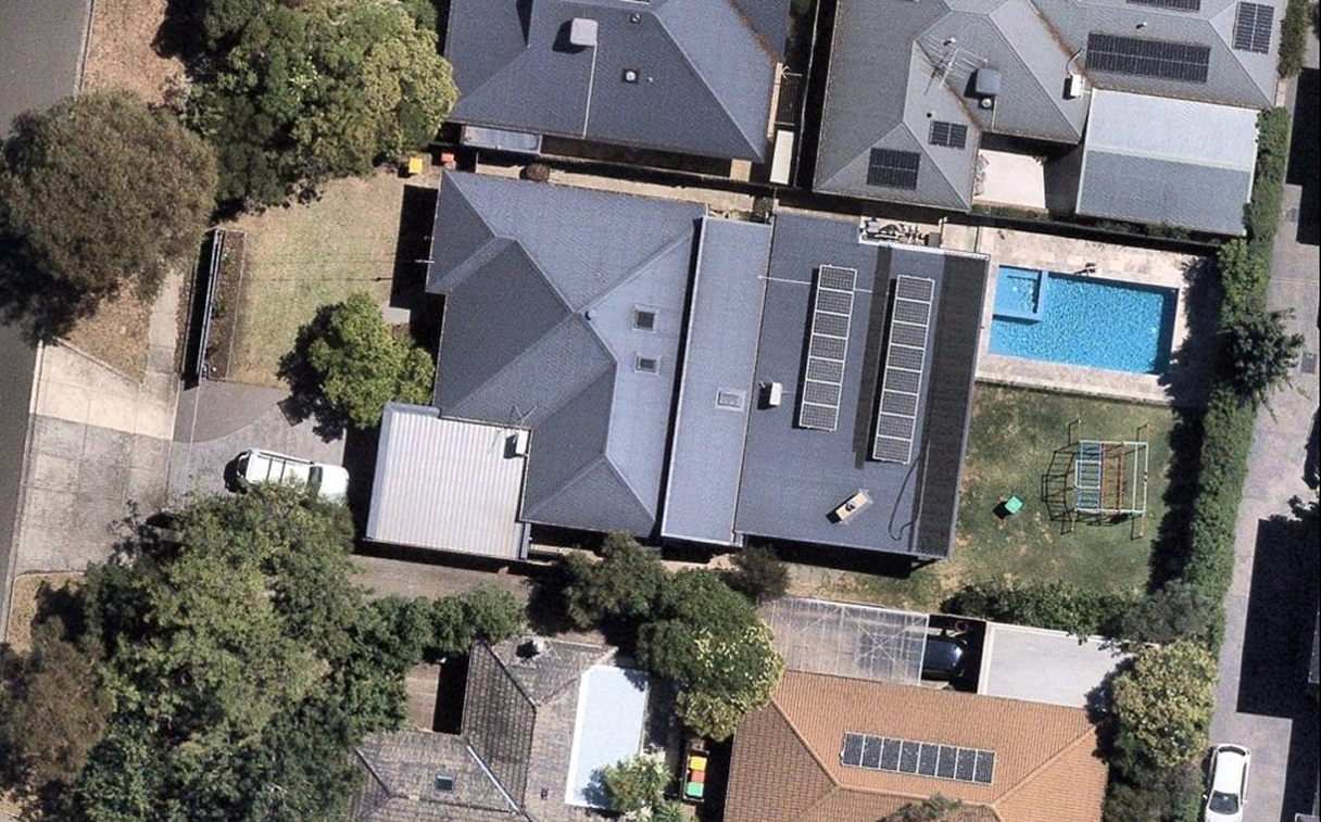
This isn’t a theoretical system. It’s real and already live. Nearmap uses this approach with its aerial imagery to help customers connect the dots between captures.
Calculating roof ageNearmap builds timelines for every roof across the contiguous United States. By examining years of historical imagery, the system works out when a roof was actually replaced. Post-Catastrophe damage assessment runs on the same foundation.Detecting damageSingle-image damage detections can conflict with each other. This used to mean manual reconciliation. Now, multiple captures flown over the same footprint after a storm combine into one stable damage rating per building. That rating is anchored to the clean pre-event image, so you can tell whether damage was pre-existing. Each rating is backed by every capture behind it.

“With Nearmap, property intelligence stops being tied to single, fixed points in time. It becomes continuous instead, dramatically improving your record of the past. Model it well enough, and that past data enables you to predict the future.”
Brett Tully, PhDSenior Director (AI) at NearmapDiscover more from Nearmap Labs
Curious what's next in property intelligence? Meet the team, follow the journey, and join the early access community.
Explore Labs