Build confidence before breaking ground
May 2025
Streamline collaboration and minimize rework on major projects using property intelligence during preconstruction.
May 2025
)
Western Sydney Airport
Keeping pace with the rate and scale of construction projects poses significant challenges. Labor shortages, soaring costs of materials and talent, declining productivity and regulatory pressures are squeezing profit margins so tightly that the industry is grasping at every opportunity to improve their bottom line.
Manage risk and reduce rework costs
Rework is expensive and can reduce yearly profits. But it happens to also be one of just a few major project costs that can be substantially reduced with more accurate data.
There are also the knock-on costs that are harder to quantify: lost productivity, increased safety and compliance risks, timeline blowouts, and wasted materials.
Rework eats profit margins for breakfast. Which is why more accurate data is critical at the earliest stages of a project. It’s about working from reality, not assumptions. Accurate property data helps teams accurately anticipate and mitigate risk on major projects before they break ground. It provides confidence for decision makers as early as the proposals phase, with a comprehensive picture of the facts on the ground.
Here’s how high-resolution aerial imagery, 3D data, and AI-powered property intelligence add value at every stage of preconstruction:
Proposals
Unearth unknowns with accurate site data
Clients want certainty. The best proposals uncover risks, obstructions, or challenges that may be encountered — from topography changes to access challenges and environmental compliance — and include a plan for mitigation. Property intelligence provides this data. For example, a construction firm bidding on a new commercial development can use property intelligence to assess a site’s current condition, such as existing buildings, terrain features, and vegetation.
AI-powered insights can even flag potential issues like vegetation coverage or structural challenges, ensuring that all relevant data is factored into the proposal and potential risks are addressed early on.
View your site in every dimension, even time
The Nearmap library of property intelligence is like a time machine, letting you search 2D and 3D site data by timestamp to track up to 15 years of changes, providing important context that could not be gathered through a site visit. With content updated multiple times a year in metro areas, it also allows you to plot trends or seasonal changes and plan around them.
Data like this gives greater clarity to proposals, allowing the addition of immersive site models, engaging images and meaningful insights that put your propositions top of mind. This allows you to communicate preliminary scenario evaluations, cost estimates, risk mitigation strategies, and change detections in a more compelling way.
Planning
Get the clarity you need from the start
When it comes to major project planning, there’s no shortage of data available. But not all information is equal. Traditional methods like site visits, surveys or drone captures are resource-heavy. Waiting on field data collection can delay access to accurate, up-to-date information which can lead to critical oversights, significant safety risks, and expensive rework. With smarter insights into the site from day one, teams can sidestep delays and design with foresight.
Nearmap on-demand vertical and 3D imagery offers comprehensive site coverage, reducing reliance on site visits, accelerating the planning process, and ensuring the data is up-to-date and detailed enough to move forward with confidence.
For instance, project teams can use 3D models to visualize the site, analyze elevation, and assess the surrounding infrastructure and potential environmental impacts. With this data, they can also identify landslide-prone areas and determine the best locations for silt and sediment fences, ensuring proper environmental safeguards and optimized site planning.
Step through the choreography of a project
Geospatial site intelligence allows project teams to accurately perform constructability analysis during preconstruction. Project managers can model different construction scenarios and choreograph the movement of equipment and materials, as well as optimize on-site safety and emergency protocols.
Being able to rehearse the key logistics of a whole project before the crew even steps onto site reduces the risk of clashes or delays, and creates confidence for a successful build.
)
Design
Answer critical questions with the full context
Know the true impact of your design decisions so you can make them with confidence. For engineers, leveraging 3D models is a game changer. It allows for the virtual visualization of design concepts against the built environment. It’s like placing your project into the world in advance, so you see and measure factors like sightlines, and shadow fall.
Moreover, AI-powered detections can identify building footprints, poles, and permeable surfaces, giving you even greater understanding of how your project fits into its existing environment. While historical imagery can help analyze changes over time.
All this data can integrate seamlessly into your GIS and BIM workflows too, so you can clearly demonstrate how your project will affect surrounding structures and comply with environmental regulations.
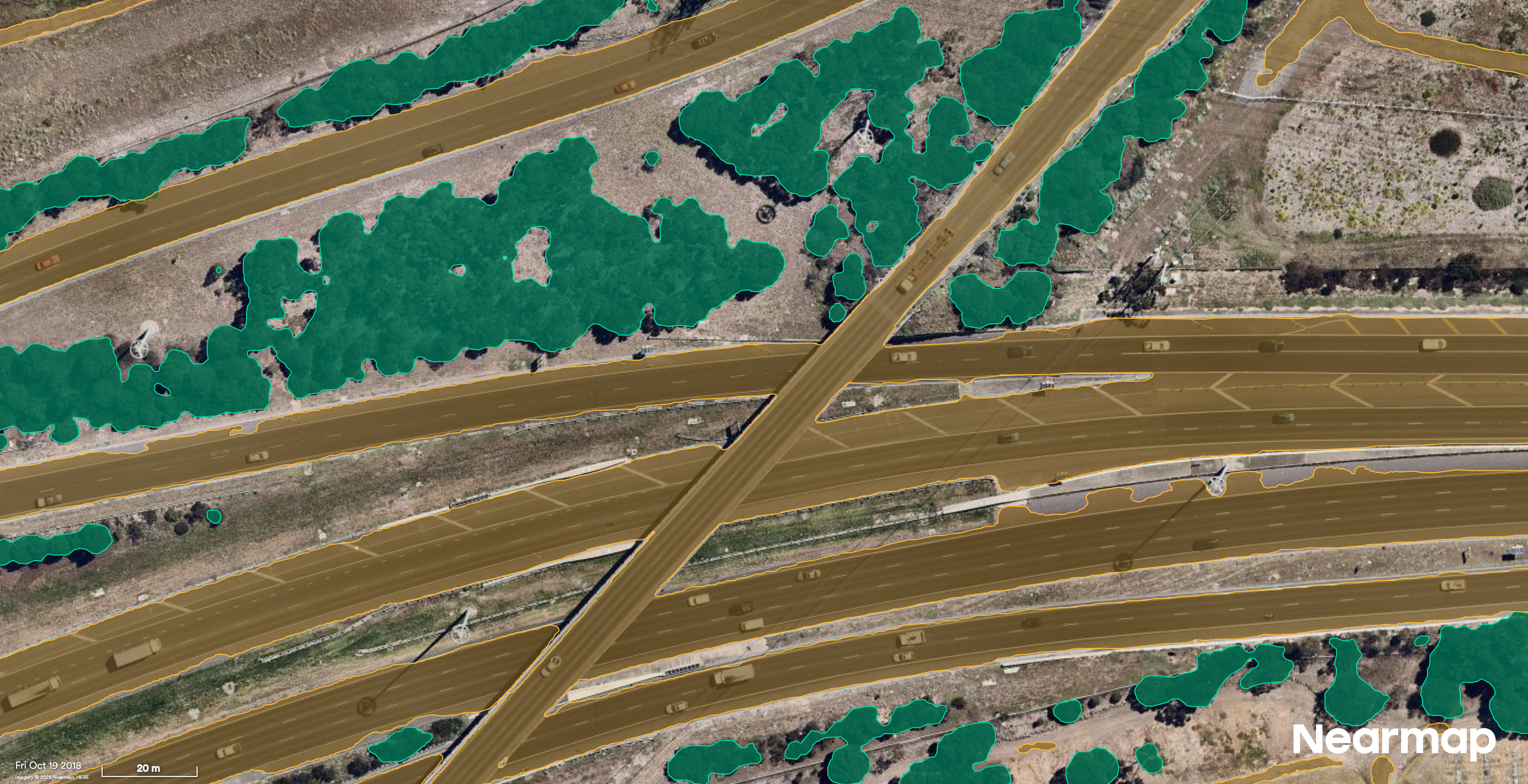
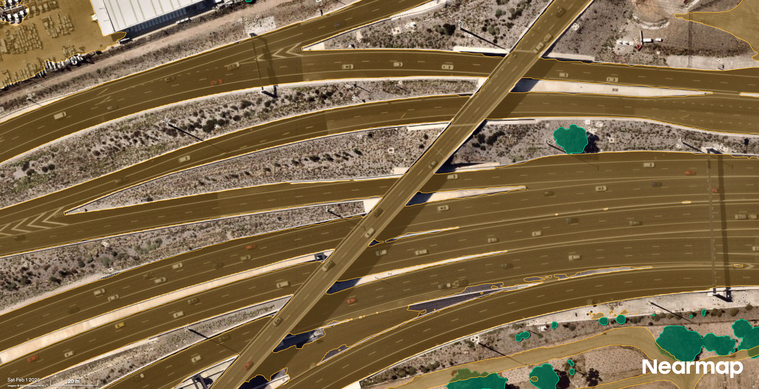
AI layers highlight changes in roads and vegetation over time.
Transform preconstruction
Infrastructure booms can cause significant challenges for project managers. Especially during the preconstruction phase where accuracy is paramount, risk mitigation is critical, and scope creep, almost a given.
Nearmap property intelligence, bolstered with features like 3D and AI, equips you with a full view of your project before breaking ground allowing you to make more informed decisions that reduce costly rework, communicate better with stakeholders at every stage, and set up on site with greater confidence.
With the right intelligence at your fingertips, you can reduce costly rework, align stakeholders faster, and move forward with clarity at every stage of preconstruction.
Gain confidence at every stage of your preconstruction workflow. Get in touch with our team today.