Disaster recovery: fast or slow?
Jun 2025
Accurate property data keeps insurance assessors, construction teams and local authorities informed about the status and speed of post-disaster rebuilds and repairs.
Jun 2025
)
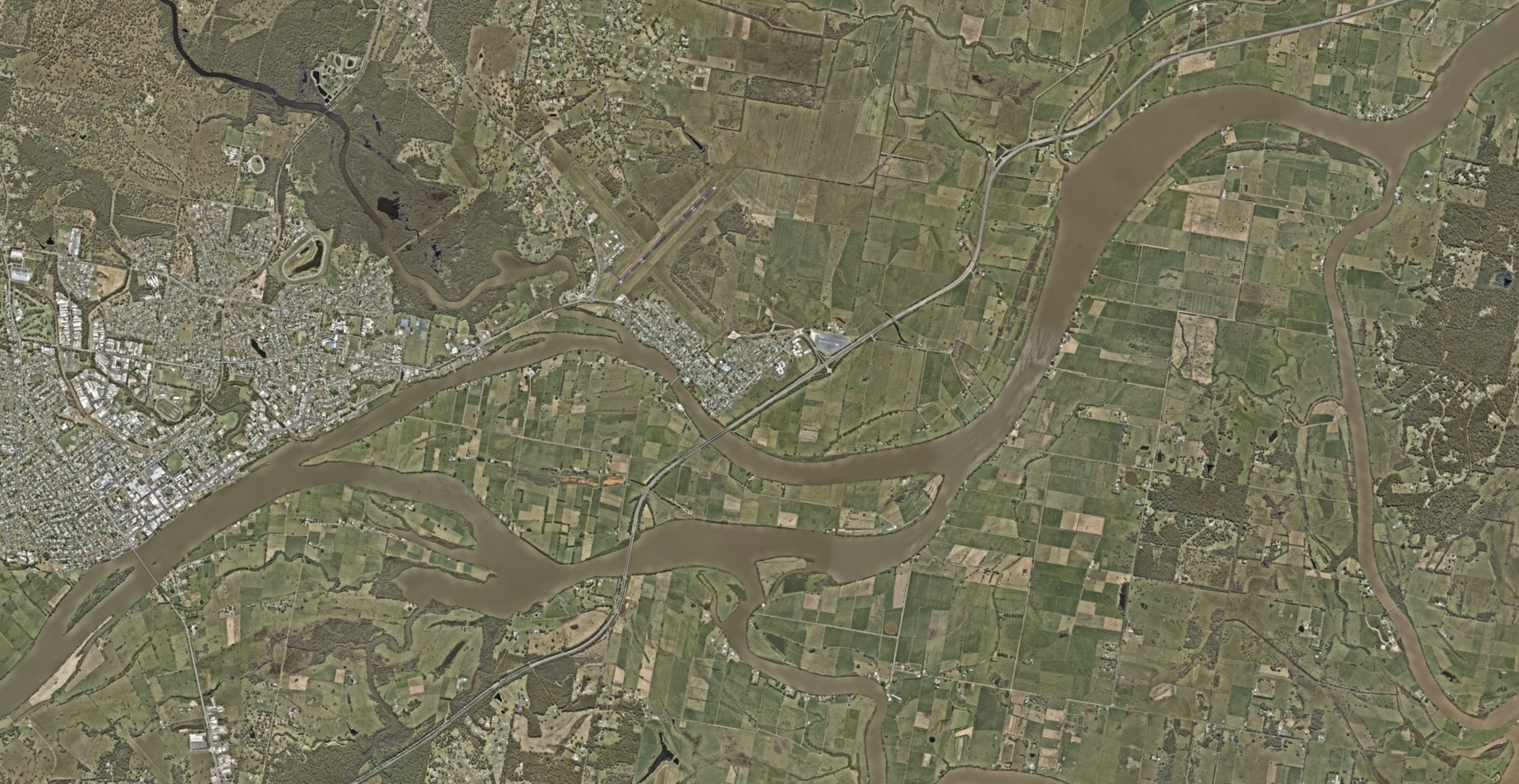
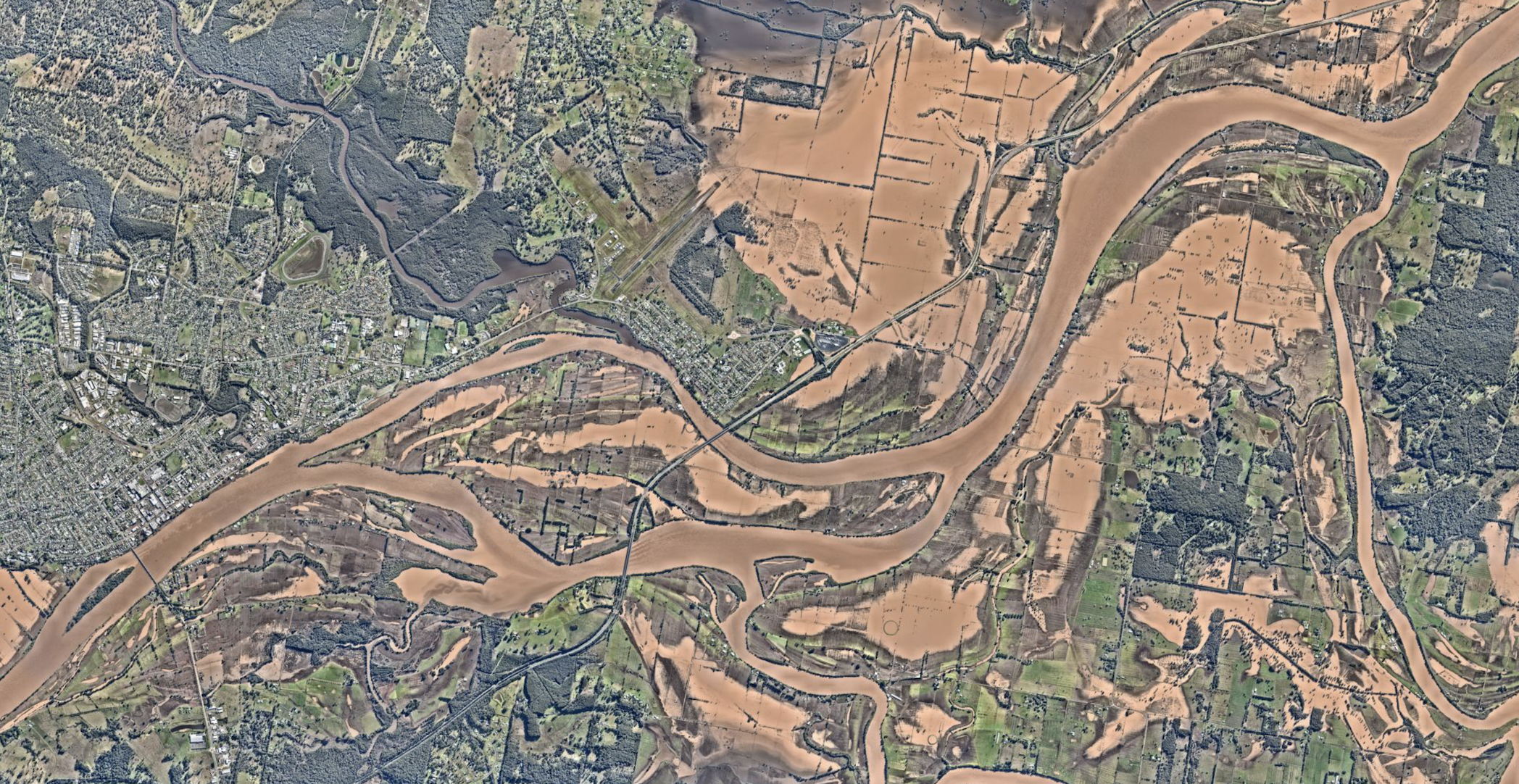
Heatherbrae NSW – May 2025
In Australia, even for those who live outside designated wildfire or flood zones, there is still a risk of being hit by damaging weather events like hurricanes, and hailstorms.
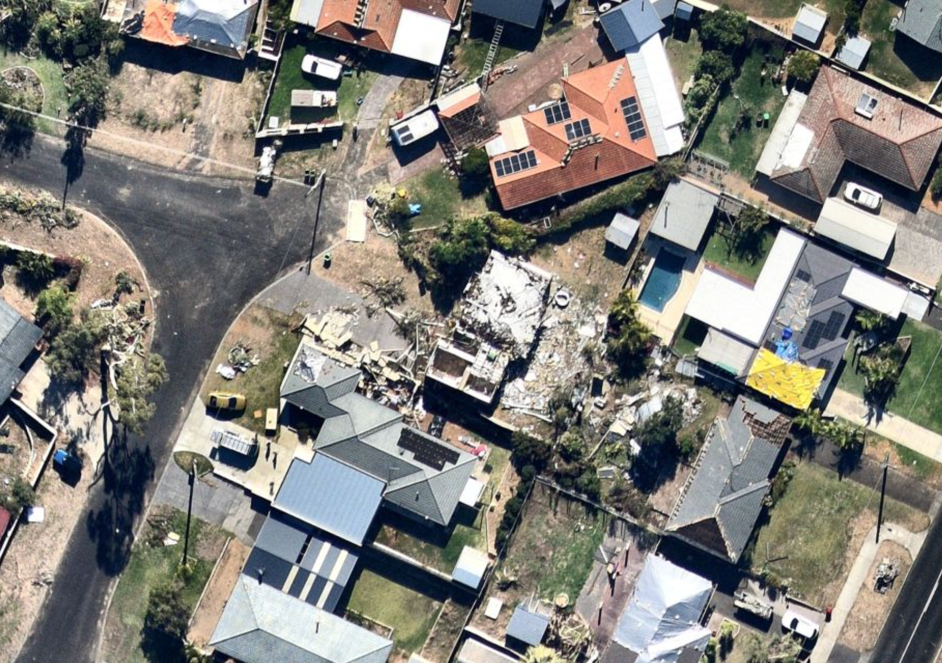
That was the case for the West Australian suburbs of Bunbury, Withers and College Grove on Friday 10th May 2024, when a sudden tornado tore a 40-meter wide path, destroying nine homes and damaging 220 others in just 10 minutes.
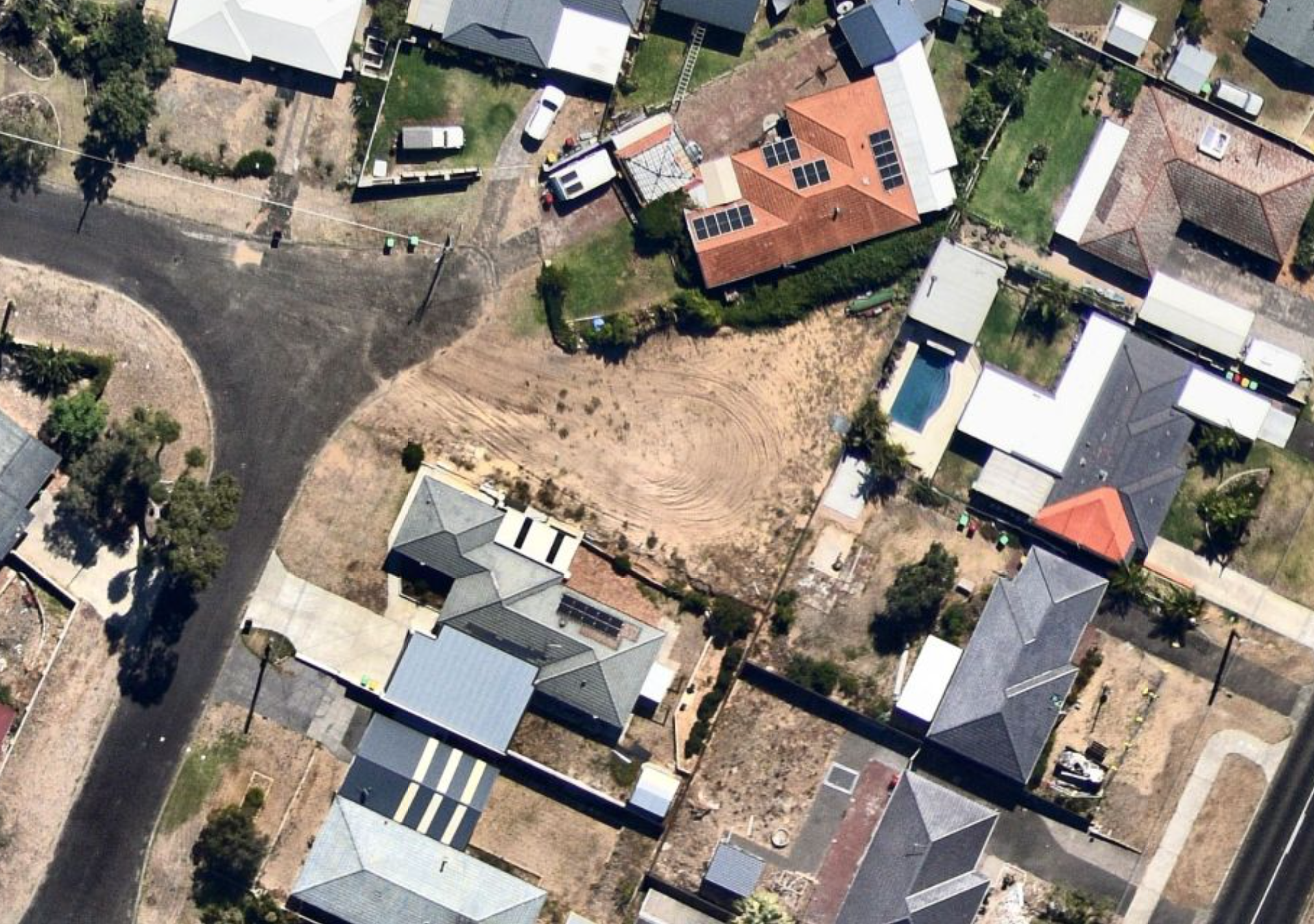
One year later and some properties in that area are still awaiting rebuild or repair.
The image slider below shows a property damaged in the 2024 tornado, still a vacant lot almost one year later.
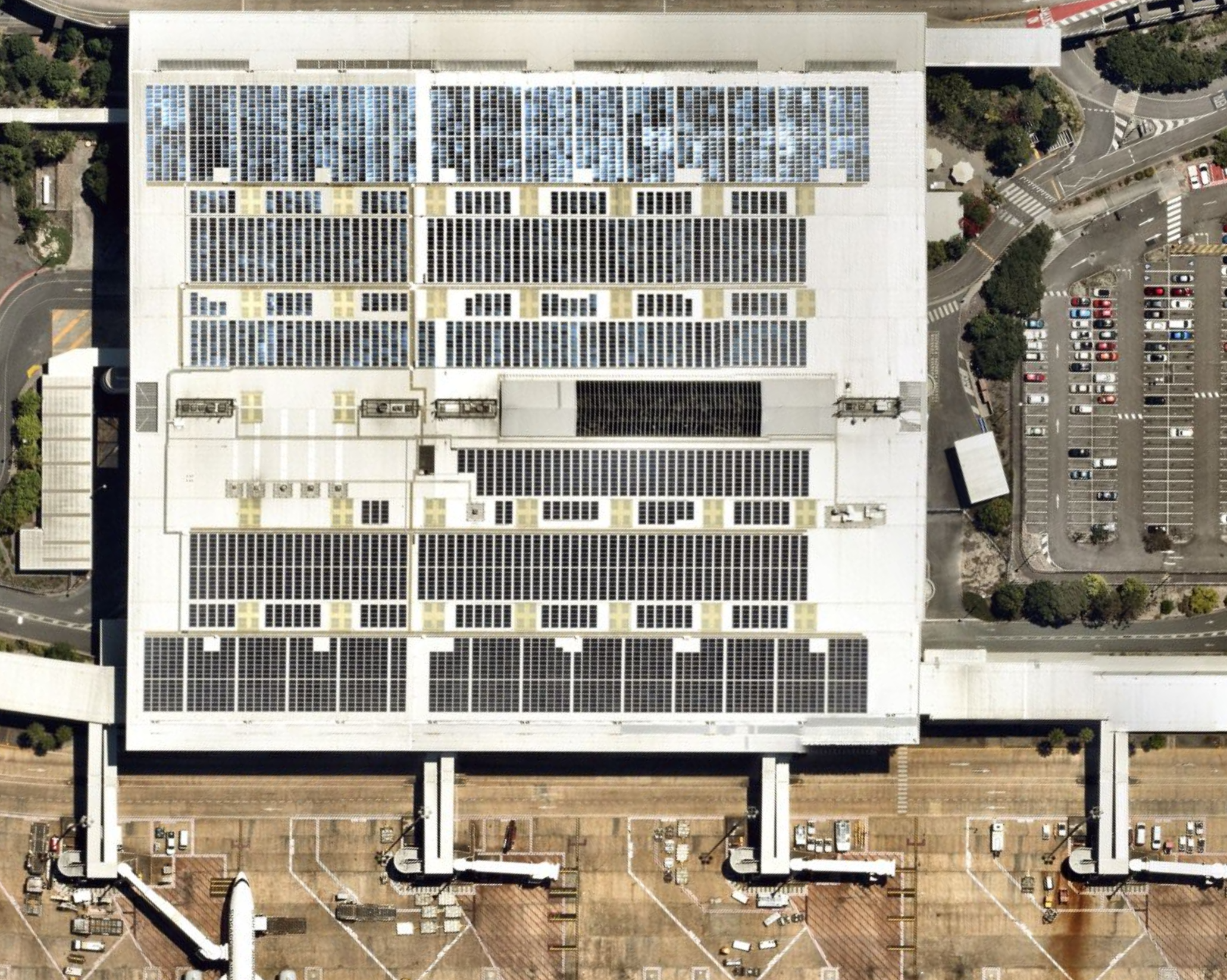
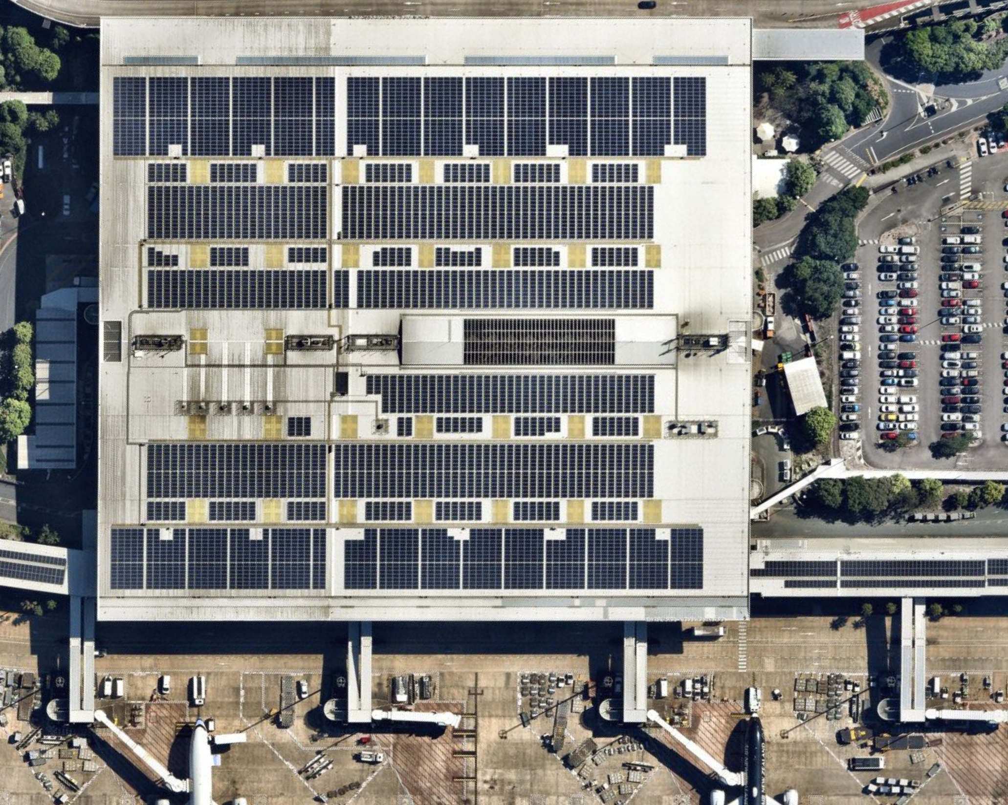
In October 2021, Brisbane Airport was also hit by a tornado, damaging solar panels on the roof of the international terminal building. Repairs were completed within one month – the latest Nearmap imagery (on the right hand side in the comparison below) shows the intact, replaced solar panels still in place today.
In 2015, a destructive tornado hit Kurnell in Sydney’s south, tearing the roof off the Kurnell water desalination plant, and leaving a trail of damage.
Reinstating the roof fully took a one-and-a-half years, as you can see in the imagery below, which shows 10 different Nearmap captures taken in the period from Friday, December 18, 2015, through to Saturday, June 24, 2017.
)
When disasters strike, property intelligence like aerial AI data provides insights that can help generate faster, more accurate decisions for insurers, responders, and recovery teams.
Accurate property information about the status of rebuilds and repairs keeps stakeholders like insurance assessors, construction teams, and local authorities informed.
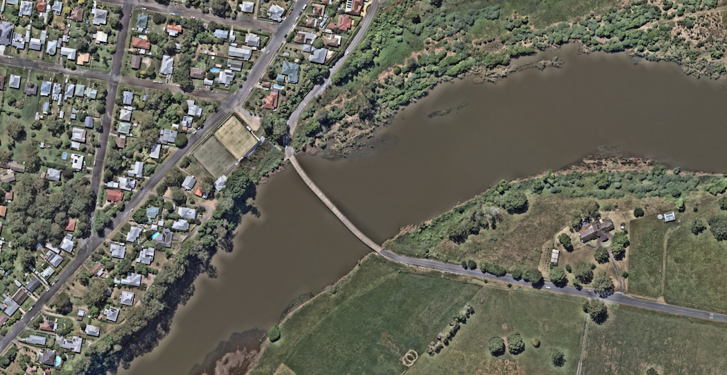
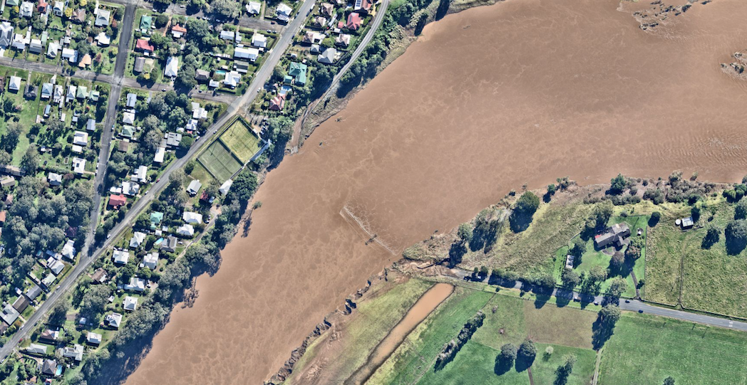
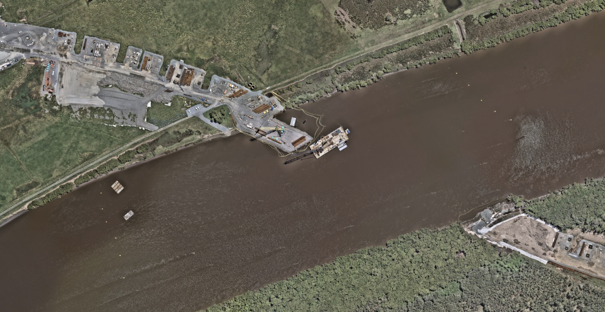
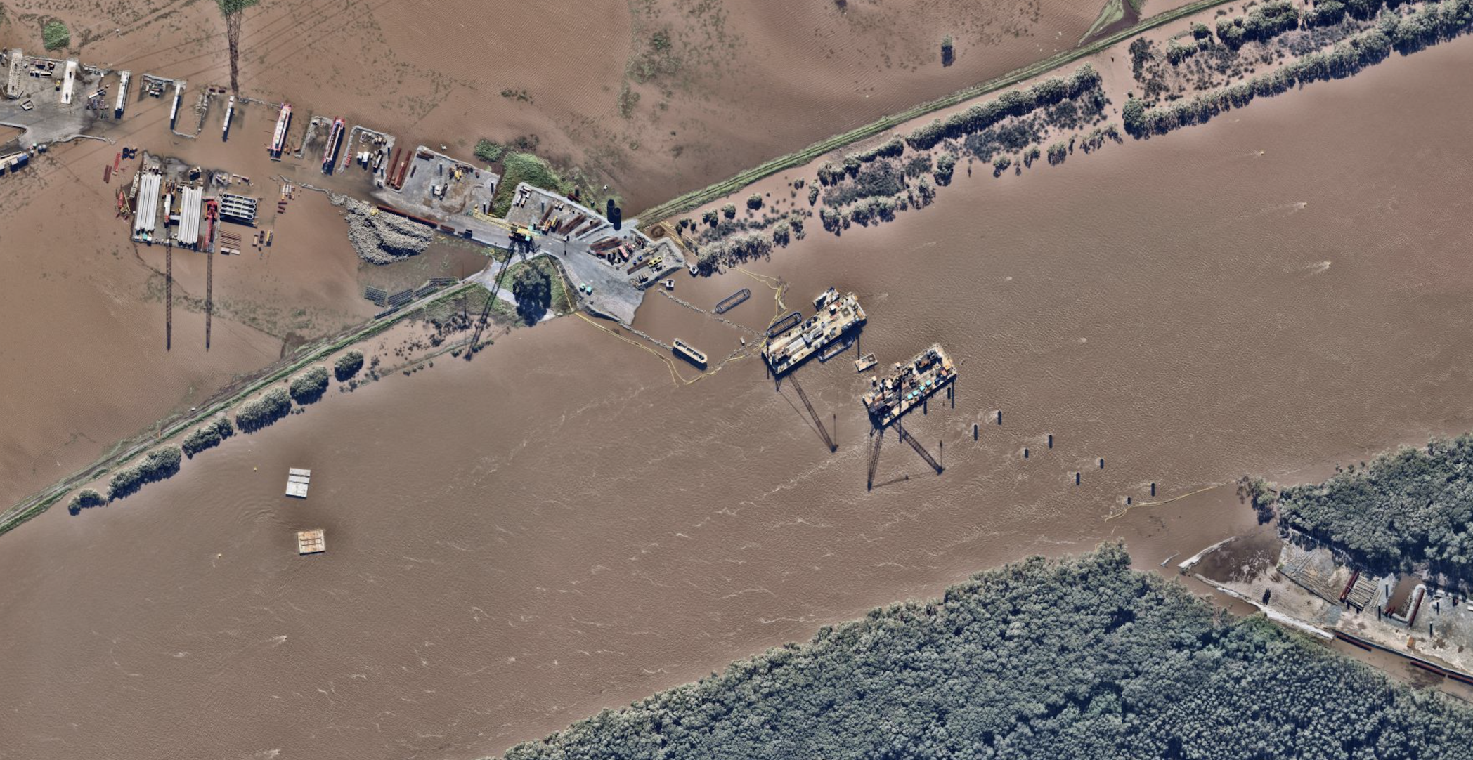
Recent tragic floods in the Australian state, New South Wales impacted lives, properties, and infrastructure along the Mid North Coast. Our thoughts stay with the responders and crews helping in the recovery and clean up. Nearmap ImpactResponse imagery below, captured days after the floods, tells part of the story.
Our aircraft-mounted cameras will continue to capture change on the ground as communities rebuild and recover, providing stakeholders with ground-truth insights when they’re needed most.
The Bight, NSW
Raymond Terrace, NSW
Taree, NSW
Disasters don’t discriminate. Be prepared with the most comprehensive property intelligence technology.