Nearmap Announces Agreement to Acquire Betterview

Learn More
X
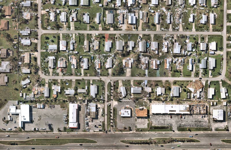
Hurricane Ida damage insurance aerial survey captures
Nearmap

Can Your Map Power the Entire Policy Lifecycle?

From quoting new policies to facilitating speedy claim responses, powerful mapping technologies from Nearmap can help you make decisions anchored in truth across the policy lifecycle.

Hurricane Ida Damage, Grand Isle, LA, U.S.

Insure Confidently in an Industry of Complexities

By using a rich stack of up-to-date location content — including historical imagery dating back to 2014, post-catastrophe captures, and AI-enabled data — gain a true understanding into what's happening on the ground, from wherever you work.

Derive the sharpest property insights with an unmatched level of accuracy and frequency to pinpoint the factors affecting your policies-in-force.

Insurance risk models with aerial image surveys
Riverside, IL, U.S.

Enhance and Customize Risk Models

Do even better with what you do best: risk selection. AI property characteristics derived from Nearmap imagery provide crucial data to enhance and customize your rating and risk models, including:

  • Building Footprints
  • Building/Roof Characteristics
  • Roof Condition
  • Vegetation, and more
Stay Covered

Remotely Assess Risk and Property Damage

Understand risk and assess damage like never before. Leverage vertical and oblique imagery to perform desktop reviews, inspections and investigations of high value properties.
Birds eye views of satellite maps in Miami, Florida

Commercial Lines Underwriting

Reduce potential blind spots that come with spread-out commercial properties by using detailed location intelligence to assess and price risk with precision.

Angled aerial views for insurance in Portland, Oregon

Residential / High Net Worth Underwriting

Deliver the Customer experience your high-value policyholders expect.  Ensure they have confidence that their assets are protected with policies backed by accurate data.

Jun 2021 | Mullica Hill, NJ, U.S.
Sep 2021 | Tornado Damage, Mullica Hill, NJ, U.S.

Capture Full Context of Claims

Make the 'moment of truth' a positive experience for your customers every time. Compare pre- and post-catastrophe imagery to get full context of a claim and expedite customer responses.

Fast Track Your Response
The combination of location intelligence, spatial accuracy, data quality and coverage consistency creates a new frontier for insurance analytics.
Director of Geospatial Capabilities for Enterprise Business Intelligence and Analytics, Top Insurance Provider
Post-disaster fire damage of buildings in Doyle, California
Fire Damage, Doyle, CA, U.S.

Built-in Certainty with Aerial Imagery

Ready to mitigate risk with ease and speed up claims? Insure confidently by understanding your policies-in-force from all angles with aerial imagery.

Start the Conversation