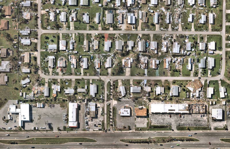
Introducing: Nearmap for Post-catastrophe Response
Post-catastrophe imagery and AI-derived property damage and condition data unite to help insurers process customer claims more efficiently.

Post-catastrophe imagery and AI-derived property damage and condition data unite to help insurers process customer claims more efficiently.
Now with AI and up-to-date imagery from Nearmap, you can create Esri based GIS solutions that save time, money and resources that help your team identify and manage changes to the built environment. With solutions such as change detection and surface permeability you can create repeatable processes and workflows that enlighten and expand the possibilities of your organization.
See how you can turn your ArcGIS tools into a solution that: