Photogrammetry software: turning pixels into precision
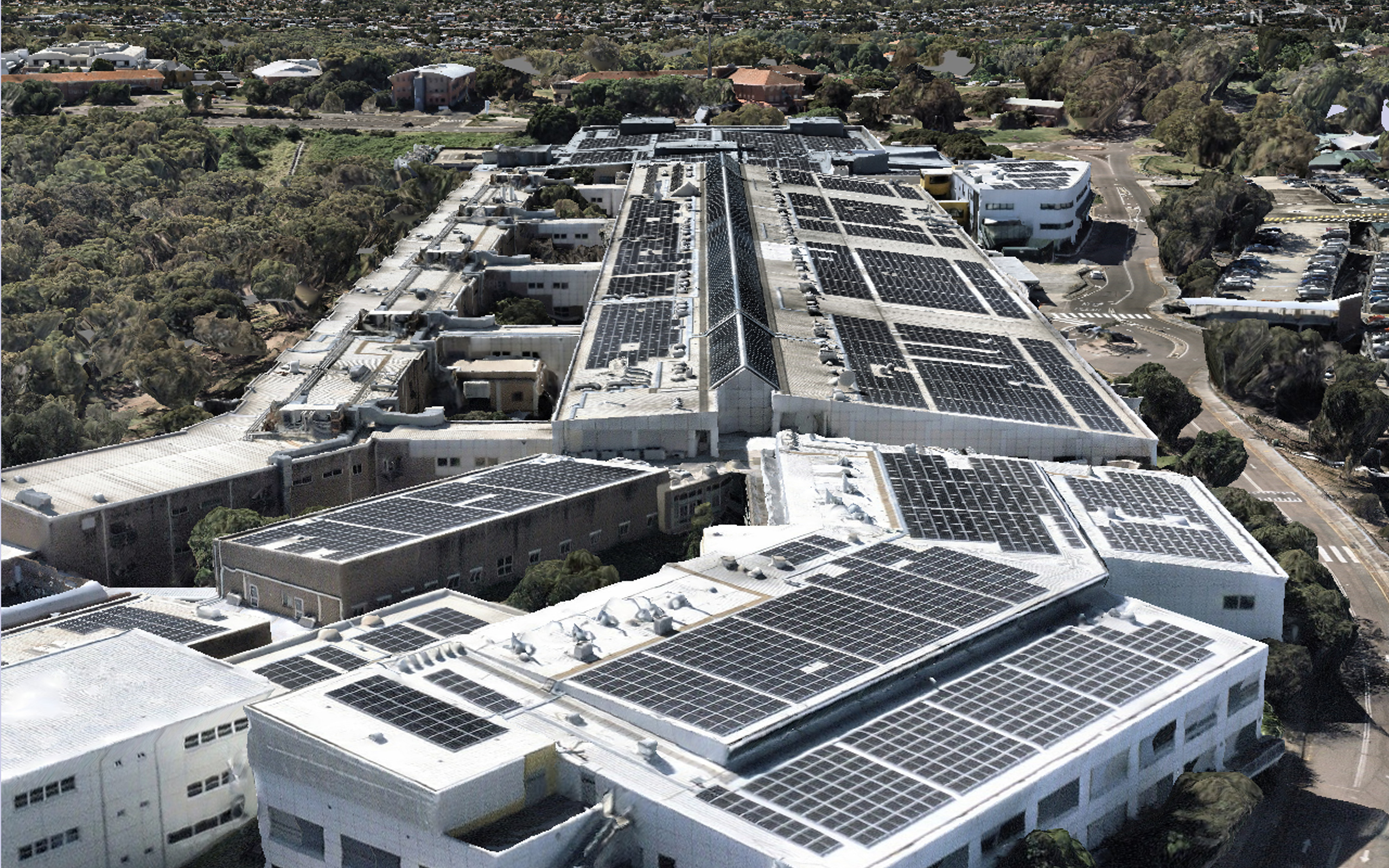
What is photogrammetry software?
- Drones (UAVs)
- Fixed-wing aircraft
- Helicopters
- Satellite sensors (in some cases)
- Ground-based DSLR and mobile cameras
What does photogrammetry software do?
- Stitch multiple images into seamless orthophotos
- Reconstruct terrain and surface models with depth and scale
- Generate detailed 3D meshes and point clouds
- Calculate volumes, distances, and surface areas
- Export to mapping platforms, engineering models, or AR/VR tools
- Integrate with BIM for design validation
- Track site conditions over time using refreshed imagery
Importance of photogrammetry software
- Supports remote site analysis without physical access
- Enables rapid decision-making in dynamic environments
- Creates visual records for compliance, planning, and asset management
- Enhances stakeholder communication and risk management
- Reduces costs and timelines compared to traditional surveying
- Improves asset management with detailed spatial models
- Provides a foundation for AI-driven analytics and digital twins
What are the features of photogrammetry software?
- Multi-image stitching — Combines overlapping photos into high-res composites
- 3D reconstruction — Builds terrain and object models from 2D inputs
- Orthorectification — Corrects distortion for map-accurate outputs
- Georeferencing — Aligns data to real-world coordinates using GPS and ground control points
- Point cloud generation — Captures millions of data points with X, Y, Z values
- Volume calculation — Ideal for construction, mining, and stockpile management
- Multi-format export — Compatible with GIS, CAD, and BIM systems
- Cloud processing — Speeds up rendering to share results easily
- Measurement tools — Enable distance, area, slope, and elevation calculations
- Custom overlays — Adds asset data, zoning layers, or annotations to models
Types of photogrammetry software
Based on the platform:
- Aerial photogrammetry software — Designed for use with planes or satellites, optimised for large-area capture
- Drone photogrammetry software — Tailored for UAV workflows, offering quick, localised capture and real-time processing for small-area capture
- Desktop photogrammetry software — Installed locally, suitable for detailed editing and custom workflows
- Cloud-based photogrammetry software — Scalable, fast, and collaborative, often with built-in AI tools
Based on output:
- 2D orthophoto generators — Focused on flat, corrected imagery
- 3D photogrammetry software — Outputs textured mesh, 3D models, and elevation data
- Photogrammetry processing software — Optimised for speed and scale, often used for large datasets and enterprise projects
Based on specialisation:
- Architectural photogrammetry software — Precision modelling for facades, interiors, and heritage sites
- Survey-grade photogrammetry software — Tuned for centimetre-level accuracy with integration into surveying systems
- Digital photogrammetry software — Used in film, gaming, or digital production for immersive 3D modelling
What is the difference between photogrammetry software and digital photography?
Feature | Digital photography | Photogrammetry software |
|---|---|---|
Purpose | Visual documentation | Measurement and 3D modelling |
Output | Photos | Point clouds, 3D models, maps |
Processing | Minimal or aesthetic | Algorithm-driven spatial analysis |
Use case | Media, art, basic records | Surveying, planning, asset management |
Data integration | None | GIS, CAD, BIM compatibility |
Advantages of photogrammetry software
- Accuracy — Generate centimetre-level models from aerial or ground imagery
- Speed — Process hundreds of images in minutes with cloud-based platforms
- Scalability — Flexibility for large or small area mapping, from properties and neighborhoods to nations
- Safety — The ability to capture data from a distance reduces field risk
- Visualisation — Create stunning 3D representations of real-world environments
- Interoperability — Export to multiple design, mapping, or modelling platforms
- Historical comparison — Compare imagery and models over time to track change
- Repeatability — Recurring flights enable change detection and monitoring
Limitations of photogrammetry software
- Weather and lighting sensitivity — Shadows, reflections, or low light can degrade output quality
- Processing requirements — High-res imagery can require significant computing power
- Line-of-sight limitations — Unable to capture beneath dense vegetation or structures
- Dependence on overlap — Inadequate image coverage can result in gaps or distortion
- Accuracy variance — Results depend on sensor quality and ground control data
- Software learning curve — Complex tools require training to unlock full potential
Future of photogrammetry software
- AI-assisted image processing — Faster, more accurate reconstructions
- Integration with AR/VR — Use photogrammetry models in immersive environments
- Machine learning object recognition — Automatically identify features like roads, buildings, or vehicles
- Live modelling — Real-time photogrammetry from drones or mobile platforms
- Open photogrammetry ecosystems — Platforms that plug into multiple sensors, workflows, and data systems
- 3D web publishing — Share interactive models directly in browsers
- Edge computing — Mobile units performing in-field processing
- Fully autonomous capture — Drones or rovers collecting and processing without human input
Frequently asked questions
Your aerial photogrammetry questions answeredIt depends. LiDAR is better suited for dense vegetation, fine elevation detail, or low-light conditions. Photogrammetry software is ideal for visual modeling, surface mapping, and when high-res imagery is available.
Surveyors, civil engineers, construction managers, architects, urban planners, asset managers, environmental scientists, and more.
Yes, many modern photogrammetry programs like Nearmap include AI for feature detection, image correction, and faster processing.
3D photogrammetry software, such as MapBrowser, is commonly used to create 3D models and export them to design tools.
GIS manages and analyses spatial data. Photogrammetry software creates the data, converting imagery into geospatial assets.
Architectural photogrammetry software, such as RealityCapture, or software suites that integrate with Revit and BIM tools, are ideal for accurately modeling facades, interiors, and historical structures.
With proper image overlap and ground control points, photogrammetry can match — and sometimes exceed — the accuracy of traditional ground surveys, especially when combined with GPS and LiDAR data.