Oblique imagery: clarity from every angle
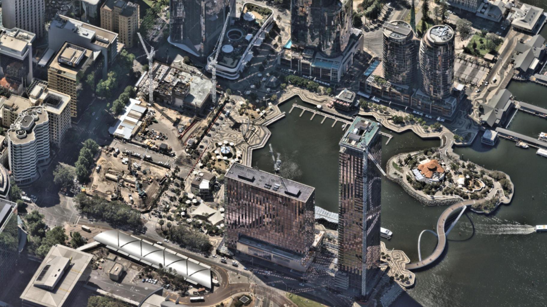
What is oblique imagery?
Types of oblique imagery
- Low oblique imagery — photographs taken at a shallow angle, typically excluding the horizon. These are useful for precise property analysis where detail matters more than broad context.
- High oblique imagery — photographs taken at a steeper angle, often including the horizon. These provide broader situational awareness while still revealing building sides and terrain features.
How can you use oblique imagery?
Benefits of oblique imagery
- Visibility of building sides and facades that vertical imagery misses
- Improved accuracy in measurements of height, slope, and surface areas
- Enhanced situational awareness for insurance, planning, and emergency response
- Better communication with stakeholders, who understand angled perspectives more intuitively

Advantages of oblique imagery
Limitations of oblique imagery
What is the difference between vertical and oblique imagery?
How accurate is oblique imagery?
Use cases of oblique imagery
- Insurance: Verifying storm damage, validating claims, and assessing roof conditions without deploying adjusters
- Emergency response: Delivering a real-time perspective during floods, fires, or earthquakes
- Urban planning: Visualising new developments relating to existing structures
- Infrastructure: Designing roads, bridges, and utilities with accurate slope and height data
- Utilities: Monitoring towers, lines, and substations from safer, remote perspectives
Additional applications
FAQs about oblique imagery
Get answers fastIts purpose is to provide angled perspectives that reveal details vertical imagery misses, supporting more accurate analysis and decision-making.
Insurers, government agencies, utilities, engineers, and emergency managers all benefit. Any organisation managing assets, risk, or development uses oblique photography.
The best platform combines high-resolution capture, intuitive visualisation, and accurate measurement tools while integrating seamlessly with enterprise workflows.
Traditional satellite imagery is typically vertical, offering wide coverage but less detail. Oblique satellite imagery provides angled views, though aerial platforms often deliver higher resolution.
Yes. With proper calibration and oblique imagery tools, accurate measurements of height, slope, and surface area are possible.
It reduces the need but doesn’t eliminate in-person inspections entirely. Complex claims or disputes may still require on-site inspections.