A before-and-after view of Victorian fire impact
Jan 2026
Nearmap post-catastrophe imagery captured the devastating extent of bushfire impact across regional Victoria — enabling insurance, government and emergency service agencies to triage their response more effectively, and help communities recover sooner.
Jan 2026
)
Harcourt, VIC
Just one week into 2026, multiple fires ignited across regional Victoria, which experienced its worst fire danger day since the Black Summer bushfires of 2019-20. With temperatures exceeding 40°C for consecutive days and wind gusts reaching 100 kilometres per hour, catastrophic conditions fuelled fast-moving fires that destroyed or damaged more than 700 structures and burned through 400,000 hectares.
As soon as conditions allowed, Nearmap deployed planes to capture aerial surveys of those areas most impacted. While we cannot prevent these disasters, we can work tirelessly to provide the data needed to aid recovery efforts.
Providing accurate views of the extent of damage, in a safe and timely manner, enables insurers, governments and emergency response agencies to speed up and triage their disaster response efforts when it matters most.
We recognise the profound impact of this tragedy and the sensitivity surrounding its documentation. Please be aware that the following images show widespread areas of property destruction.
)
Ruffy, VIC
)
Muckatah, VIC
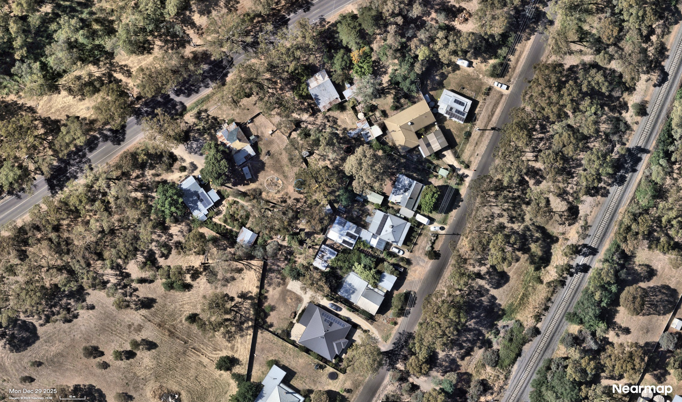
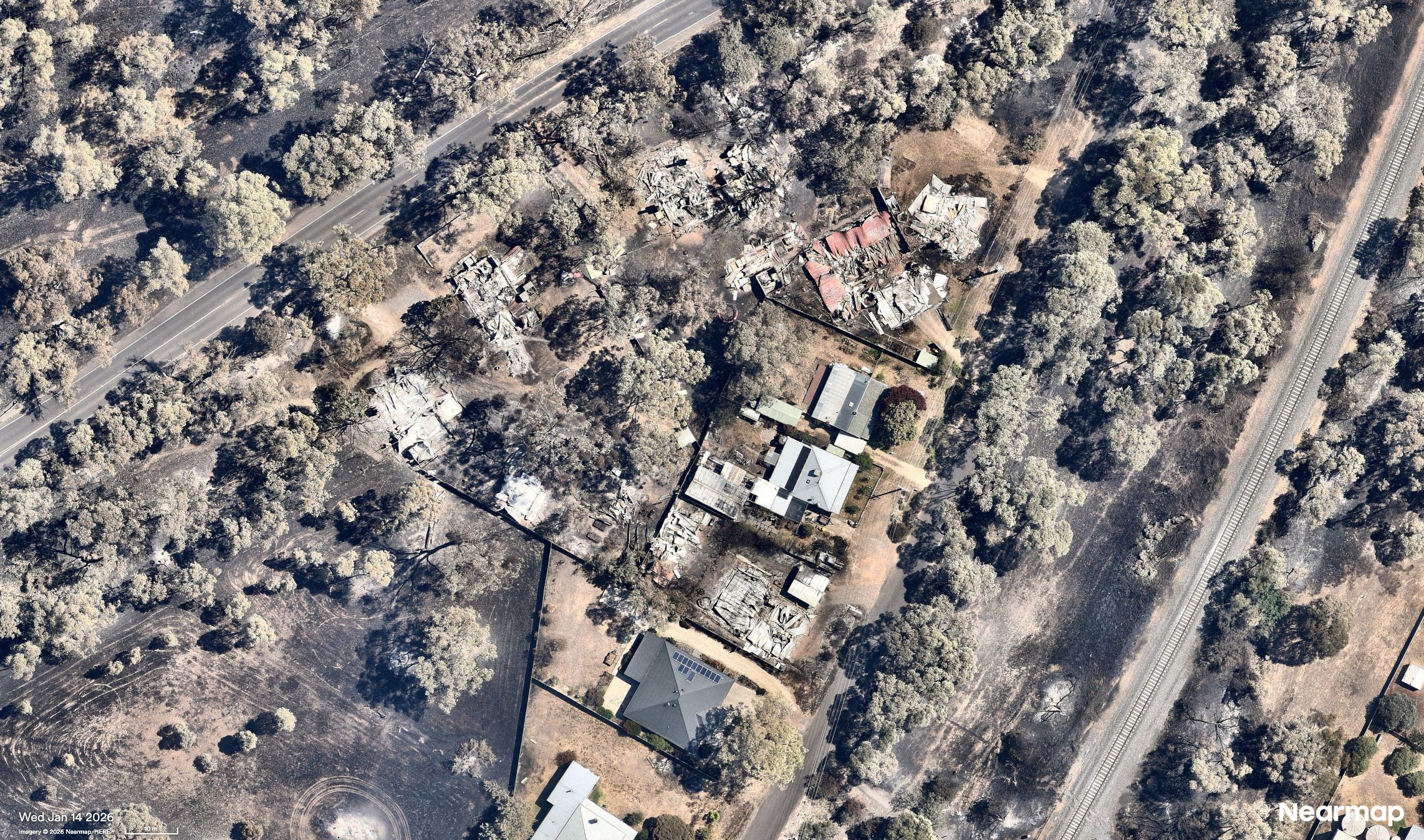
Longwood fire
The Longwood fire became one of the most dynamic and dangerous blazes, spreading in multiple directions across Victorian communities including Longwood, Euroa, Ruffy, Terip Terip, Yarck and more.
Captured just weeks apart, Nearmap imagery shows the devastating before-and-after of fire impact on Longwood.
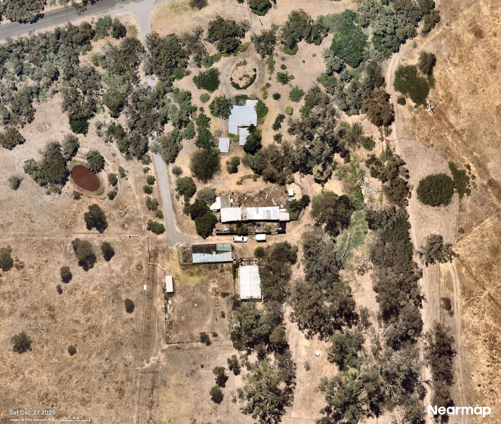
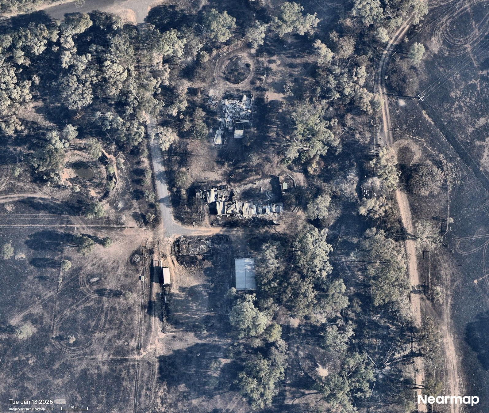
Longwood
Nearmap AI automatically detects and classifies features in our aerial imagery, transforming high-resolution captures into actionable insights. The technology can identify and measure property attributes such as building footprint, vegetation, roof type and more.
This AI-derived location data layered on top of post-catastrophe imagery, demonstrates the scale of destruction in Ruffy — supporting governments, emergency crews, and insurers tasked with triaging response and recovery.
)
Damage detections in Ruffy, VIC
AI Layers
Grass Flat fire
The erratic Grass Flat fire moved with extreme speed through the area Natimuk, Quantong, and surrounding communities.
Before and after fire damage in Natimuk, VIC
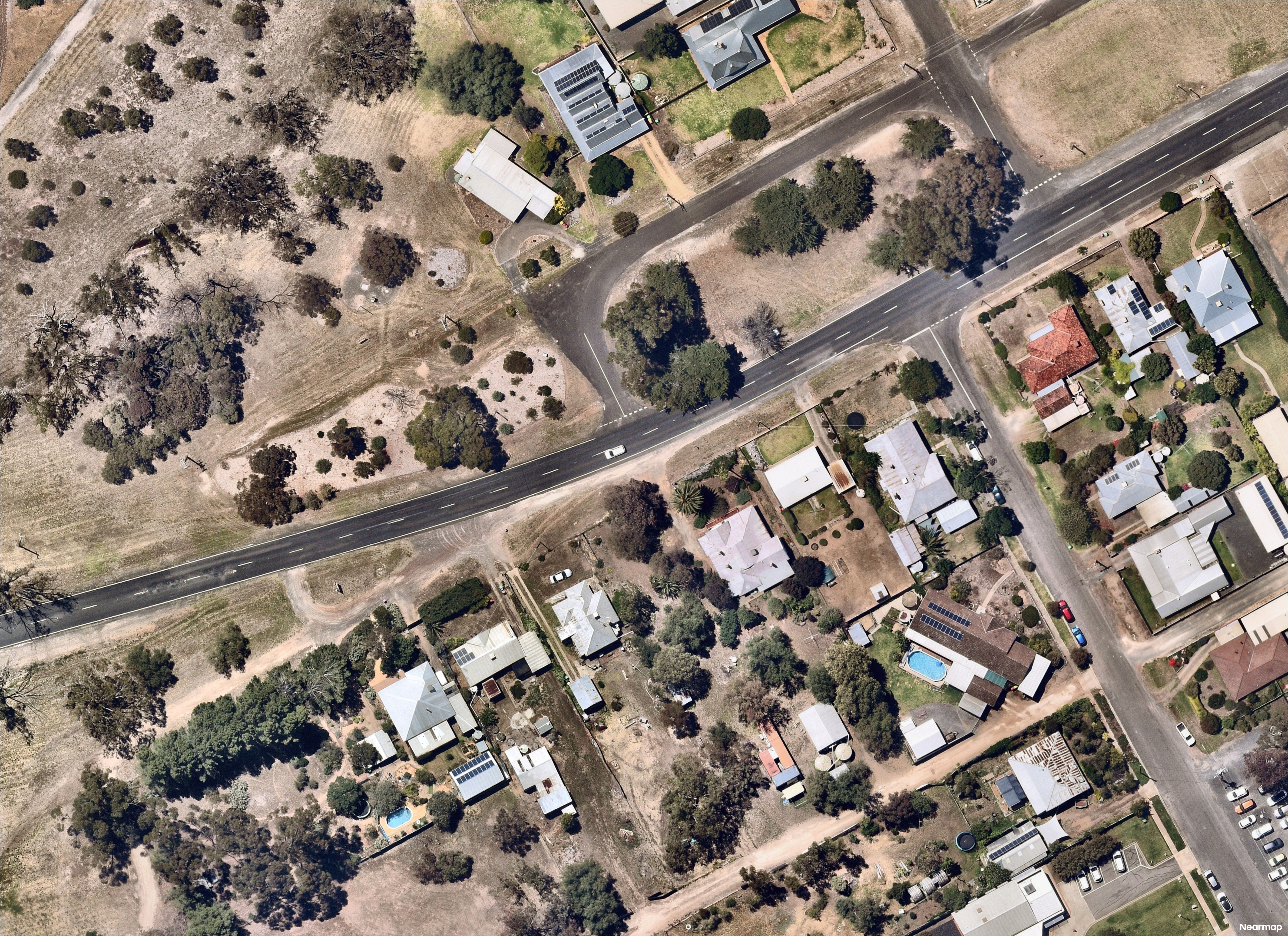
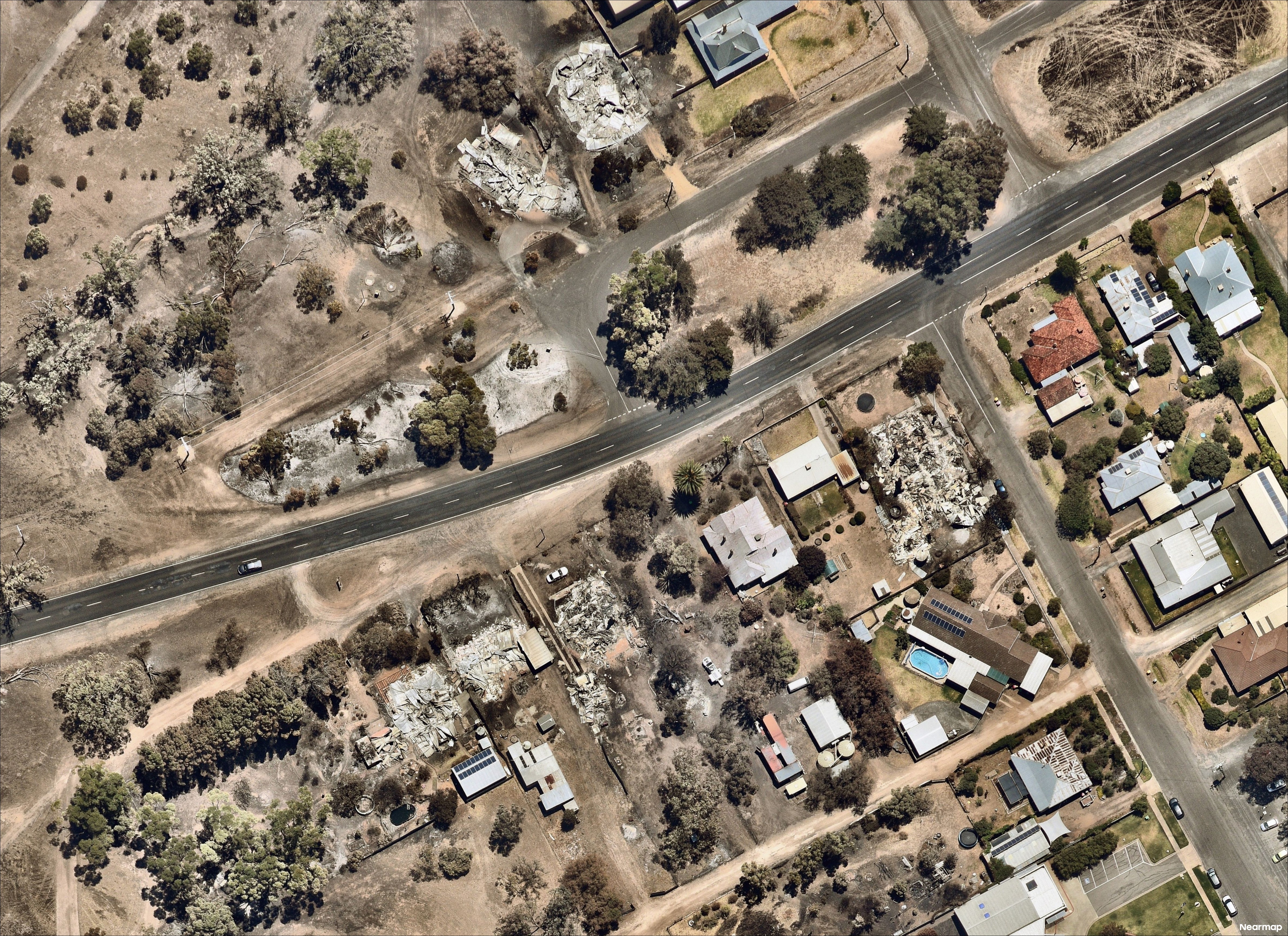
Streatham fire
The Streatham fire roared east along the Glenelg Highway and leaving a path of destruction as it moved towards Skipton. The fast-moving grassfire tore through upward of 50 structures including homes, community and agricultural buildings, and claimed thousands of hectares of important agricultural land.
)
Skipton, VIC
)
Carranballac, VIC
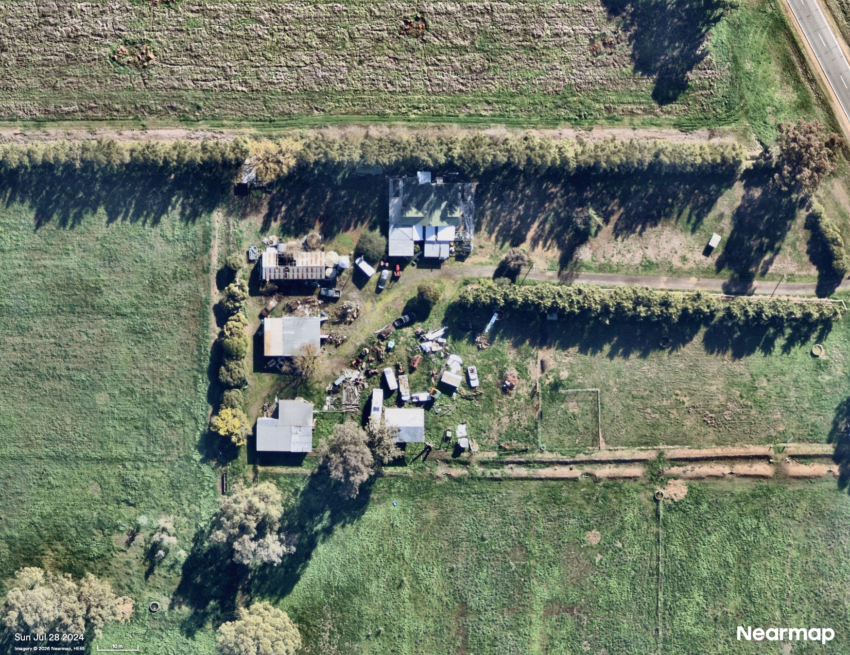
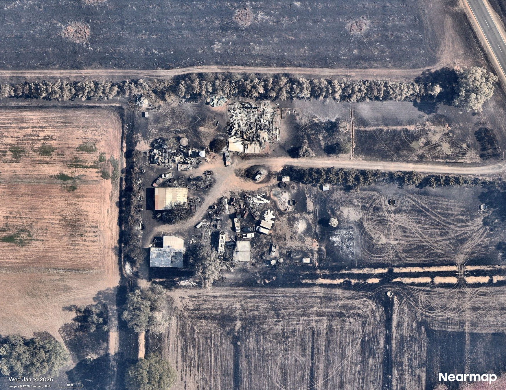
Ravenswood fire
The Ravenswood fire was one of the most destructive in Victoria, with our post-catastrophe imagery showing areas that have been left unrecognisable from when we captured them just a month prior to the disaster.
Reports state Ravenswood and Harcourt have lost 47 homes and three businesses, including the Harcourt Cooperative Cool Stores which provided refrigerated storage for around 85 businesses.
Harcourt, VIC
Harcourt Cooperative Cool Stores
Yarroweyah fire
The grassfire that started at Yarroweyah moved with frightening speed through the pastoral landscape before travelling south-east towards Muckatah.
Yarroweyah, VIC
)
Muckatah, VIC
What now?
More than 1,400 insurance claims have already been lodged as damage assessments continue across affected regions and the true scale of bushfire damage unfolds. As the affected communities begin their long journey toward recovery, Nearmap will continue to capture the truth on the ground.
And while fires continued to burn through parts of central Victoria, other parts of the state’s coast were battered by record-breaking rain, resulting in destructive flash floods. As weather weather events become increasingly extreme and volatile, the need for rapid-response aerial intelligence has never been greater.

For Insurers
The ImpactResponse System delivers near real-time assessments of property-specific impact insights to help you respond faster, and help customers recover sooner. Explore Nearmap ImpactResponse System for insurers

For government, emergency service and utility providers
Dive deeper into how Nearmap ImpactResponse imagery supports safer and more efficient disaster response, recovery, and resilience planning.