There’s imagery. And then there’s intelligence.
Nearmap delivers inspection-grade geospatial intelligence — 10–15x sharper than satellite, proactively updated up to 3x per year, and trusted by teams who can't afford to guess.
Stop debating. Start deciding.

Make intelligence-powered decisions
When your imagery is high-resolution, current, and defensible, teams are empowered to act with confidence.
Access site data without field dependency
Work from proactively refreshed intelligence, not outdated data
Decide with defensible intelligence
Leverage 130+ AI-derived insights for instant, accurate data
Replace outdated aerials and low-resolution satellite imagery
What makes Nearmap different? Everything.

Resolution that reveals every detail
10–15x sharper than standard satellite isn’t marketing. It’s measurable. Nearmap delivers 4-7.5 cm or better ground sampling distance (GSD) imagery (compared to standard commercial satellite imagery at 30-50 cm). This ASPRS-aligned inspection-grade imagery lets you assess roofs, structures, terrain, and site conditions remotely with confidence competitors can’t touch.

Intelligence you can defend
Nearmap enhances imagery insights with more than 130+ AI-derived property attributes aligned with industry accuracy standards. This isn’t guesswork dressed up as analytics. This is repeatable, auditable, defensible intelligence that supports governance, enables scale, and reduces manual review.
Dive deeper
Get in-depth analysis and expertiseMake data-driven decisions
Housing trends with AI

Proactive updates, consistent captures
We continually survey your world. Nearmap captures locations proactively, consistently, and with standardised processing that ensures reliable apples-to-apples comparison over time.

End-to-end control
Nearmap is purpose-built from the ground up. Our camera systems and processing software are engineered to work together as a single integrated system. When the camera, flight system, and processing pipeline are designed to work as one, you get a fundamentally higher level of quality, consistency, and reliability.
Proprietary camera systems designed and built for consistent, inspection-grade capture
Dedicated aircraft flying standardised survey patterns for repeatable results
In-house processing tuned to our sensors for consistent quality across every capture
Direct delivery through cloud-native tools and APIs
Because every component is designed to work in harmony, quality stays consistent from capture to delivery. The result is a single, reliable source of truth your teams can trust — with data that’s ready to use, compare, and act on.
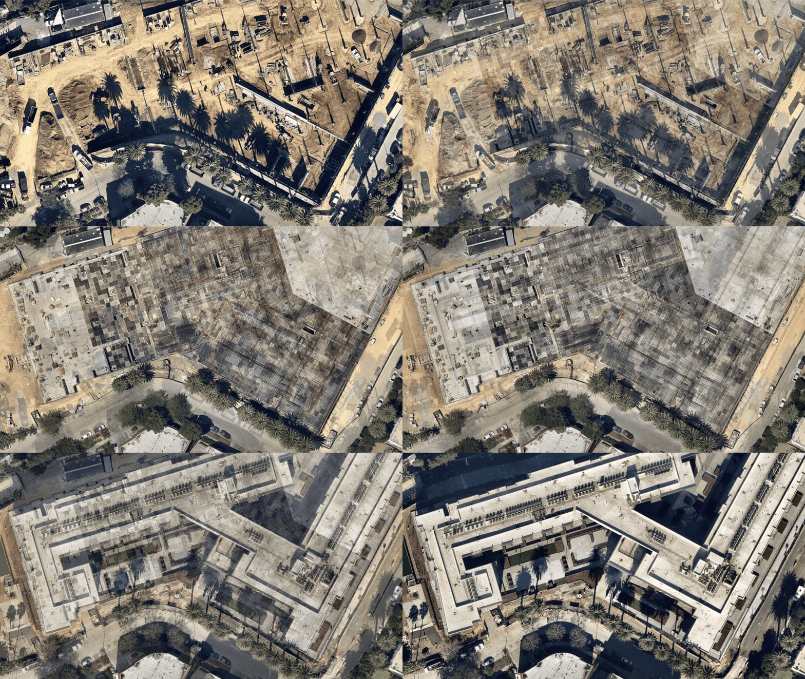
From planning to response, Nearmap outperforms
Evaluate site feasibility earlier. Decide faster. Reduce rework. Field visit only when necessary.
Assess more properties. More bids. Faster turnarounds. Higher win rates.
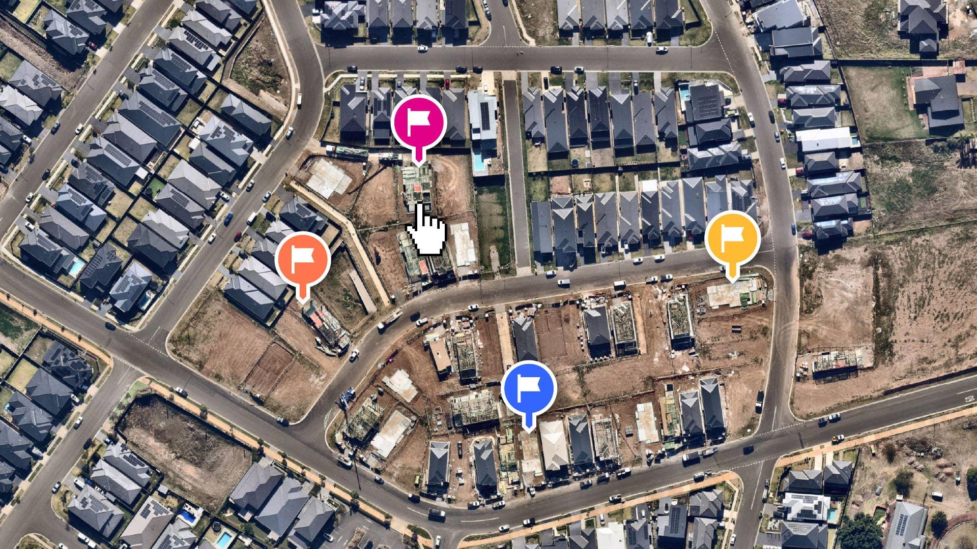
Portfolio-wide visibility without portfolio-sized field budgets.


Introducing Nearmap Labs
A living look at the research and technology behind what’s next in property intelligence. Get early access, see how the ideas work, and meet the people behind them.
Intelligence this good should be easily accessible
For teams who can’t afford to guess

Featured customer results
20% reduction in rework with accurate site intelligence
Replaced outdated satellite data with proactively updated Nearmap intelligence
Improved project profitability by reducing non-billable reconnaissance hours
50% increase in bid opportunities
28% faster property measurements for maintenance services
34% faster takeoffs for enhancement projects
85% increase in average bids per week

Eliminated guesswork in building measurements and slope analysis
Won competitive bids with photorealistic 3D models that would be impossible with satellite
Accelerated project timelines by removing dependency on site reconnaissance

See the difference for yourself
Nearmap delivers inspection-grade geospatial intelligence that outperforms on every dimension that matters. Ready to reduce site visits, speed up decisions, and free your teams to focus on higher-value work?
Discover What's Possible