Complete property intelligence has a definition. Only one provider meets it.
Jun 2026
Jun 2026
Most of what the market calls property intelligence isn’t actually intelligent.
Picture a roof replacement claim. The adjuster pulls imagery from one vendor, an estimate from another, and materials pricing from a third. That’s three vendors and three data standards, each giving different answers. The disputes come in and what could have been done in weeks takes months to get resolved as there isn’t a single, trusted source of truth.
The problem also shows up in construction. A structural engineer wins a bid for a highway overpass rehabilitation and the site assessment looks solid. But the imagery is 18 months old. Immediately, the crew finds drainage infrastructure that wasn’t in the dataset — leading to a redesign that costs more than the margin.
In government, a property owner appeals their assessment. During the review, city assessors discover that 6,000 of their 10,000 parcels don’t match what actually exists on the ground. The imagery they’ve been relying on is years out of date, and the appeal succeeds.
None of these scenarios are uncommon. They play out daily, across every market, because the industry accepted fragmented data as the price of doing business. It was never good enough. It was just the only option available. Complete property intelligence is the alternative the market has been waiting for.
)
What ‘complete’ means in property intelligence
Property intelligence is not a synonym for geospatial intelligence. It’s not an AI risk score. It’s not a materials pricing tool. Each of those, in isolation, is a data product. When owned and governed by a single provider, they become something categorically different.
Complete property intelligence is the combination of geospatial intelligence, AI-derived analytics, and guaranteed building materials data integrated into a single, owned source of truth for the built environment. It answers more than what a property looks like. It answers what condition it’s in, what risk it carries, and what it costs to act.
Geospatial intelligence captures reality. Like a photograph, it gives you an accurate, detailed picture of what’s there. Property intelligence interprets that reality, giving you a deeper level of insight that supports a decision — not just an observation. One shows you what exists. The other tells you what it means.
Combine the two and the value amplifies, as richer AI analytics layer onto precise data capture to drive decisions that neither could support on their own.
Most property intelligence is built on data the provider didn’t capture, processed by AI it didn’t train, and priced by a database it doesn’t own. Nearmap owns all of it, so every insight traces back to one source, one standard, and one provider that stands behind every answer.
)
Owned, high-recency data capture
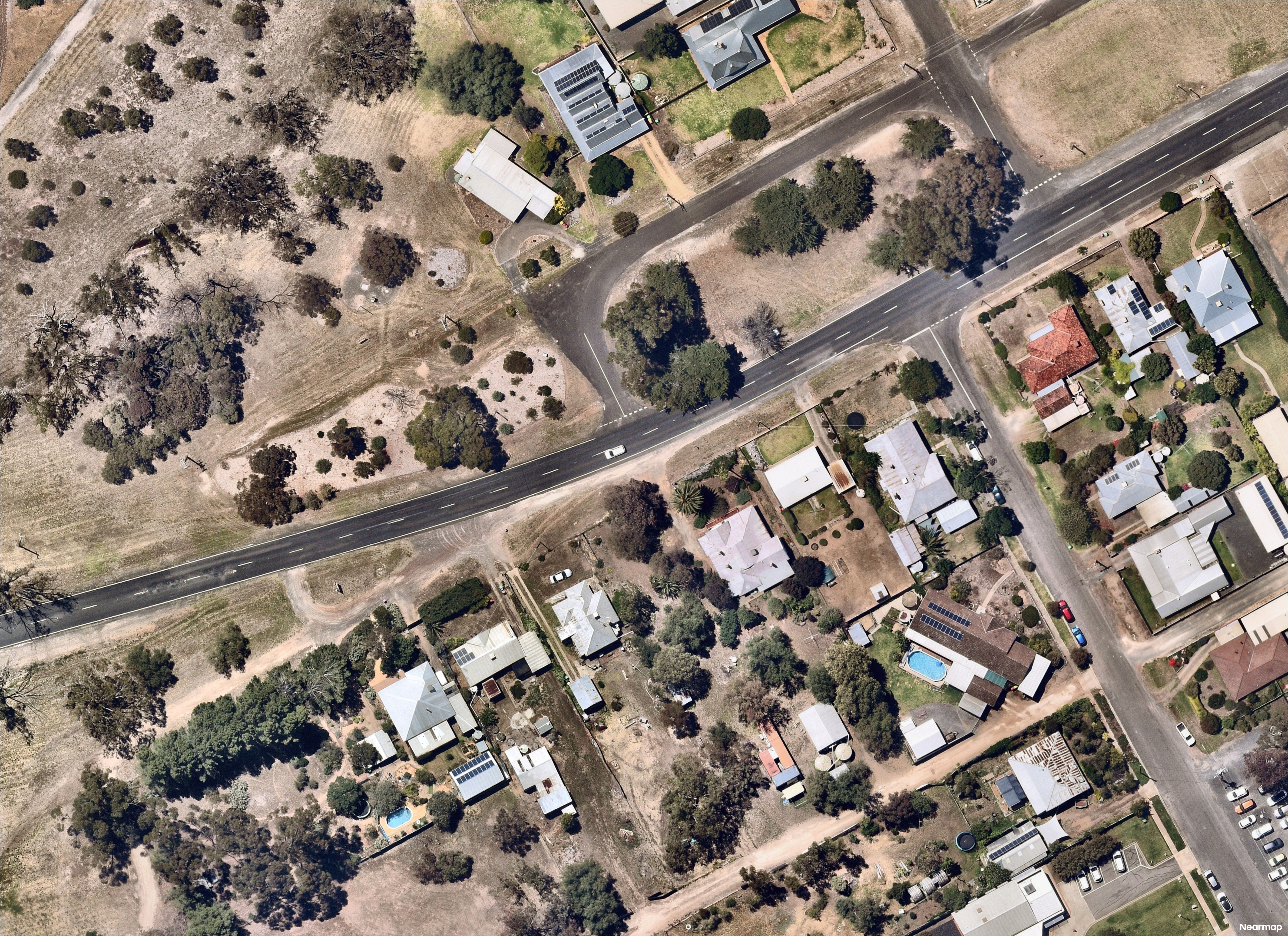
Outdated imagery is more than an inconvenience. It’s a policy priced on a roof that no longer exists. A claim assessed against conditions that predate the damage. A portfolio with exposures nobody identified. How recently the imagery was captured, and at what resolution, determine the value of a capture program. Both are controlled by whoever owns it.
)
AI analytics trained on owned imagery and traceable to the source
AI trained on borrowed imagery inherits every gap in the source data. Those blind spots don’t announce themselves. They surface when a rate filing draws regulatory scrutiny or a claim goes to litigation. Owned imagery trains better AI. Better AI produces outputs traceable to the source. Traceable outputs produce defensible decisions.
)
Guaranteed building materials data
Aerial imagery shows the damage and AI assesses it. Neither prices it. Most providers fill that gap with an estimate, and estimates can be challenged. When the number is disputed, the claim stalls. Loss adjustment expense climbs. And the homeowner is left waiting. A guarantee is different. One provider owns the number, has independently verified it against real supplier data, and will defend it in any dispute.
)
Complete property intelligence in practice
Plenty of vendors cover one layer. A few cover two. Only one owns all three. The real measure of property intelligence isn't the data. It's what customers accomplish with it.
The before matters as much as the after
Utica First cut average inspection time from 30 days to 30 seconds. Inspection costs fell 77% per location. Total inspection budget dropped 42% over five years. The efficiency story is real. But what drove those numbers was the historical archive — a direct product of the Nearmap capture program and its decade-plus of time-stamped imagery.
When a claim came in for missing roof shingles after a storm, Nearmap imagery showed the shingles had already been missing before the loss date. The claim was denied without dispatching an adjuster.
“That's a potential claim avoided right out the gate.”
Shawn Kain, Chief Underwriting Officer, Utica FirstWithout the before, there’s no comparison. Without the comparison, the claim gets paid. A provider who licenses imagery doesn’t control how far back the archive goes, or whether it exists at all.
What the camera sees, the AI explains
Frederick Mutual pre-inspects every piece of new business with Nearmap AI before a policy is written. This resulted in a direct loss ratio improvement of 27%. Rockford Mutual achieved 28% higher underwriting efficiency and cut annual inspection spend by more than $100,000. Ohio Mutual reduced inspection costs 64% in two years. Arden Insurance improved their loss ratio by 5.5 percentage points and underwrote three or more additional submissions per week.
Walter P Moore recovered at least 20% of design workflow time replacing outdated datasets with current Nearmap captures. Arcadis cut project visualisation time by approximately 60% using Nearmap 3D models. CBBEL used Nearmap leaf-off capture window to identify a trail through dense forest canopy, which is only visible from above in a narrow seasonal window.
)
End pricing disputes before they start
Every claim comes down to the price. Without a verified answer, that number becomes a negotiation between the adjustor, contractor, and homeowner. The gap between them is where claims stall, costs climb, and trust breaks down.
“What's happening in a claim is you and your insurance company trying to agree on a dollar amount to bring your home back to where it was. The problem is nobody trusts anyone.”
Scott Dukes, Portfolio Marketing Lead, NearmapNearmap guaranteed pricing replaces the negotiation with a verified answer. Every price is drawn from 30 years of real supplier data, independently analysed, and backed by a guarantee.
The outcome is never predetermined. Roughly 40% of analyses return a no-match result because the right comparable simply doesn’t exist. Nearmap doesn’t have a stake in the result. That neutrality is what makes the number trustworthy to every party in the room, and what allows the claim to move forward.
)
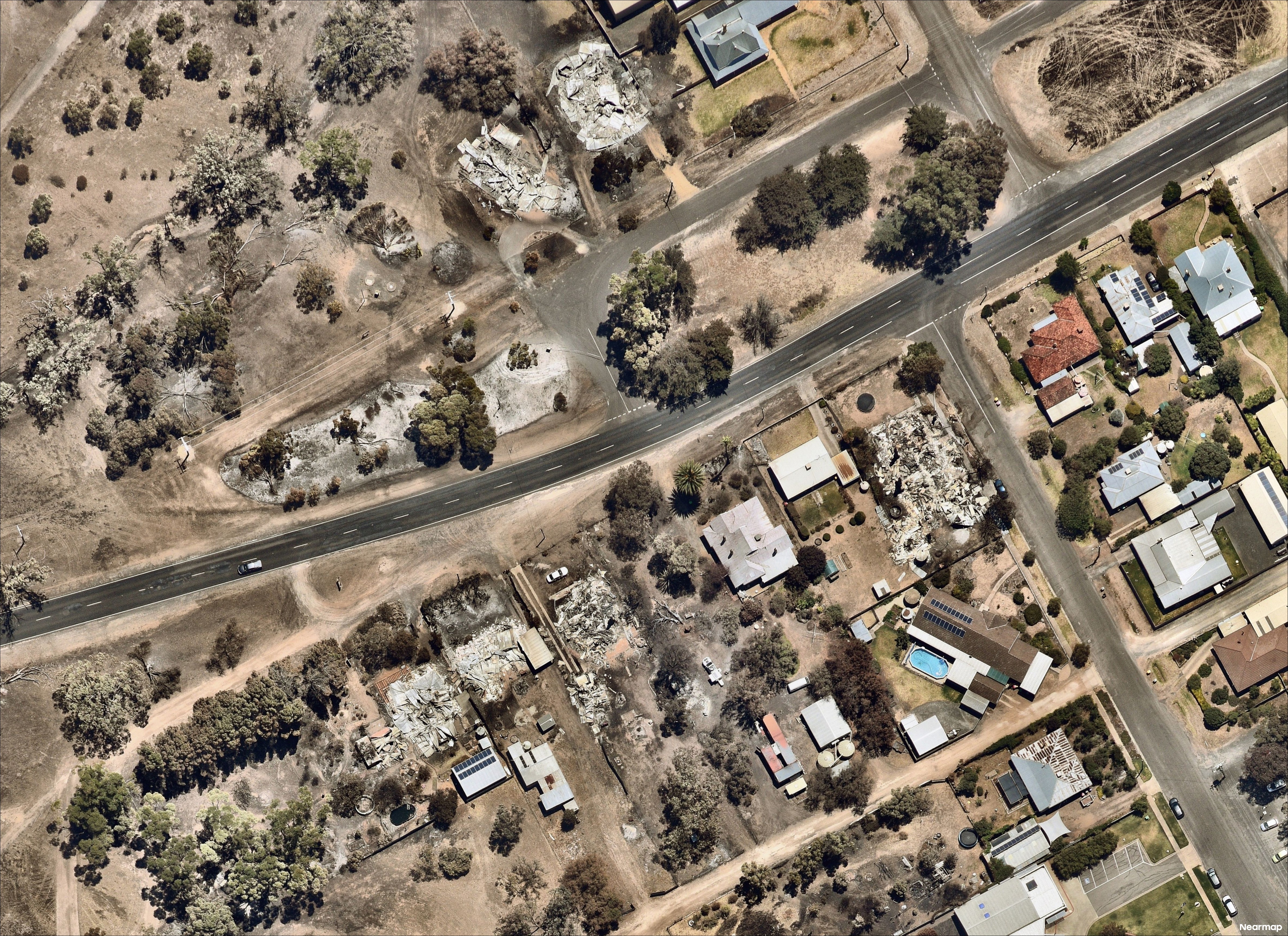
Post-catastrophe data delivered in days, not weeks
The decisions made in the first 48 hours after a catastrophe determine how fast communities recover. Nearmap ImpactResponse maintains reserve aircraft capacity specifically for disaster response. Planes are airborne over an impact zone within 24 hours of conditions clearing. A provider dependent on third-party imagery has no equivalent lever to pull.
Before Hurricane Ian made landfall, Kin Insurance had already mapped every exposed location across 40,000 insured properties. When the storm cleared, more than 50% of claimants were supported within five days.
“We can get money in their bank account before they even know they've lost their home.”
Adam Sturt, SVP of Data and Analytics at Kin Insurance.Faster catastrophe response isn’t built in the aftermath. It’s built on years of frequently updated imagery that existed before anyone knew the event was coming.
)
Accurate data saves more than time
Bexar Metro 9-1-1 routes emergency responses across three Texas counties from a single dispatch center. When Nearmap imagery identified a misaligned road centerline directing first responders to the wrong approach point, it was corrected the same day. Ambulances are now directed to the right address.
The City of Melrose reviewed 10,000+ parcels and identified nearly 6,000 discrepancies between assessment records and what actually existed on the ground. Plan review time dropped from 30–40 minutes to 5–15. Brisbane Airport cut annual roof inspections by 90%, saving more than $1.3M annually.
What makes these outcomes repeatable is what makes Nearmap different. Owned imagery, integrated AI, and guaranteed pricing working together as a single source of truth to answer property questions with certainty.
)
Complete property intelligence from a single, owned source
“With absolute confidence, we can talk to our customers about where the data derives,” says Andy Watt, CEO of Nearmap. “We have all parts in our world. That’s where we’re different.”
Most providers own one layer and license the rest. Nearmap owns all three.
The capture program features patented camera systems, flown on a schedule Nearmap controls, at 4.4–7cm resolution. Surveys are updated up to six times per year in key markets, covering 95% of the AU population annually.
The AI automatically surfaces 130+ property attributes extracted from Nearmap imagery. Models are trained on Nearmap data and always trace back to the source capture.
The guaranteed materials data is powered a 30-year pricing database. It’s trusted by leading P&C insurers because every number is backed by Nearmap in any situation.
Full ownership changes what’s possible at every stage. Insurers settle claims with pricing nobody can dispute. Underwriters price risk against verified current conditions. Catastrophe teams respond with actionable intelligence before adjusters can safely reach the impact zone. Government agencies assess entire jurisdictions without a site visit. Engineers design from accurate ground truth rather than last year’s assumptions.
Complete property intelligence has a definition. And only Nearmap meets it.
The standard for property intelligence
Properties change every day. Most property data can't keep up. Nearmap fixes this at the source with owned data capture, AI trained on that imagery, and guaranteed materials pricing from a single provider. That's complete property intelligence, and it's only available from Nearmap.
Discover What's Possible