Temporal Reasoning Engine: Separate real change from noise
)
Every property tells a story spanning years, not just a single snapshot. Nearmap Property Intelligence reasons across a full imagery timeline, separating real change from noise and answering questions no single image can.
A single image can only tell you what a roof looks like right now. Ask the same question about that roof a year later, using a new photo, and the answer may shift due to different lighting, bare trees instead of full ones, or a different camera angle. The roof itself might not have changed at all. The problem is memory: a single image has none. It can’t connect today’s answer to yesterday’s, so each photo stands alone, judged only on what’s visible in that one frame.
But your goal isn’t describing what a single image shows. It’s modeling the truth on the ground, the actual physical state of a property, independent of how any single capture represents it.
That’s a higher bar than computer vision has cleared so far. Detecting a pool, a solar panel, or storm damage in a single image is hard. Getting it right took years of research.
“Increasingly, the real question that needs answered is how a place has changed over time. Answering that requires a reasoning system built to work across time, not just within a single image. With that kind of system, you’re no longer limited to the individual moments when a capture happened. You get a representation of a location’s true state across a continuous history.”Eleanor McDonald, PhD, Principal Data Scientist (Product) at Nearmap
)
Knowing change from noise
A model reasoning across time has to track a specific object, weigh each new observation against everything it’s seen before, and shift its answer only when the evidence justifies it. A single low-confidence detection shouldn’t flip the answer. Multiple independent captures agreeing most likely should.
Most engineering effort goes into knowing what’s signal and what’s noise. Stability and change are two sides of the same coin. Model a stable truth well, and real change becomes obvious.
Two photos of the exact same, untouched roof can look meaningfully different. Sun angle shifts through the seasons. Shadows fall differently in late morning versus mid-afternoon. Trees fill out, then drop their leaves. Different flights and sensors produce slightly different results.
Telling a new roof, storm damage, or a torn-down structure apart from ordinary flight-to-flight noise takes more than one image. It takes several, looked at in unison. Ambiguous cases like staining or rusting are especially vulnerable to this kind of noise. Properly accounting for these cases require tracking a roof’s condition over time.
Only then can you confidently answer property questions like “Is the condition of this roof deteriorating over time, and if so, what’s the rate of decay?Eleanor McDonald, PhD, Principal Data Scientist (Product) at Nearmap
One record, fully traceable
This kind of understanding takes a rich foundation of data — years of consistent, repeated imagery over the same location, plus non-imagery sources like insurance assessor data or building permits filed with local authorities. Combine all of it into one system, and reasoning over time becomes possible for any given location.
The other piece is identity. Try matching a rooftop in this month’s capture to the same rooftop from three years ago, even as footprints get redrawn, parcels get resurveyed, or a building gets extended. The degree of difficulty is an entity resolution problem. Geometry and image features solve it together. Carrying a database ID forward and hoping it still lines up doesn’t.
Get identity and history right, and a stack of unrelated images becomes a timeline. Every value in it points back to the captures, model version, and confidence score behind it. The system can tell you what a property looked like as of any date, so a “roof replaced in 2024” answer can be checked against the exact images it came from.
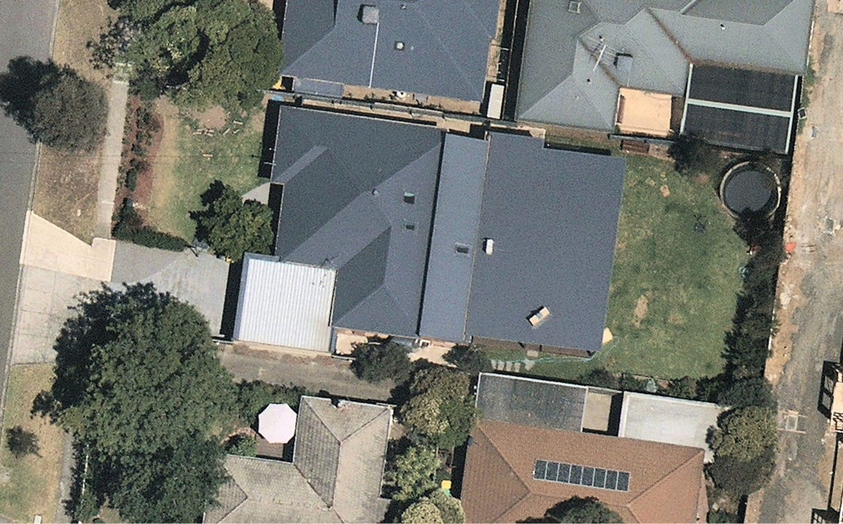
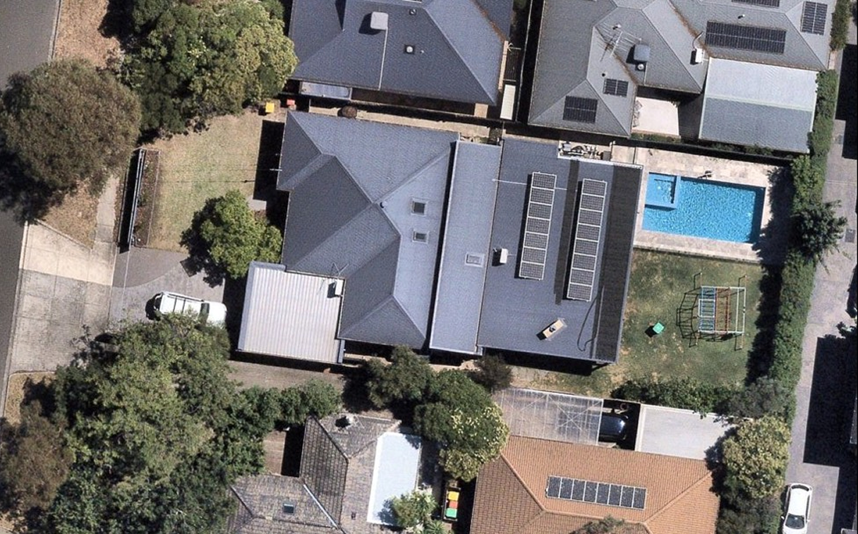
Already up and running
This isn’t a theoretical system. It’s real and already live. Nearmap uses this approach with its aerial imagery to help customers connect the dots between captures.
Here’s how it works:
Calculating roof ageNearmap builds timelines for every roof across the contiguous United States. By examining years of historical imagery, the system works out when a roof was actually replaced. Post-Catastrophe damage assessment runs on the same foundation.Detecting damageSingle-image damage detections can conflict with each other. This used to mean manual reconciliation. Now, multiple captures flown over the same footprint after a storm combine into one stable damage rating per building. That rating is anchored to the clean pre-event image, so you can tell whether damage was pre-existing. Each rating is backed by every capture behind it.
)
Neither of these exists just because the imagery exists. Both depend on technology built to reason across that imagery as one continuous record. That combination — deep historical capture paired with the modeling built to make sense of it over time — is what makes this a distinctly Nearmap capability.
With Nearmap, property intelligence stops being tied to single, fixed points in time. It becomes continuous instead, dramatically improving your record of the past. Model it well enough, and that past data enables you to predict the future.Brett Tully, PhD, Senior Director (AI) at Nearmap