How a tier one P&C insurer is reducing wildfire cycle times
From day-to-day claims operations to disaster response, this insurer accelerates claims without compromising on accuracy.


Faster triage and more accurate estimates

Improved customer trust and experience

Reduced unnecessary and unsafe site visits
The challenge
Physical inspection-dependent triage compromised speed and accuracy of decisions
One of the U.S.’s largest, tier one P&C insurers needed to move beyond inefficient verification methods in its day-to-day claims and disaster response operations.
A reliance on physical inspections drove up cycle times, costs, and meant that crews were being deployed to properties too unsafe to inspect. It was demanding on resources and difficult to scale.
Phone-based judgment or outdated imagery enabled a quicker response but meant adjusters were sometimes working from interpretation rather than defensible evidence.
The insurer sought a property intelligence platform that would reduce unnecessary site visits, speed up the claims cycle, and improve the customer experience.
The solution
Property intelligence across the full claims lifecycle
The insurer integrated Nearmap property intelligence across triage, catastrophe response, field safety, remote estimating, and dispute resolution.
Rapid CAT triage with ImpactResponse
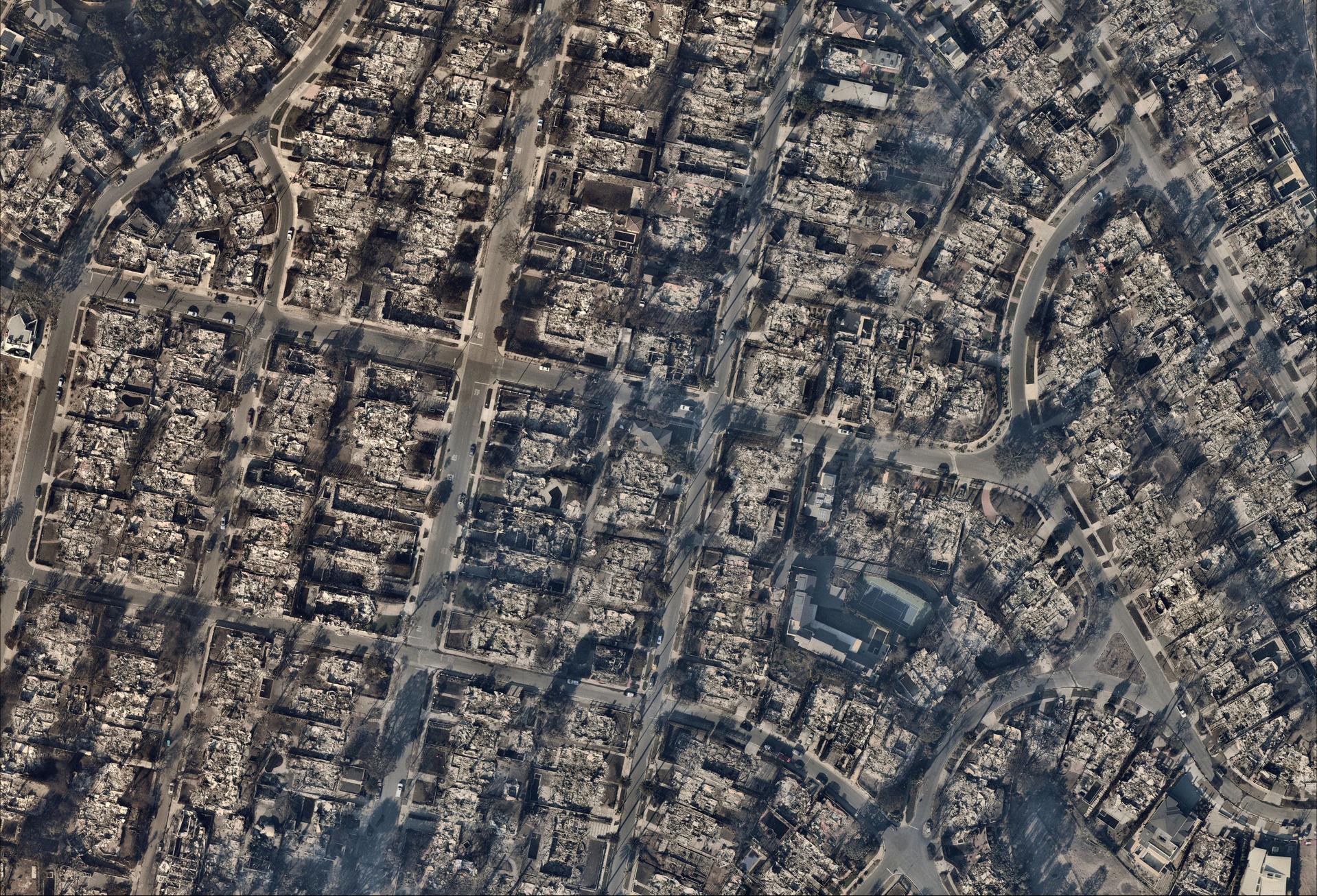
Nearmap ImpactResponse delivers post-event property intelligence as early as 24–48 hours of impact. Adjusters can remotely identify total losses, assess damage, and confirm property status across the affected area — without waiting for a field crew to reach each site. This rapid disaster intelligence also ensures crews are only deployed where it’s safe and necessary.
Historical imagery for pre-loss condition analysis
Nearmap hi-res imagery is captured at a sub-7cm ground sampling distance is captured up to 3 times a year, providing a date-stamped record of property condition before a reported event. Adjusters use it to accurately date roof replacements and identify damage that predated the reported event or policy inception in both post-CAT and day-to-day claims conversations.
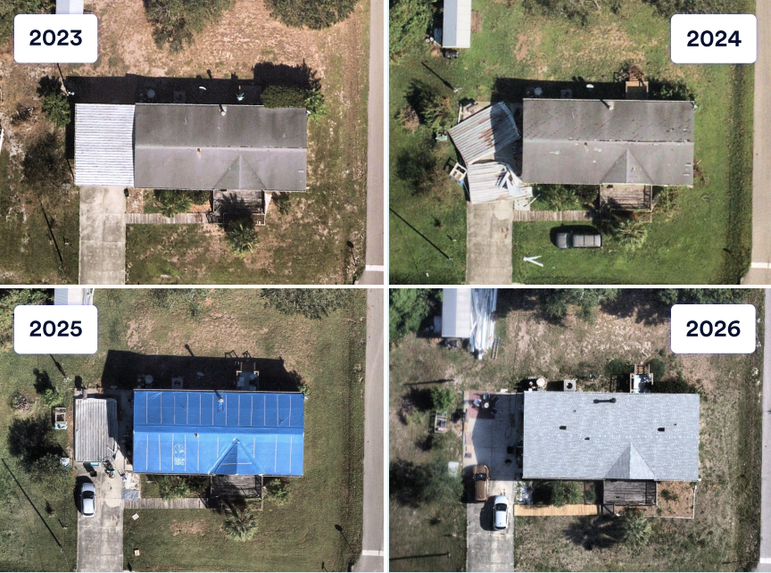
Remote estimating and measurement validation capabilities
Precise aerial measurements enable adjusters to produce defensible estimates at scale in daily claims. Assessments are grounded in measured data, allowing the team to validate and scope claims remotely that previously required in-person verification.
Proactive customer communication during evacuations
During evacuations and major events, aerial imagery gives the insurer visibility into a property’s condition before the policyholder can return. That evidence supports proactive, transparent communication in the moments customers need it most.
In focus: The LA Wildfires
When the LA wildfires struck, the insurer faced the challenge large carriers must address — hundreds of total loss determinations needed across a vast affected area, with field access limited and customer urgency high.
Using Nearmap ImpactResponse, the team identified total losses remotely at scale, enabling earlier claim routing and resource alignment. Base limit payments were issued weeks ahead of what a traditional inspection-first process would have allowed. Combined with broader workflow improvements, dwelling payment cycle times were cut in half or more.
The impact
Accelerated claims cycles that don’t compromise on accuracy
Property intelligence-driven remote validation enabled this insurer to make safer, more efficient decisions — across both day-to-day claims and CAT events.
Base limit payments issued weeks earlier, driving customer loyalty
Evidence-based total loss confirmation accelerated payments significantly, reducing the financial and emotional burden on displaced policyholders, and contributing to a higher customer retention.
Faster triage, better claim routing
The ability to assess damage and route work effectively before deploying resources reduced unnecessary touchpoints, improved overall efficiency, and lowered loss adjustment expenses (LAE).
Reduced preventable risk by eliminating hazardous inspections
Remote pre-assessment meant crews were no longer deployed to properties that were too steep or structurally unsafe — reducing preventable field risk and increasing adjuster efficiency and satisfaction.
Disputed claims resolved with trusted evidence, not interpretation
Historical imagery gave adjusters objective, date-stamped documentation to close claims involving pre-existing damage or fraud with confidence, accurately controlling indemnity and loss ratio.
See what property intelligence can do for your claims operation
Learn more how Nearmap ImpactResponse and aerial property intelligence can help claims teams make faster and safer decisions — from triage through to settlement.