Location intelligence: the competitive edge
Unlock smarter decisions with location intelligence solutions. Nearmap delivers high-impact data for success in real estate, enterprise, and urban planning.
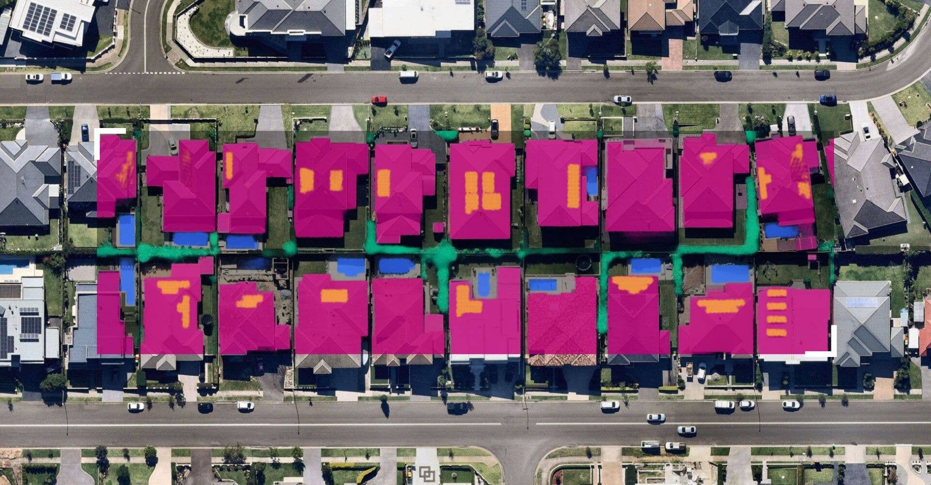
In today’s data-driven landscape, understanding the “where” is as crucial as the “what.” Location intelligence (LI) transforms geospatial data into actionable insights, empowering businesses to make informed decisions. Nearmap, a leader among location intelligence companies, offers a robust location intelligence platform that integrates high-resolution aerial imagery with advanced analytics.
What is location intelligence?
Location intelligence involves analysing geospatial data to uncover patterns, trends, and relationships. By layering various datasets — such as demographics, traffic, and weather — onto maps, organisations can visualise complex information in an accessible format. Nearmap location intelligence software provides detailed aerial imagery, enabling users to understand specific areas comprehensively.
Who uses location intelligence?
A diverse range of industries leverage location intelligence solutions:
- Insurance: Understand risk, assess portfolios and validate claims
- Real Estate: For site selection and market analysis
- Construction: To monitor project progress and plan logistics
- Utilities: For infrastructure management and maintenance
- Government: In urban planning and emergency response
Nearmap enterprise location intelligence services cater to these sectors, providing tailored solutions that address specific operational needs.
Why is location intelligence important?
Understanding spatial relationships enhances decision-making by:
- Improving efficiency: Streamlining operations through better resource allocation
- Enhancing accuracy: Reducing errors in planning and execution
- Driving growth: Identifying new market opportunities and optimising existing ones
By utilising location intelligence data, businesses can stay ahead of the competition and adapt to changing environments.
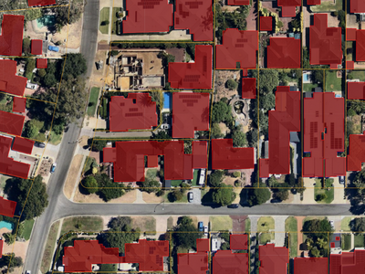
Location intelligence use cases
Practical applications of location intelligence include:
- Disaster Management: Assessing damage and coordinating relief efforts
- Environmental Monitoring: Tracking changes in land use and natural resources
- Transportation Planning: Optimising routes and managing traffic flow
- Marketing Strategies: Targeting campaigns based on geographic and demographic data
Nearmap location analytics tools provide insights into how to execute these tasks effectively.
How is location intelligence different from business intelligence?
While business intelligence (BI) focuses on analysing business data to inform decisions, location intelligence adds a spatial dimension, revealing insights that traditional BI might overlook. For instance, BI might show declining sales, but LI can pinpoint geographic factors contributing to the trend, such as new competitors in the area or changing traffic patterns.
Types of data used in location intelligence
Location intelligence integrates various data types:
- Geospatial data: Coordinates, maps, and aerial imagery
- Demographic data: Population statistics, income levels, and education
- Behavioral data: Consumer habits and movement patterns
- Environmental data: Weather conditions and natural features
Combining these datasets allows for a multifaceted analysis of any location.
Benefits of location intelligence
Implementing location intelligence offers several advantages:
- Enhanced decision-making: comprehensive data leads to smarter choices
- Cost savings: Identifying inefficiencies and optimising use of resources
- Risk mitigation: Anticipating and addressing potential issues proactively
- Competitive advantage: Gaining insights that competitors may lack
Nearmap location intelligence services deliver these benefits across various industries.
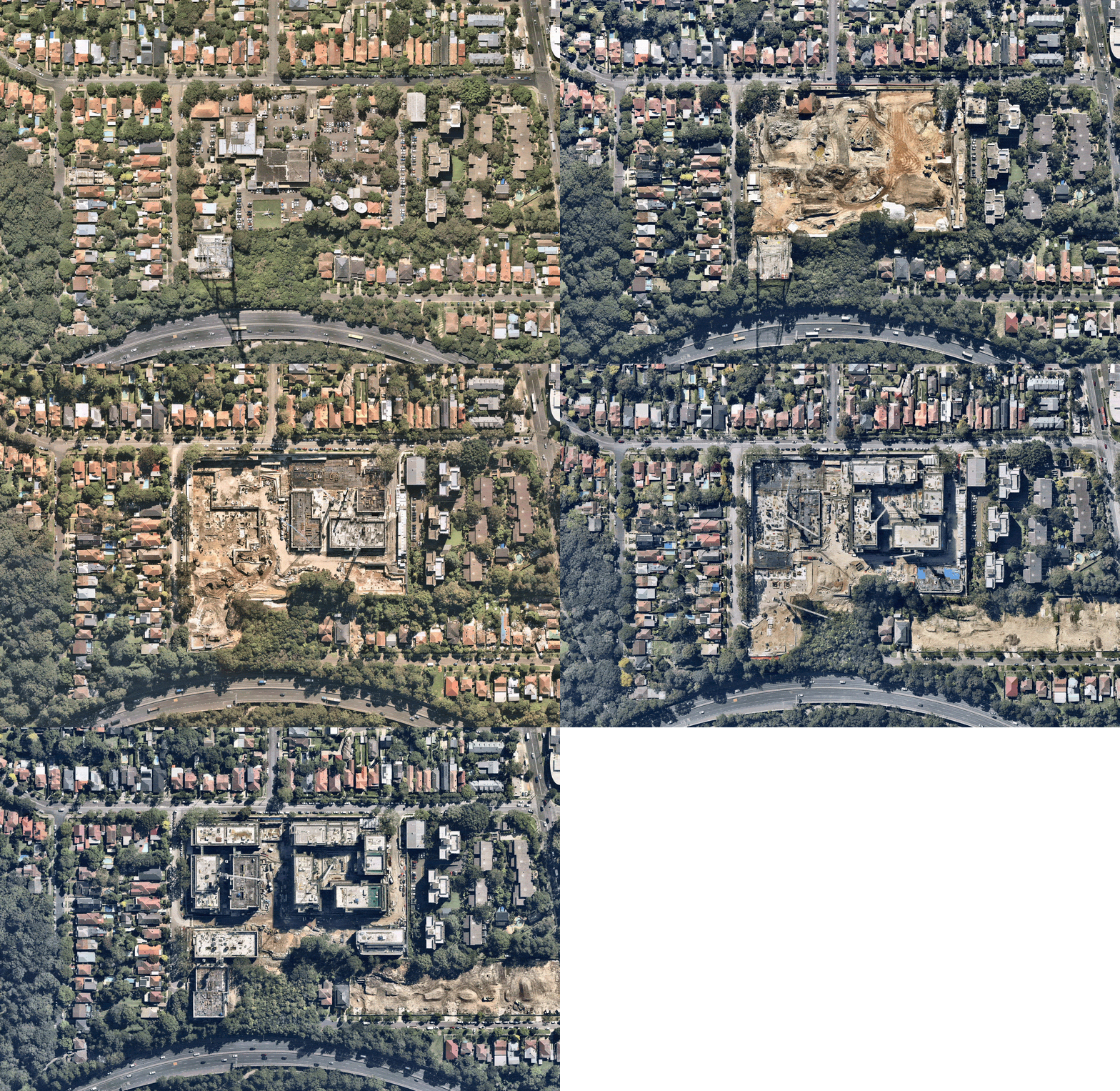
Top industries using location intelligence
Industries that significantly benefit from location intelligence include:
- Insurance: Assess portfolio risk, inspect damage and process claims
- Real estate: Streamline property valuation accuracy and investment analysis
- Retail: Identify and develop viable store locations
- Utilities: Optimise asset management and service delivery
- Transportation: Plan and manage assets, routes and logistics
- Public sector: Drive urban development and public safety initiatives
Nearmap solutions meet the unique needs of these sectors.
Challenges of location intelligence
Despite its advantages, implementing location intelligence can present challenges:
- Data integration: Combining disparate data sources into a cohesive system
- Privacy concerns: Ensuring compliance with data protection regulations
- Technical complexity: Managing sophisticated software and analytical tools
- Cost: Investing in high-quality data and technology infrastructure
Addressing these challenges requires careful planning and the right partnerships.
Technology used in location intelligence
Key technologies underpinning location intelligence include:
- Geographic Information Systems (GIS): For mapping and spatial analysis
- Remote sensing: Collecting aerial imagery data
- Global Positioning Systems (GPS): Providing precise location data
- Big Data analytics engines: Processing large datasets to identify trends
- Artificial Intelligence (AI): Enhancing predictive capabilities and pattern recognition
Nearmap integrates these technologies into its location intelligence platform, offering comprehensive solutions.
Examples of informed business decisions using location intelligence
Businesses have leveraged location intelligence to:
- Optimise supply chains: Analyse and improve transportation routes and warehouse locations
- Enhance marketing campaigns: Target promotions geographically
- Improve customer experience: Understand regional preferences and behaviors
- Mitigate risks: Assess environmental hazards and planning accordingly
These applications show the transformative impact of location intelligence on strategic planning.
Frequently asked questions
You have questions, we have answers.Yes, AI can process complex geospatial data, uncover patterns, and make predictive analyses, enhancing the capabilities of location intelligence platforms.
Applications span various sectors, including site selection, market analysis, logistics optimisation, and risk assessment.
It refers to analysing and interpreting spatial data to understand geographic patterns and inform decision-making processes.
By understanding customer behavior and geographic preferences, businesses can tailor offerings, streamline service delivery, and enhance satisfaction across regions.
Not at all. Small and mid-sized businesses benefit as much from optimising local marketing campaigns as they do from identifying new opportunities in their surrounding markets.
Unlock the power of location intelligence with Nearmap
Harnessing the full potential of location intelligence requires the right tools and expertise. Nearmap advanced location intelligence solutions provides high-resolution imagery and analytical capabilities to drive informed decisions across industries.
Ready to transform your business with spatial insights?
Explore Nearmap location intelligence solutions today and gain the competitive edge you need. Book a demo and see how Nearmap can elevate your strategic planning.