Nearmap Announces Agreement to Acquire Betterview

Learn More
X
Nearmap NAVIG8 2021 annual technology event
Events

Nearmap NAVIG8 2021

Explore presentations from Nearmap NAVIG8 2021 to uncover insights and learn how aerial technology helps solve real world problems.

Picture the Future, Today

Be inspired by informative super sessions, and learn more about MapBrowser and Nearmap products from technical workshops delivered by Nearmap experts.

Picture the Future, Today

Be inspired by informative super sessions, and learn more about MapBrowser and Nearmap products from technical workshops delivered by Nearmap experts.

Keynote Session

What does it mean to picture the future, today? How does Nearmap help your organization plan for tomorrow? Watch the NAVIG8 2021 keynote presentation to find out.

Shaping Our World, to Help Shape the Future

Discover how businesses and governments are building resilience and preparing for the future. Hear from Nearmap CEO Rob Newman, members of the Nearmap executive team and keynote guest Benjamin Grant, renowned author, artist and influencer.
Watch the Keynote

Technical Workshops

Get hands-on with Nearmap products and technology. Learn tips and tricks as you explore our flagship web application, MapBrowser, unwrap Nearmap premium content and more.

MapBrowser Basics Overview

Watch this session for an overview of the Nearmap web application MapBrowser to see how easy it is to navigate the latest imagery, review historical imagery, measure and markup projects.

Inside the Insights: Nearmap AI

Dr Michael Bewley, Senior Director of AI Systems shares the capabilities of Nearmap Gen 4 AI, including feature extraction across an entire landscape, not just a single property or parcel.

Level Up with Premium Content

See how you can use Nearmap content, from 2D to 3D to AI, to understand, communicate and support informed decision-making.

MapBrowser Masterclass

Take your MapBrowser skills to the next level and learn how to toggle layers on and off, export the latest imagery or import .KML files for easy boundary visualization.

Integrations and APIs

Learn how to use an API to create an interactive map app, access Nearmap content outside of MapBrowser, scaffold an application using an OpenLayer sample code, and access multiple Nearmap captures.

Super Sessions

Turn your attention to the NAVIG8 2021 super sessions and see how leaders in industries from insurance to government are viewing the world through a new lens.

Smart Cities in the Age of Digital Twins

Geospatial tech leader Esri shares how digital twins are connecting data models and technologies, and how GIS is essential for creating powerful digital twins of the natural and built environment.

Mapping New Infrastructure with 3D Data

Bentley Systems demonstrates the benefits of 3D digital twin models to optimize smarter city planning, delivery and maintenance – spanning engineering, procurement and construction.

Disaster Recovery Resilience

For Disaster Relief Australia, resilience is crucial. From mapping emergency routes to rapid damage assessment, discover how the organization prepares for response with aerial imagery.

Intelligence for Property Insurance

Learn how Nearmap empowers insurers to gain contextual clarity and make decisions across the policy lifecycle, gaining insights from high-res 2D imagery, 3D reality models, and AI location data.

Imagery Help USGA Plan the U.S. Open

Planning the annual world-famous U.S. Open Championship, the United States Golf Association (USGA) applies geospatial technology and imagery to efficiently map and build this iconic event.

Transforming GIS Workflows

See how the City of Carmel, Indiana leverages Cityworks to embrace digital transformation and GIS technology, transforming their workflows from procurement and budgeting to data sharing.

Enabling IoT for Smart Cities

Meshed demonstrates how the LoRaWAN® network wirelessly connects IoT devices to regional, national or global networks, helping bring Smart City visions to life.

Tomorrow's Telecom Network

Telco customers can reap benefits from smart system end-to-end experiences enabled by geospatial technology, explains Telstra’s Head of Customer Experience and Digital Innovation.

SFO: GIS Airport Mapping

To comply with FAA regulations and maintain operations, the San Francisco International Airport (SFO) GIS team maps the SFO built environment using accurate data from BIM and 3D reality models.

Solving Next-Gen Global Issues

Minderoo Foundation in Australia uses technology-enabled real-time situational awareness to help reveal solutions for major global factors such as fire and flood resilience, climate and health.

Weather Protection that Works

In response to the impact of severe weather events, Stormseal developed a lightweight, strong polymer film that heat-shrinks, and unlike tarps, resists all weather until permanent repairs are made.

Integrated City Asset Management

The City of Kingston, Ontario, Canada applies a digital-first approach using geospatial technology to improve planning, engineering, construction and public service operations.

Data Driving Insurance Start-ups

Bryan Falchuk of Insurance Evolution Partners shares insights on how insurance start-ups are gaining traction with technology and third-party data insights, such as high-resolution imagery.

Validating Mutual Insurance

See how Picnic Insurance uses Nearmap imagery to validate existing natural peril risk models to make better underwriting decisions for its Platform-as-a-Service mutual digital model.

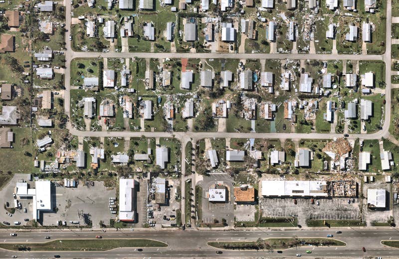
Aerial map imagery exhibition revealed during Nearmap NAVIG8 2021

Imagery Exhibit

Become immersed in a virtual exhibit with images curated by Nearmap employees and Benjamin Grant, founder of Overview. 

View Exhibit
High resolution image of Calera, Alabama
May 2022 | Calera, AL, US

More Live and Virtual Events

Whether the events are in-person or hosted virtually, as a large conference or webinar, aerial image technology can help to change the way you work.

Learn more about Nearmap at any of the upcoming or past industry events.

View Other Events