Nearmap Announces Agreement to Acquire Betterview

Learn More
X
Up-to-date satellite maps of Seattle, Washington
Nearmap

Can Your Map Do That?

Make confident decisions every day with powerful mapping technologies and up-to-date location intelligence.

Jun 2021 | Seattle, WA, U.S.

Crystal-clear Certainty has Never Looked so Good

See more and do more with consistent, high-quality geospatial intelligence from Nearmap. Create profound, scalable change right from your desk. See what else you can do with Nearmap imagery and data.

Dec 2019 | Lafitte, LA, U.S.
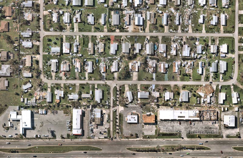
Aug 2021 | Damage from Hurricane Ida, Lafitte, LA U.S.

Can Your Map Enhance Risk Models?

Get eyes on the ground without ever leaving your desk.  Understand risk and assess damage in ways that weren't possible - until now.
Insure with Confidence
Aerial views for government city management
Neighborhood Growth, Lehi, UT U.S.

Can Your Map Manage a Growing City?

Leverage Nearmap imagery to plan for smarter more livable cities and meet every need of your communities.

Up Your Aerial Game
Time-lapse historical aerial maps of construction remote monitoring
SoFI Stadium Construction, Inglewood, CA U.S.

Can Your Map Enable Remote Engineering?

Plan and monitor projects, provide accurate quotes, and visit job sites remotely with up-to-date aerial content.

Skip the Survey Site
High resolution aerial maps in New York
New York City, NY, U.S.

Do More with a Map that does More

Get more than aerial imagery - get on-the-ground intelligence. Unlock productivity and plan confidently by understanding the world from all angles.

See for Yourself