
Introducing: Nearmap for Post-catastrophe Response
Post-catastrophe imagery and AI-derived property damage and condition data unite to help insurers process customer claims more efficiently.
Post-catastrophe imagery and AI-derived property damage and condition data unite to help insurers process customer claims more efficiently.
Rapid advancements in technology that require major infrastructure upgrades can be daunting investments for telecommunications companies. New cell phone towers, fiber networks, buried and aboveground infrastructure all need to be continually assessed and improved.
Many companies are turning to high-resolution imagery to help manage, monitor and plan for new pieces of infrastructure, helping them move more quickly to market with new technology. Some benefits include:
During the inception phase, telecom companies can conduct initial site inspections using high-resolution aerial imagery. Imagery is updated frequently throughout the year to offer up-to-date and varied views of sites, making it more cost effective versus sending crews for evaluation.
Aerial imagery can show water issues, surrounding infrastructure, vegetation, and point out locations that are inappropriate or need further research. This can help speed new technologies to market through better allocation of resources.
Often companies use oblique imagery to map out poll heights and placement before stepping on-site. Combining aerial imagery with geographic information systems (GIS), telecom companies can mitigate risk by layering critical location data with real visual context.
Because time is of the essence when trying to compete in today’s fast-paced market, telecom companies require highly accurate, up-to-date data. More importantly, they need to be able to visualize ground conditions clearly and consistently.
In particular, oblique images are important for telecom companies since they need to assess the height of infrastructure in comparison to the surrounding environment and view locations from multiple perspectives.
While aerial imagery may not eliminate the need for site visits, it allows field crews to be efficient about where and how they spend time once they are on-site. Because high-resolution aerial imagery is captured multiple times per year, it also allows businesses to view and analyze changes over time. For example, telecom companies may require views of locations during “leaf-off” seasons.
Aerial imagery is scalable, easily integrated into planning tools and provides accurate, up-to-date information enabling telecom companies to plan, implement and maintain infrastructure needed for new technology.
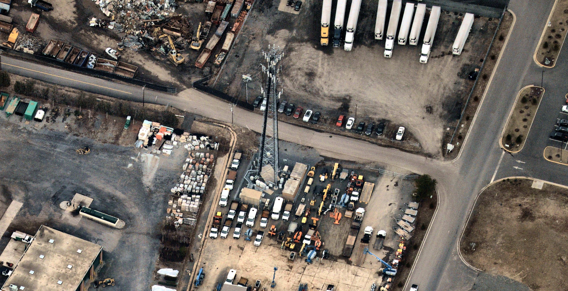 Cell Tower - Gainesville, VA; captured February 15, 2019
