
Introducing: Nearmap for Post-catastrophe Response
Post-catastrophe imagery and AI-derived property damage and condition data unite to help insurers process customer claims more efficiently.
Post-catastrophe imagery and AI-derived property damage and condition data unite to help insurers process customer claims more efficiently.
A recent article published in Trajectory by the USGIF said it best about the insurance industry. Mark Alderton writes:
“Insurance companies are the gutsy gamblers of the business world. Like high rollers in a Vegas casino, they spend their days playing the odds in a game of real-life roulette.” Mark goes on to state “As any actuary, underwriter, or adjuster can attest, the difference between winning a bet and losing it is information. And to make gambles that are responsible rather than reckless, insurers need lots of it. Some of the best information they can acquire is geospatial in nature.”
“Some of the best information they can acquire is geospatial in nature.” It’s this information that’s used to ring the risk out of underwriting. It’s this information that allows insurance claims to be processed without dispatch. To attain these goals, insurers rely on new approaches to technology, including advances in data science.
One of the key pieces of foundational information needed to create the data science is aerial imagery, or “aerial maps”. These high resolution, updated photographs are instantly accessible and show incredible detail about the truth on the ground related to these individual properties. Take a look at this aerial map for Malibu, California taken in the fall of last year:
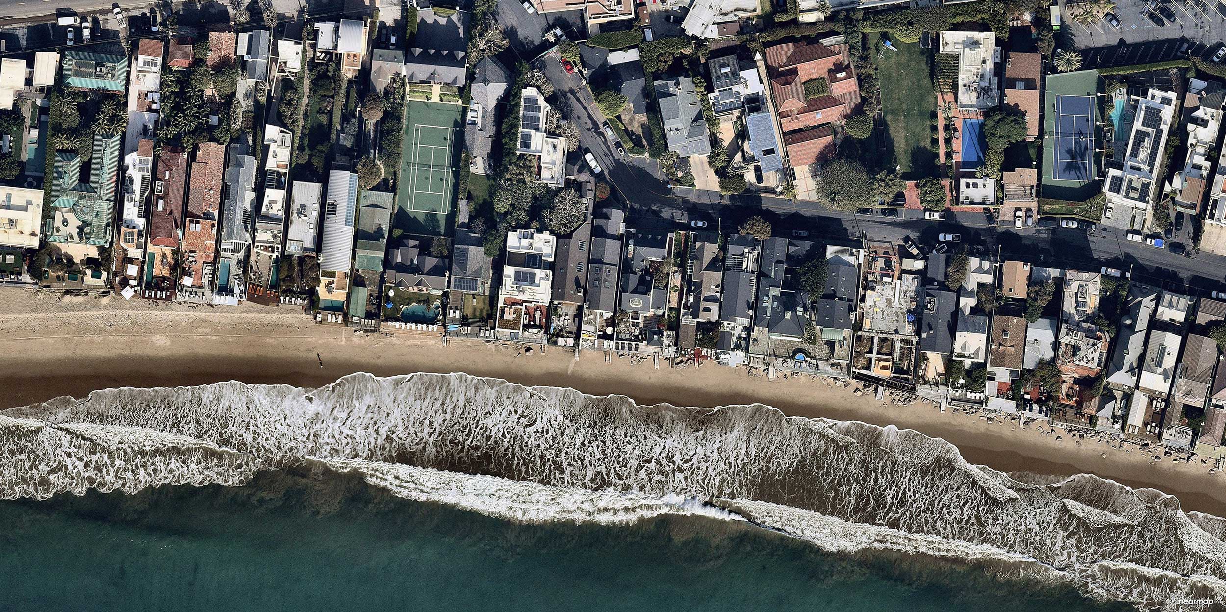
If you take the time to study it, you’ll notice different types of roofs, pools, new construction and so much more. But can you quickly identify the rich set of data in this single shot—say, the different roof types? Can you see where trees encroach and overhang homes and buildings, increasing the risk? Can you identify all the pools and solar panels? Where are the construction sites, could these be future opportunities to underwrite? Even though the imagery is very high resolution, there’s an investment of time needed to discern these attributes, many of which are essential in scoring risk in insurance and appraisal.
Not fully convinced yet of the value? Try it this way: paint the same imagery with intelligence gleamed from machine learning attributes and overlay them on the imagery to bring greater meaning—at scale, anywhere the imagery exists. This blend of artificial intelligence and aerial maps ends up looking like this:
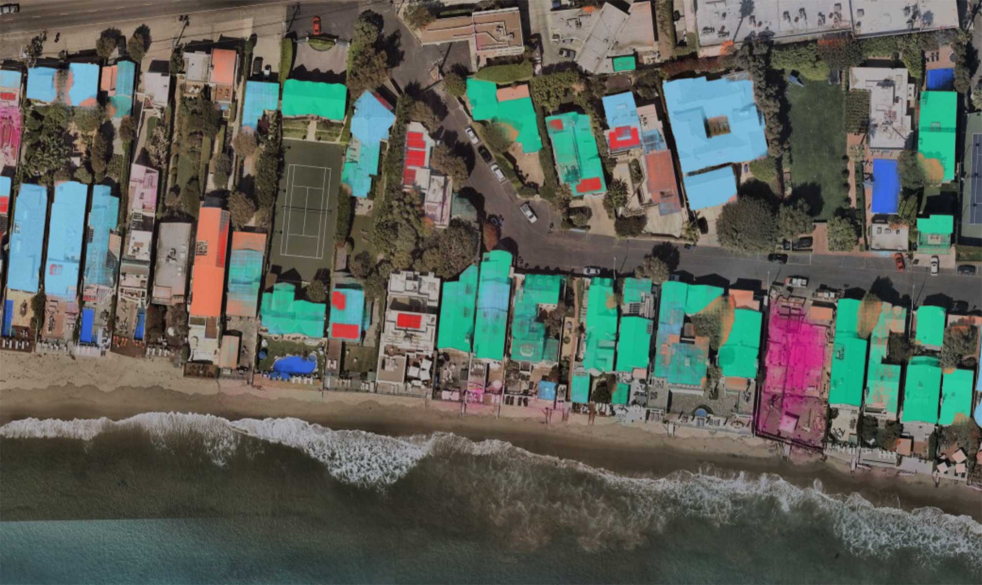
And here are the answers – again, automatically identified:
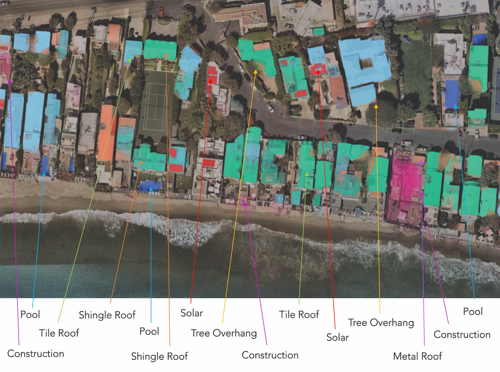
Using tested machine learning algorithms, the attributes within the imagery has been classified along with confidence scores. You may have noticed that some of the roofs are more transparent than others. This corresponds to confidence: the more transparent, the lower the confidence. With this added insight, you can make better decisions.
Using these approaches, insurance carriers can review at scale their policies in force, in addition to pricing and bidding on new business with real, verifiable data. They can export these parcels, determine how many properties have the attributes and how many do not. They can make underwriting decisions, verify claims after hurricanes and better understand how properties are changing over time. They can allocate resources more efficiently, resolve customer inquiries faster, measure surface areas and integrate these images into other products revealing new insights.
In use cases very close to this one, county appraisers interested in home valuation and meeting tax role deadlines now have new intelligence to improve the accuracy of their commercial or residential assessments. They can verify permits, reduce the number of appeals, minimize inspection time, and work faster with fewer resources.
The application of AI and machine learning to imagery is breaking new ground for insurance providers and government appraisers. The fact that imagery capture, processing and machine learning can now be accomplished against massive amounts of aerial maps with true location intelligence, means that any organization can immediately improve their approach and save time and money in the process. For the first time ever, those assurances we all want are readily available from your tablet or notebook – instantly.
Want to learn more? Discover additional features and benefits of using Nearmap AI, or for a demonstration of this new technology, contact Nearmap. We’re ready to show you how automated insights can help transform the way you work.
