Introducing: Nearmap for Post-catastrophe Response
Post-catastrophe imagery and AI-derived property damage and condition data unite to help insurers process customer claims more efficiently.
Post-catastrophe imagery and AI-derived property damage and condition data unite to help insurers process customer claims more efficiently.
In August 2015, Apex North Carolina, a fast growing town near Raleigh was rated #1 in Money Magazine's Best Places to Live. Blessed with a charming downtown, highly rated schools, a community spirit second to none and high paying tech jobs, the population of Apex has more than doubled since 2000 and there’s no end in sight. Growth is the new normal for Apex where a three-bedroom home costs an average of $265,000 and a 7,000-Acre area called Research Triangle Park is only 18 miles away. Tech jobs abound and fuel the growth. But with it comes the ever present need to work smarter, plan better and ensure the citizens of Apex and surrounding towns continue to live, work and play in one of the finest places in the US.
Apex realized a while ago that to accommodate this type of growth, they needed to leverage modern approaches to city planning. They needed to work efficiently to manage constant development. One of the solutions they use combines Esri’s ArcGIS technology for mapping and Nearmap high resolution aerial imagery. The combination allows them to visualize and measure with unparalleled accuracy. Relying on out-of-date satellite imagery was not getting the job done. In a city where population change is a way of life, GIS professionals needed instant access to the most current information available. In years past, planners had to drive the streets, inspect roadways and roll out the measurement wheel. But now, they can do a lot more within constrained windows of time – all in the cloud.
The use cases for these solutions are diverse. Law enforcement calls on GIS professionals from Apex to quickly provide current, clear, aerial photography for active or on-going investigations. Planners focused on development are charged with meeting state regulatory reporting guidelines when it comes to building and maintaining roads. Environmentalists want to know if anyone is digging on protected land. The list goes on and on.
So why does this matter? In recent conversations with Steve Nelson, a GISP with Apex, NC, we reviewed the State Street-Aid Program, also known as the “Powell Bill” where financial allocations are made to incorporated municipalities eligible under North Carolina law. It makes sense. State routes that pass through incorporated cities are maintained by the cities. Cities are responsible for paving new roads but the state has the power and economic means to reimburse them. If any of this sounds dull to you, guess again. The Powell Bill disbursed close to $150 million to qualifying municipalities in FY 2015 and Apex received well over 1 million of those funds. With increased growth in FY 2016, the financial return projected may be 30% higher than the prior year. These funds are essential if Apex is going to continue to provide the level of government service that citizens have come to expect—a big reason why people continue to move there.
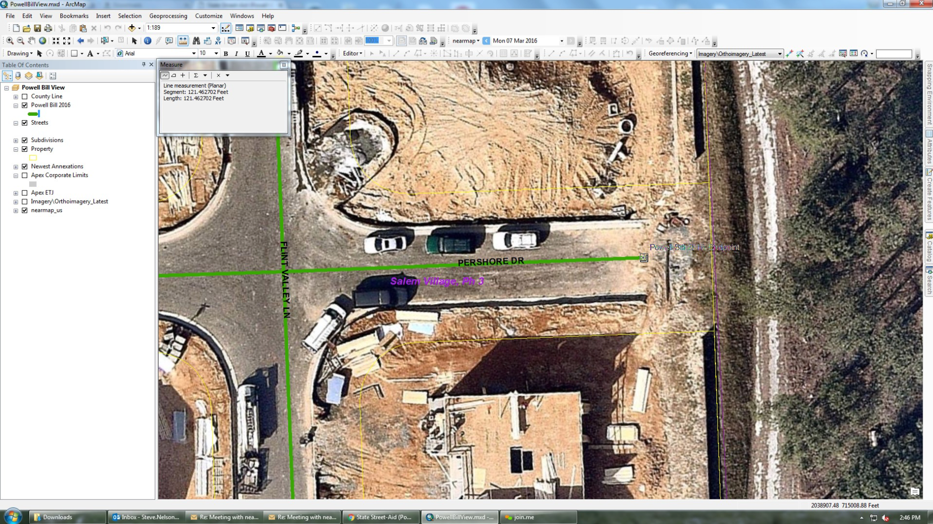
Let’s look more closely at how this works. To qualify for reimbursement for new roads developed and maintained, Apex needs to submit a report to state engineers for review. In short, the report documents the distance for all the newly paved roads. Prior to using Nearmap, they had access to imagery from 2013 but the actual development took place after this. In Figure 1 below, the 2013 imagery simply outlines the parcels and rights of way. But since it has no detail with respect to where the roads start and end, a lot of field work was needed to take measurements, drive roads scattered across the county and collect data.
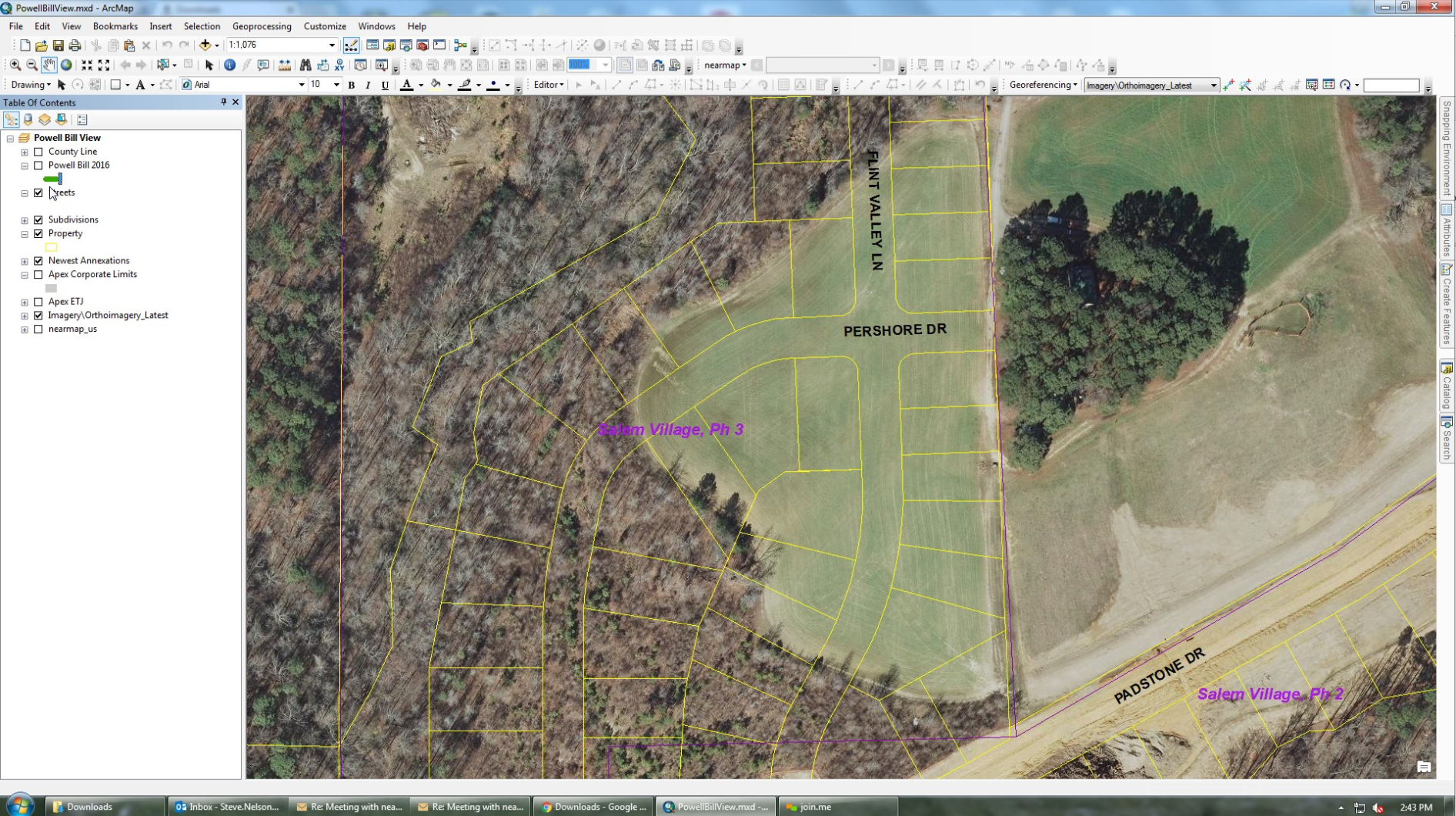
Figure 1: Aerial Imagery from 2013 displayed in ArcGIS® from Esri®
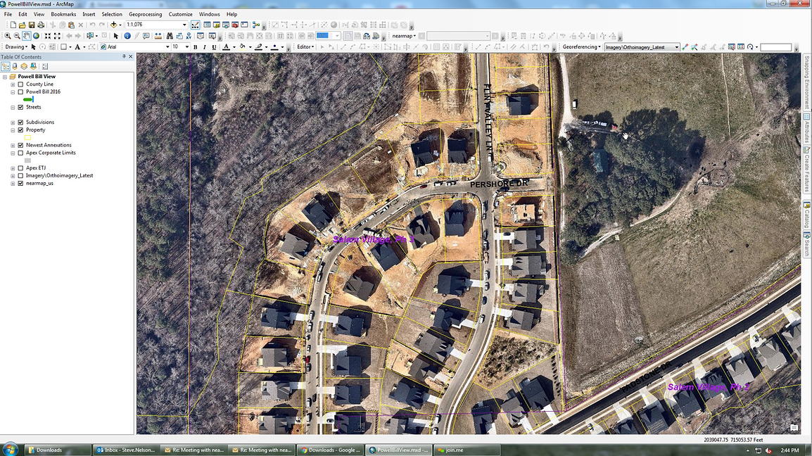
With ArcGIS and Nearmap, people like Steve Nelson have instant access from their desktop to the same location from the Spring of 2016. Three significant differences come to mind
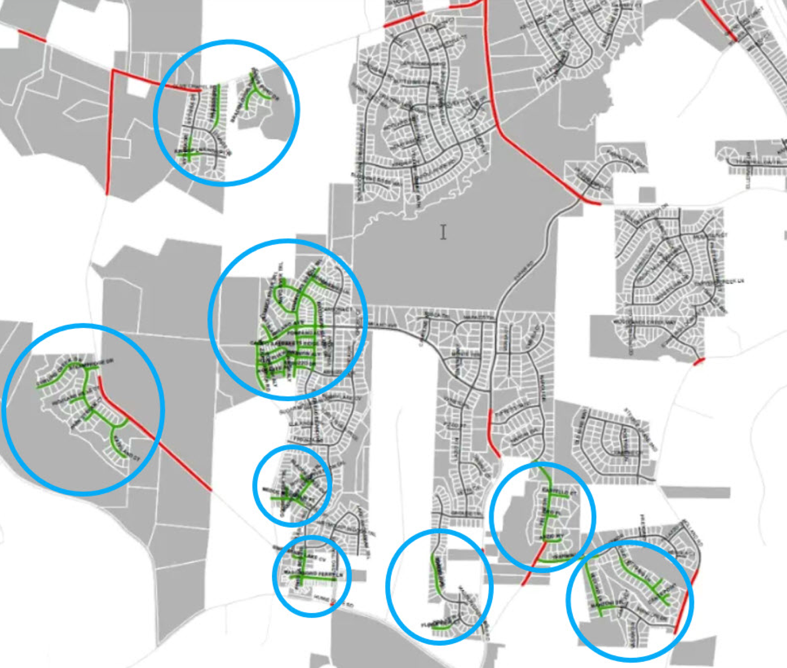
When you consider this type of growth, Apex has found innovative ways to get the job done. The diagram below highlights a small portion of new roads created in Apex within the last year. The green lines highlighted are scattered across the city. As Apex continues to grow and annex adjacent territory, the dynamic nature of this problem requires current, clear imagery that shows changes over time. Nearmap and ArcGIS from Esri provide the solution to a very big problem where the financial return can make all the difference.