
Introducing: Nearmap for Post-catastrophe Response
Post-catastrophe imagery and AI-derived property damage and condition data unite to help insurers process customer claims more efficiently.
Post-catastrophe imagery and AI-derived property damage and condition data unite to help insurers process customer claims more efficiently.
There’s a lifecycle in civil engineering and construction. Projects are born and mature over time. As they speed to completion, developers, engineers, designers and construction pros work diligently to minimize risk every step of the way.
Anyone involved in this process understands the value of seeing the real world with perfect clarity. They recognize that current ground truth represents the difference between success and failure, profit and loss. In this world, the details really do matter—from site evaluation through selection, site planning, design, engineering, construction and maintenance.
High resolution aerial imagery is a powerful force in the engineering and construction lifecycle. If you could instantly visualize current imagery for hundreds of possible locations in collaboration with developers, wouldn’t the process be simplified? As you assess environmental conditions, neighboring communities, adjacent development and other sources of data, you filter out the noise. With careful selection, risk is minimized.
This rock solid foundation cements the structure for the rest of your project. Designers thoughtfully visualize the world in which we live. Engineers guarantee precision. Builders streamline construction. Inspectors work faster. And as the lifecycle continues, maintenance and expansion teams are able to see clearly, anticipate change and better manage resources.
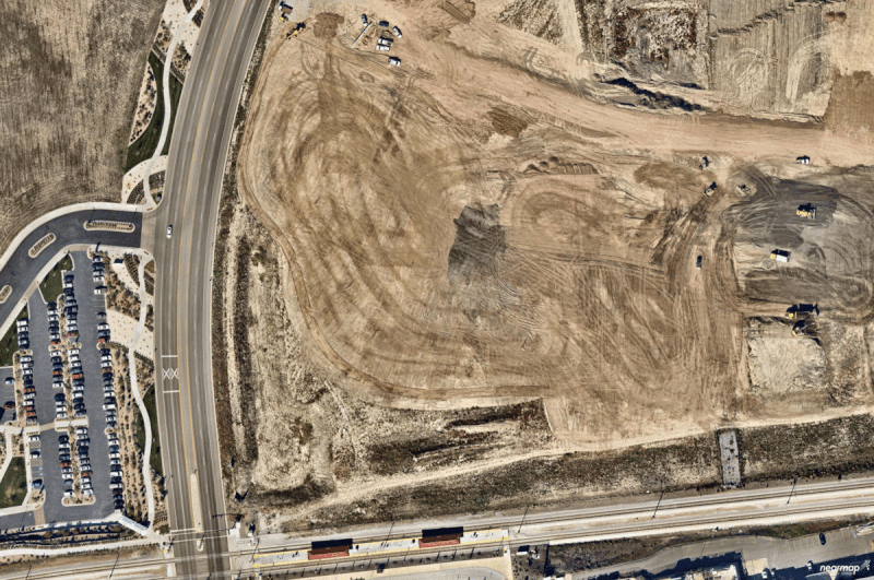
New Overstock HQ in Salt Lake City, Utah – Aerial Imagery shows change from October 2014 to August 2016
To make this happen, the aerial imagery you use has to have these 6 attributes:
The use cases for instantly accessible, high resolution aerial photography in architecture, construction and engineering continue to proliferate. Organizations focused on commercial and residential development, water treatment, roadway design, sewer management, traffic engineering, feasibility analysis are all circling around advances in location content to drive their business.
Today and tomorrow, those interested in transforming the way they work will use high-resolution aerial images to assess road conditions, land features, drainage patterns and land acquisition. They will strive to manage all phases of the engineering and construction lifecycle using modern approaches to location content. Instant access to recent aerial imagery allows you to perform the due diligence to get the job done. Progressive organizations have discovered a new way to compete, a new template for success—current, clear, changing imagery providing unprecedented access, higher levels of productivity and smarter communication is becoming the new normal.
Interested in learning more? Talk to one of our experts to get a live demo of Nearmap.
