Nearmap Announces Agreement to Acquire Betterview

Learn More
X
Proactive City Planning with Aerial Maps
Customer Story

Proactive Emergency Response Through Aerial Imagery

The power of combining data and imagery for city planning.

Aug 2022 | Kelowna, BC, CA
We use Nearmap proactively by using passive data and the frequency of the imagery provided throughout the year to plan for our city. It’s like Christmas day to my team when I send out the announcement that new imagery is available in Nearmap. The truth on the ground delivered by each new survey empowers Kelowna with the certainty that they will have the data in place to plan for any situation.
Kevin Stehle, Business Systems Analyst (GIS and Data Analytics), City of Kelowna
Logo

Kelowna is a city in the south of Canada’s British Columbia. The city uses Nearmap aerial imagery to collect location intelligence and create a resilient community. With the help of the Advanced Planning Team at the Emergency Operations Center, Kelowna uses this data to enhance their understanding of what’s happening on the ground without having to go onsite.

The Challenge at a Glance

Proactive Risk Assessment

Kelowna is located near the salmon-bearing Mission Creek, the largest tributary in the area. This past spring, heavy rainfall resulted in an unusual amount of debris getting stuck under a low-lying bridge. Flows in Mission Creek were high, but not as high as some recent events.

Kevin Stehle, Business Systems Analyst at the City of Kelowna, and the team leveraged aerial captures of the creek’s surroundings to identify the cause of the excess debris. The team went to Nearmap MapBrowser to look through the library of historical images to see what had changed in the creek. The Kelowna GIS professionals found several small log jams upstream of the bridge that created debris issues. Using the next aerial capture, after the event, they were able to illustrate that previous log jams had been greatly reduced.
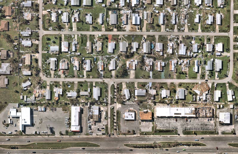
Environmental disaster planning with aerial images Mission Creek Log Debris Identified
River debris monitoring with vertical aerials Excavator removing debris from Mission Creek
The Solution at a Glance

Data-driven Decisions with Aerial Imagery

The Emergency Operations Center now has the data they need to make more informed decisions for the next event. In 2022, Nearmap aerial intelligence enabled Kelowna to gather more than two dozen high-resolution visuals that clearly depicted the severity of the issue and the potential damage to nearby infrastructure in the event of the log jam breaking free.

The city then look in MapBrowser to use its oblique vintages and the built-in measurement tools to estimate the potential impact. The multiple vantage points provided by Nearmap enabled the city of Kelowna to investigate the area for removal points and approve the necessary actions.

City Impact

Creating More Time to Act

The use of aerial intelligence allows Kelowna to evaluate their community at scale, inspect with sharper detail, and move forward with confidence with insight-rich visuals. The city’s Emergency Operations Team Analysts were able to evaluate the risk of several log jams in minutes—a process that would take weeks if done manually. They used this precious extra time to notice a bridge across Mission Creek as the main concern due to its lack of height above the water surface, which could result in multiple debris impacts, as well as potential flooding.

With access to regularly updated aerial imagery, Kelowna is able to create a resilient city capable of reducing risk through proactive measures. In an era where aerial data is able to drive decisions, the city’s GIS professionals view the ability to know about what’s happening in their county as the return on investment.

Bridge monitoring aerial image software Monitoring Debris Under Bridges
High quality aerial maps for government
Related Product

Nearmap Vertical

Get a clear perspective with frequently captured high-resolution aerial imagery and geospatial data.

Find Out More
Emergency response planning in Kelowna
Aug 2022 | Kelowna, BC, CA

Join the Mapping Evolution

Work with frequently captured high-resolution aerial imagery for a clearer view to assist in disaster recovery and rebuild.

Start the Conversation