Nearmap Announces Agreement to Acquire Betterview

Learn More
X
Historical Image Comparisons, Sep 2019 - Dec 2019 | Cudlee Creek, SA, AU
Customer Story

Managing Disaster Aftermath with Nearmap

With 2,500 members and six teams, Disaster Relief Australia relies on Nearmap to help communities bounce back after a disaster. 

Dec 2019 | Cudlee Creek, SA, AU
Nearmap provides us the solution we need to maximize our resources and provide the greatest benefit to our communities.
Richard Adams, National Director, Disaster Relief Australia
Disaster Relief Australia logo

When the fire is out and the floodwaters recede, the flurry of activity associated with emergency response subsides. It’s also when communities affected by disaster need the next wave of help. Meet Disaster Relief Australia.

The Challenge at a glance

Navigating Post-Disaster Recovery

The National Director of Disaster Relief Australia (DRA), Richard Adams, says that the organization operates in the recovery phase, as opposed to the response phase. DRA identified a gap between the emergency response stage and the assistance communities required post-disaster as the organization, along with its volunteers, are working to fill this gap.

Bushfire damage and recovery in Cabramurra, New South Wales Jan 2020 | Cabramurra, NSW, AU
Bushfire recovery aerial satellite images of Kangaroo Island Jan 2020 compared to Dec 2020 | Kangaroo Island, SA, AU
The Solution at a glance

Big Picture Perspective

In the past, DRA had relied on drones to get the imagery it needed, but realised the limitations of drone imagery when providing relief after the Kangaroo Island bushfires in early 2020.

DRA was introduced to Nearmap and quickly realized the benefits:

  • Ability to survey the entirety of Kangaroo Island
  • Effective, efficient use of volunteers
  • Ability to plan and deploy teams where required with confidence
  • Capture dispersed areas 
  • Fast insights for property assessment
Business Impact

Maximizing Resources

According to Adams, Nearmap imagery has given DRA a much better idea of what’s required for its disaster relief efforts, especially in large areas. This means being able to focus their drone teams on smaller, more appropriate tasks, while also reducing the inefficiency of putting people in cars to drive to each property to undertake initial impact assessments.

“The more people who can have access to a tool that provides them with that situational awareness, the better,” Adams says.

Post catastrophe bushfire images on Kangaroo Island Jan 2020 | Kangaroo Island, SA, AU
Aerial images for bushfire recovery
Related Product

Find the Unfindable with Nearmap

Expand your visibility with Nearmap's frequently-captured, high resolution aerial images.
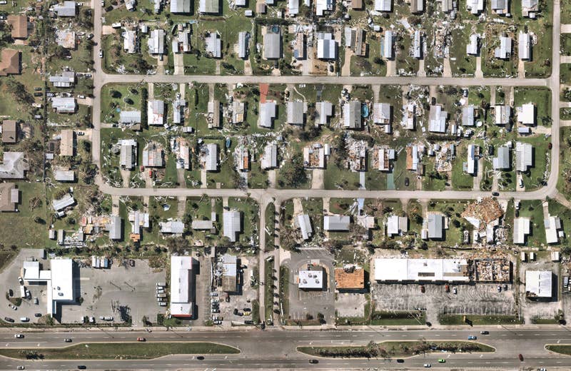
Discover Vertical Imagery
Disaster recovery high quality aerial images on Kangaroo Island
Jan 2020 | Kangaroo Island, SA, AU

Join the Mapping Evolution

Up your aerial game and start working with high-res, current imagery of your work sites and properties. Get the advantage of premium geospatial content combined with world-class mapping software and integrations.

Start the Conversation