Nearmap Announces Agreement to Acquire Betterview

Learn More
X
Integrations

Aerial Map Geospatial Integrations and APIs

Leverage the power of Nearmap high-resolution aerial imagery and datasets inside industry-leading platforms or custom-built applications.

Easily Access Nearmap in your Current Workflows

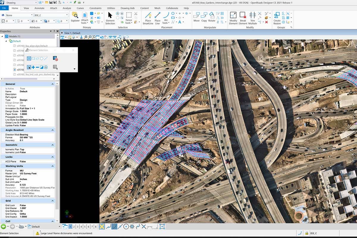
Nearmap gives your organisation a convenient way to access reality in your favourite workflow applications, including GIS, CAD and asset management platforms. Whether you’re technically experienced or just getting started, you’ll find easy, intuitive options to plug current and historical Nearmap content into your workflows.
Nearmap Vertical

Quick, Easy Integrations

Comfortably configure your preferred integration method in minutes to consume Nearmap imagery and content in your preferred workflow — no coding or software development required. Nearmap offers four simple methods to integrate:

  • WMS 2.0 (Web Mapping Service) – auto-generate a WMS URL to stream Nearmap Vertical in a wide range of third party applications.
  • ArcGIS Marketplace - convenient integration for Esri users. Stream Nearmap Vertical via the ArcGIS Marketplace. automatically updated for each new capture.
  • MapBrowser Export – export georeferenced 2D content out of MapBrowser using your preferred projection.

Aerial Integration Partners

Nearmap integrations are release-ready, allowing you to maintain a seamless workflow alongside software updates. Fresh surveys are published automatically so you always have the latest content at your fingertips. Nearmap offers integrations into a wide-range of applications from our technology alliance partners: Autodesk, Bentley, Cesium, Cityworks, Esri, Ruekert & Mielke and VertiGIS.

Measurable Obliques

Oblique views show you a gallery of individual images from four directional perspectives, capturing a high resolution view of the sides of buildings and other ground features.

Browse aerial view maps of property and accurately measure what matters: building heights, widths, roof pitch, and roo


Nearmap Vertical

Nearmap APIs for Developers

Easily implement Nearmap into developer applications to suite your unique business needs. With Nearmap APIs you can create custom functioning applications for bespoke solutions and within popular GIS and CAD applications. Learn about Nearmap APIs on our Help Centre including:

  • DSM and TrueOrtho API
  • Tile API
  • Image API
  • Coverage API

See More. Do More.

Your insights and experience help us rapidly develop groundbreaking aerial imagery technologies and products. Schedule a live demo to see how our updated maps are much more current than the latest satellite images.

Start Now