Property intelligence, imagery-verified.
View each property at scale. Powered by frequent aerial capture and 130+ AI detections.
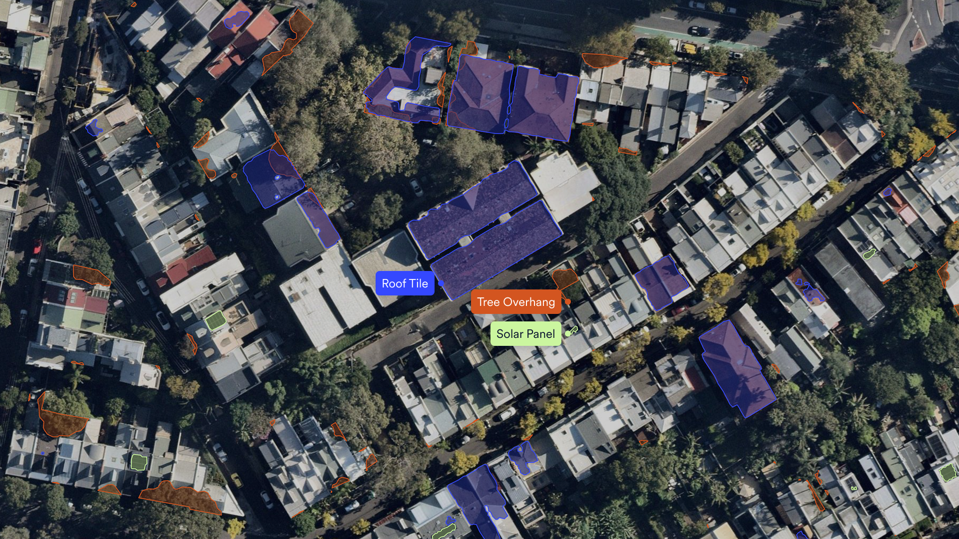
Where the data does its work
)
Select risk based on what’s actually there
Risk selection is only as precise as the property data behind it. When that data leans on customer disclosure or inputs that don’t reflect what’s currently there, adverse risk selection and underinsurance follow. Current, imagery-verified evidence gives underwriters confidence at new business, at renewal, and throughout the policy term.
Get ahead of catastrophe season
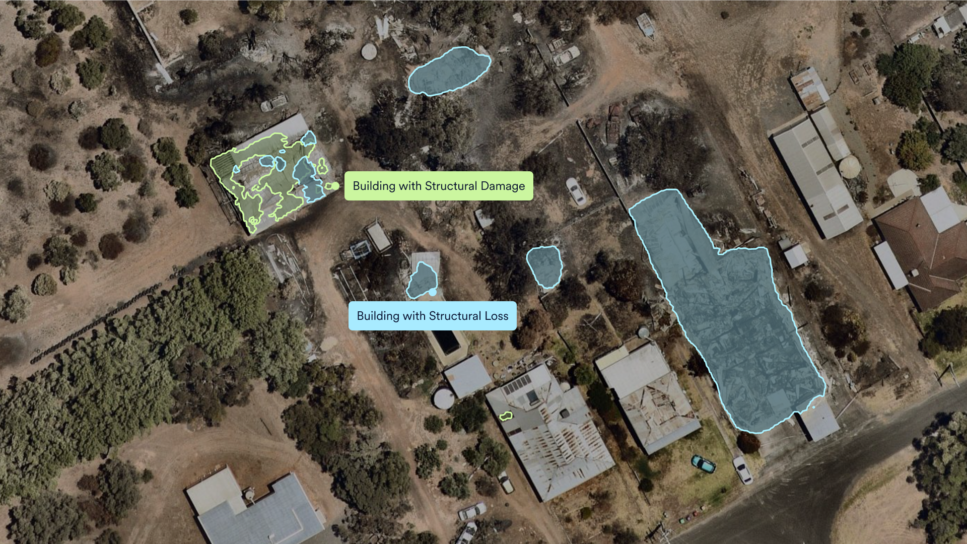
Before and after fire damage
Natimuk, VIC
Across the lifecycle, make informed decisions
Attributes describe the condition, while condition describes the risk

Sharpen your loss ratio
Accurate, current property intelligence across the entire policy lifecycle means a healthier portfolio, fewer avoidable losses, and stronger customer retention.

Settle claims faster
Understand exposure quickly, make fast and defensible decisions, and ensure accurate payouts.

Build customer confidence
Reduce friction at every touchpoint: pre-filled attributes at quote, no surprises at renewal, faster triage at claim time.
Our property intelligence. Your workflows.
Data & Imagery API
Seamless integration with policy and claim workflows.
Analytics UI
Purpose-built UI for underwriting, claims, and CAT response.
Single Sign-On (SSO)
Simplified user experience and access control.
Partner integration
Pre-built integrations with insurance partners including EWN and Weatherwatch, with more available.
External data warehouse
Complete portfolio analysis.
PDF reports
Download property insights reports in seconds.
Let's have a conversation
We’re the only ANZ provider with full ownership of every link in the chain: camera systems, capture programme, AI, and data delivery. All built and operated in-house. That ownership is what keeps the data consistent across the country, refreshed on a program we control, and aligned to a single attribute taxonomy. No third-party imagery dependency. Our team is ready to chat.
“Nearmap imagery is one source of truth that allows us to understand many attributes about a property that standard data sources may not catch. Recent imagery from Nearmap allows us to review the insights against the analytics and truly understand the property's condition.”
Kin Insurance — SVP, Data and Analytics
“We learned so much about our policies and were able to improve the overall book of business through that imagery.”
Rockford Mutual — President / CEO
“We can look at different time frames and verify whether a loss occurred on a roof during the Frederick Mutual policy term. In other cases, we can isolate a claim that happened during a catastrophic event which may become part of the CAT event reporting and recovery process.”
Frederick Mutual — CEO