Nearmap Announces Agreement to Acquire Betterview

Learn More
X
Nearmap aerial map images TV commercial - The Most Intelligent Aerial Map on Earth
Industries

Up-To-Date Location Intelligence as a Service

From landscaping to advanced telecommunications to commercial solar, recent maps power today’s industry and bring future projects to life. Because the truth is in the detail.

Aerial Imagery: The New Business Intelligence

Aerial imagery used to be the stock and trade of a small cadre of geospatial data specialists. But now, all businesses can leverage accurate location data that's far more detailed and up-to-date than current satellite imagery. 

Government

Inspect or assess properties remotely, formulate emergency response plans, visualise urban change over time, plan and monitor large infrastructure projects, and promote transparency to ensure community buy-in for public works projects and other initiatives.

aerial, road, development, transport, Bennett Springs, WA, 2019 May 2 Highway Development Bennett Springs

Government

Inspect or assess properties remotely, formulate emergency response plans, visualise urban change over time, plan and monitor large infrastructure projects, and promote transparency to ensure community buy-in for public works projects and other initiatives.

aerial, industries, insurance, Goodna, QLD, 2011 January 13 Flood Damage Goodna QLD

Insurance & Financial Services

Verify data remotely to resolve customer inquiries in real time, provide stakeholders with clear aerial photos referenced by exact date and geolocation, or review historical imagery over time to gauge risk, price policies, and investigate possible fraud.


Property & Real Estate

Inspect properties in detail, and educate the customer with clear, beautiful imagery. Visualise in 3D, and demonstrate location context by measuring  distances to nearby schools, parks, transit hubs, police stations, and shopping centers.

Architecture, Engineering & Construction

Conduct thorough virtual site surveys so you can compare before and after images for critical events, anticipate safety equipment needs, estimate materials requirements, plan heavy vehicle access points, and determine crane clearance requirements.

aerial, bridge, construction, Western Australia, 2018 September 19 Bridge Construction Western Australia
aerial, property, roofing, Farrer, ACT, 2019 May 17 Urban Property Farrer ACT

Property & Real Estate

Inspect properties in detail, and educate the customer with clear, beautiful imagery. Visualise in 3D, and demonstrate location context by measuring  distances to nearby schools, parks, transit hubs, police stations, and shopping centers.

Roofing

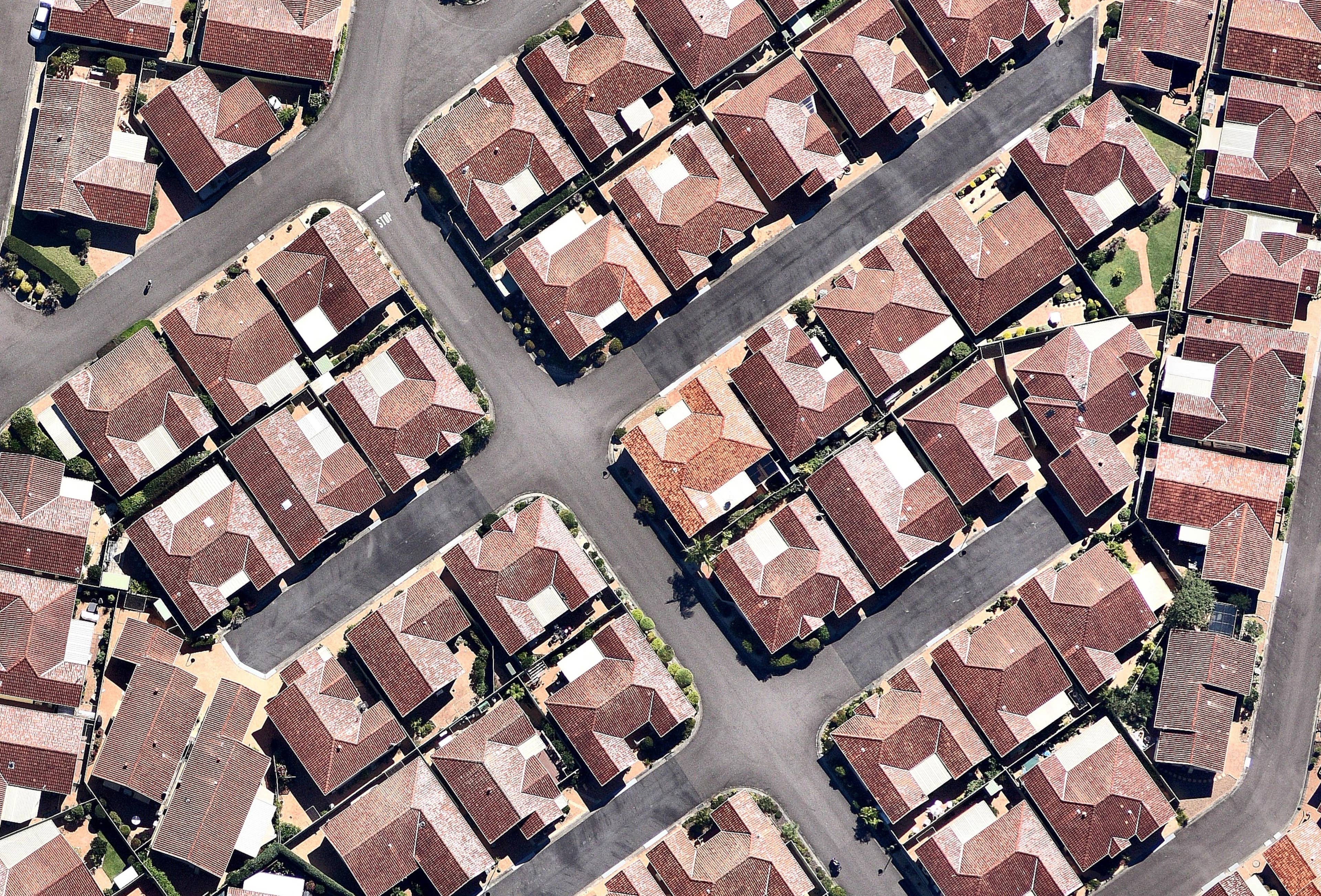
Deliver quotes with greater speed and accuracy by measuring roof pitch, roof area, and building heights within minutes. Remotely calculate materials and other costs, and save your team climbing on dangerous or damaged roofs. Verify property details in real time to firmly establish your credibility with the customer.


aerial, roofing, Erina, NSW, 2019 March 31 Property Roofing Erina NSW

Roofing

Deliver quotes with greater speed and accuracy by measuring roof pitch, roof area, and building heights within minutes. Remotely calculate materials and other costs, and save your team climbing on dangerous or damaged roofs. Verify property details in real time to firmly establish your credibility with the customer.


aerial, solar, farm, Canberra, ACT, 2019 March 26 Solar Farm Canberra

Solar

Prospect entire neighbourhoods in minutes, develop breathtaking proposals, and improve your design and implementation process. Inspect current roof conditions and historical shading, and measure roof pitch and area to determine panel requirements.


Utilities

Turn large-scale infrastructure challenges into manageable projects with visual data to conduct accurate risk analysis, plan tower  placement, ensure regulatory compliance, monitor field assets, and keep stakeholders informed during each project stage.


aerial, remote, utilities, Ashendon, WA, 2019 January 27 Remote Utility Ashendon WA

Utilities

Turn large-scale infrastructure challenges into manageable projects with visual data to conduct accurate risk analysis, plan tower  placement, ensure regulatory compliance, monitor field assets, and keep stakeholders informed during each project stage.


aerial, utilities, Acton, ACT, 2018 September 14 5G Line-of-Sight Analysis, Brisbane QLD

Telecommunication

Streamline management of large telecommunications networks. With current, high resolution aerial imagery, you can track assets, allocate your field workforce efficiently, perform detailed viewshed analysis, and plan 5G networks with reliable line of sight data.


Transport & Logistics

Plan and budget efficiently for capital works and maintenance programs with asset maps that are verified and up-to-date. View and inventory equipment remotely. Give staff mobile access to current imagery so they can respond quickly from out in the field.

aerial, transport, roads, Homebush West, NSW, 2019 May 12 Urban Transport Homebush West NSW

Transportation & Logistics

Plan and budget efficiently for capital works and maintenance programs with asset maps that are verified and up-to-date. View and inventory equipment remotely. Give staff mobile access to current imagery so they can respond quickly from out in the field.

Industry vertical aerial of highway intersection at Dundowran, Queensland
Dundowran, QLD, AU

Instant Business Intelligence

Stream high resolution aerial imagery directly to your desktop or mobile device. View and measure with MapBrowser, or integrate with leading GIS or CAD platforms.
eBook: HD Aerial Maps Mean Business View the e-Book