Nearmap Announces Agreement to Acquire Betterview

Learn More
X
Cityworks aerial image waterfront housing Point Piper New South Wales
Technology Partner

Cityworks & Nearmap: Inspect with Confidence

View current details before setting foot on the ground.

Jun 2020 | Point Piper, NSW
Nearmap affords us the ability have a birds-eye view of our city not just once a year, but several times per year, at a resolution that is rarely obtainable within our budget. Going with Nearmap just makes sense for our GIS applications across the organization.
Matthew W. Bradbury, GIS Administrator, City of Redlands, CA

Up-to-date, detailed Nearmap aerial imagery integrates with Cityworks. Give yourself an easier, clearer way to manage public assets, reduce site visits, and plan smarter before sending a crew out in the field. Get the most comprehensive imagery on the market with industry leading GIS enterprise asset management software.

Cityworks aerial vertical of cracked damaged roads in Roselands, New South Wales
Jun 2020 | Roselands, NSW

SEE CRACKS IN THE STREET

There’s no better way to identify basic needs from the air than with stunning high-resolution aerial imagery. Nearmap Vertical imagery can get within 15cm GSD, closer and clearer than more publicly sourced imagery. Streamline your workflow in Cityworks with clarity over roads, assets, buildings, terrain, parks and vegetation, and accurately measuring length, area, and radius. View the details of a city crossroad with manhole covers, hydrants, striping, and signs.
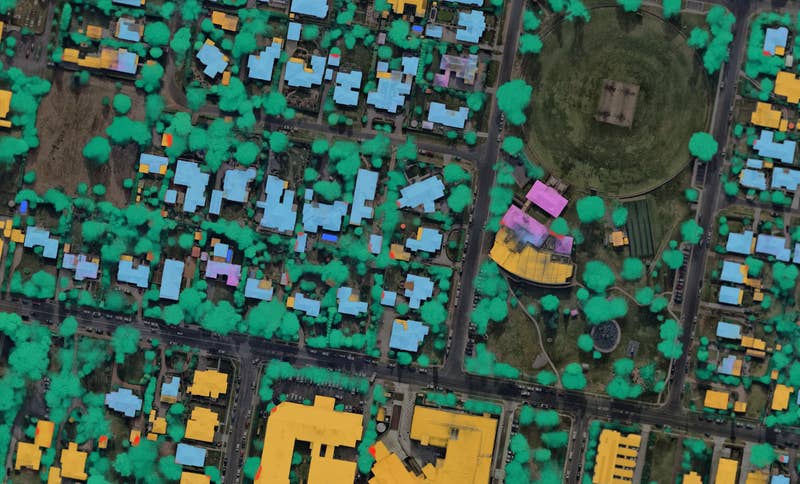
SAVE TIME & IMPROVE PLANNING

“With the rapid expansion in Grand Rapids, Nearmap provides current imagery that allows us to emulate changes of projects and infrastructure while reducing field site visits.” – Angela Doede, Application Administrator, City of Grand Rapids, MI

Cityworks aerial image of urban properties in Brisbane, Queensland
Jul 2020 | Brisbane, QLD

CLEAR, CURRENT IMAGERY YOU CAN TRUST

Start your project with greater confidence knowing you are seeing accurate high-resolution imagery. Nearmap flies over most cities upto 6 times a year. This type of detailed information can improve communication with your team, help you make better decisions, keep project timelines in check and enrich your overall Cityworks experience.