
Introducing Nearmap for Post-catastrophe Response
Post Catastrophe Imagery and AI-derived property damage and condition data unite to help insurers process customer claims more efficiently.
Post Catastrophe Imagery and AI-derived property damage and condition data unite to help insurers process customer claims more efficiently.
More data, more power
High-resolution aerial imagery has given us the ability to model reality in a more cost-effective, efficient way. Our patented camera systems have captured 3D data that is viewable and measurable, in over 99,000 mi2 in the U.S. and nearly 23,000 km2 in Australia. Real-life visualisation is now a reality in mere seconds for planners, engineers, and designers alike.
Previously, 3D data was only available as an offline export. The nature of accessing 3D content became a challenge, available only to those with large budgets, skilled technicians, or robust software licensing. With Nearmap 3D, you have an easy, immediate, relatively affordable channel to incorporate 3D into your workflows.
Today’s aerial maps have evolved into full-blown analytics platforms, helping transform the way many industries work. Just as technology evolves to give us new ways to see the world around us, aerial imagery is evolving to help solve some pretty big challenges such as 5G implementation. How? By giving us a way to see truth on the ground, as it really exists.
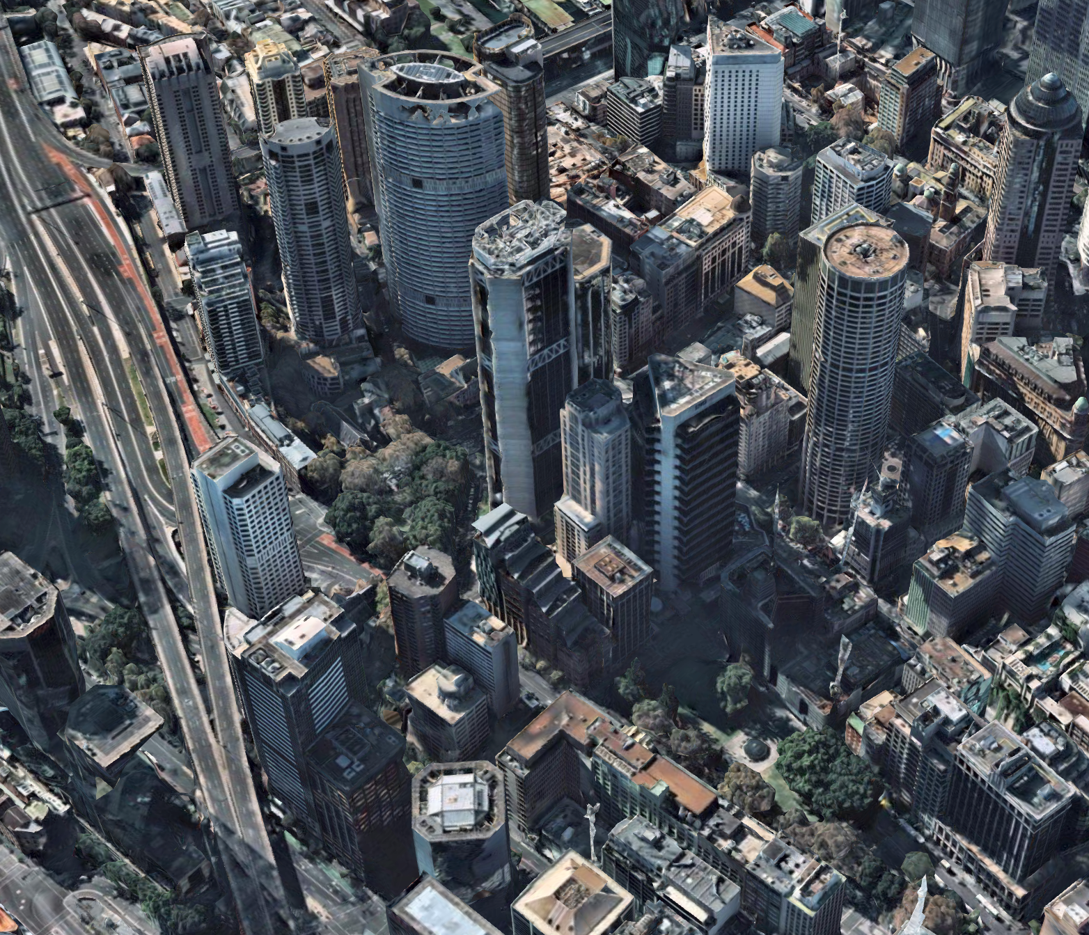
Sydney, NSW
The power of 3D data
If you know anything about the gaming industry, you know that a big draw for its popularity is the ability to immerse yourself into the environment. Creating a virtual reality in which to play in—and now to design in—offers an entirely new way to look at an environment and solve real world problems.
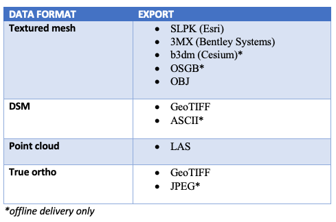
Nearmap’s patented camera systems capture each point on the ground several times, generating extraordinarily rich data sets. That data is then fed into our proprietary processing software which produces a comprehensive, up-to-date 3D representation and rich location intelligence. Online access to these images offers users the ability to personalise their export of 3D data for easy integration into the platform of their choice. The variety of file formats available allows for easy visualisation for inspecting, measuring, and exporting in the following formats.
What sets Nearmap 3D apart from other imagery providers is you can define down to the foot what type of 3D content you want to export. Draw your area of interest in any polygon shape you wish, down to a specific block or landscape feature—an adaptable solution to help you save time and increase flexibility.
Model reality to solve real-world problems
Having the enhanced ability to visualise a project gives you a chance to imagine a variety of possibilities. When combined with GIS systems such as Esri, Autodesk, Bentley, and others, Nearmap’s photorealistic 3D location intelligence is transforming how industries work to address challenges large and small. So how can our 3D imagery offer solutions to real problems?
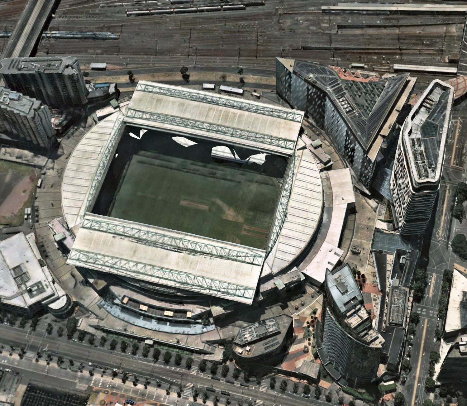
Melbourne, VIC
Instant access = immediate benefits
Now that 3D content is instantly accessible online, the benefits of how it can be used can be applied immediately.
As a cost-effective, efficient way to visualise the future, Nearmap 3D gives you a new portal to imagine possibilities. The power to visualise your project is in your hands on a whole new level. Go further faster with instant access to immersive Nearmap 3D.
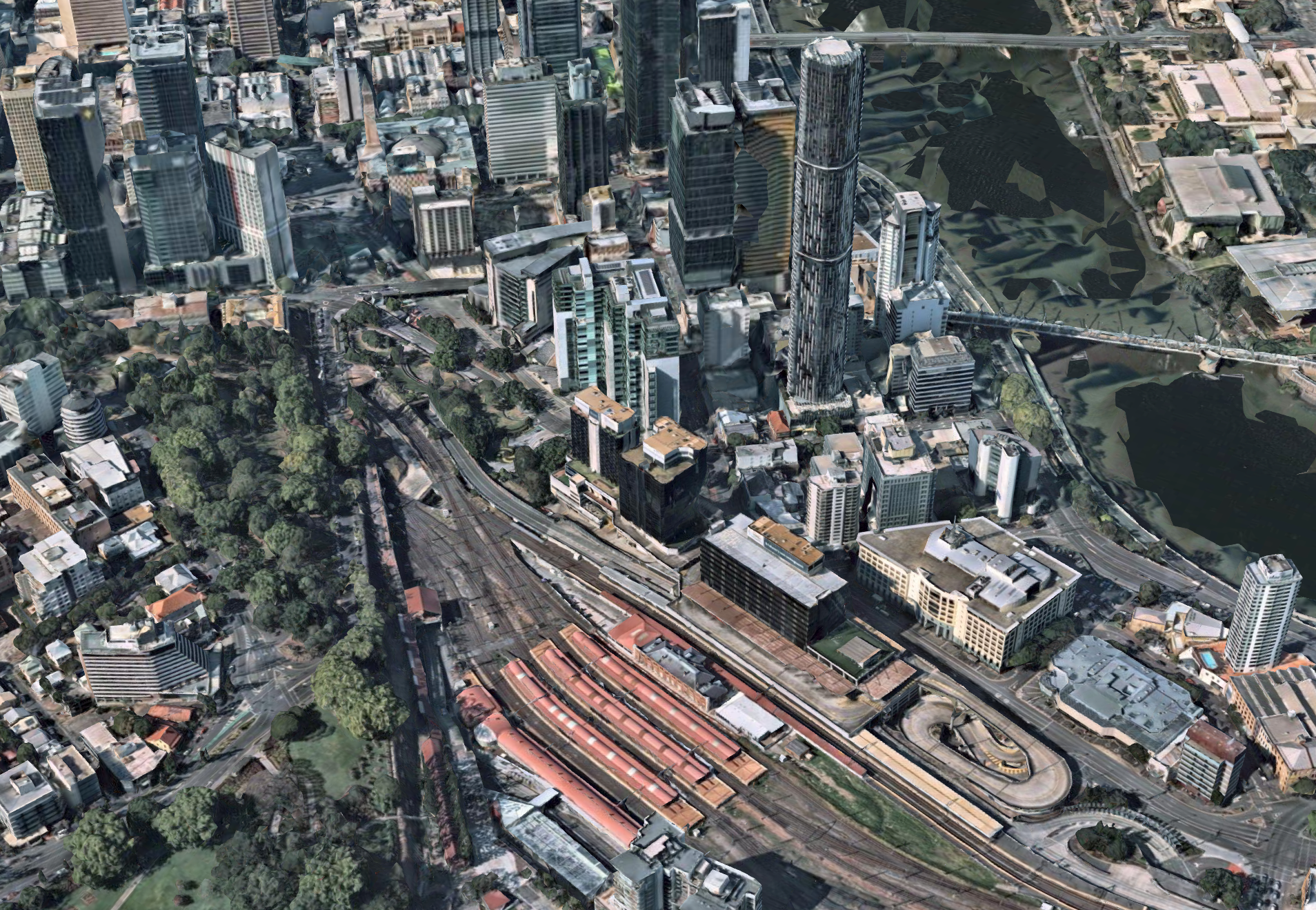
Brisbane, QLD
