
Introducing Nearmap for Post-catastrophe Response
Post Catastrophe Imagery and AI-derived property damage and condition data unite to help insurers process customer claims more efficiently.
Post Catastrophe Imagery and AI-derived property damage and condition data unite to help insurers process customer claims more efficiently.
When it comes to urban planning, questions abound regarding the impact of change on an environment. What will the wear and tear on streets be like? Will line markings and crosswalks need to be repainted? What about soil erosion? Is the impact of construction going to negatively affect the local vegetation? What about the repercussions or long-term impact to animal life?
Local cities, construction companies, environmentalists and engineers are left with one big question: How do I strike a balance? Insurance companies especially want to assess the impact these changes have on home values and risk.
It all comes down to planning - better planning helps mitigate some of the major issues mentioned above. Discovering how to improve streamlining a project revolves around planning as you take into consideration how to manage change, reduce friction, and reserve resources. Estimating the level of effort, the time involved, and notifying taxpayers can all be more efficiently done with better planning.
Aerial imagery is a beneficial and highly sought-after resource to help in urban planning. And now there’s additional data you can derive from aerial imagery thanks to a groundbreaking achievement by Nearmap: Artificial Intelligence (AI). Nearmap data scientists have discovered a way to classify buildings, trees, pools and construction sites and instantly visualise them as data layers on crystal clear maps. Replete with tools for measurement, search and location identification, this newfound intelligence is helping cities dramatically improve their planning processes. It’s helping construction companies work in concert with a vast ecosystem of architects, engineers, utilities, telco and city planners to manage these projects with dispatch. Compliance professionals can visualise site plans to assess where or not they meet code. Safety experts have current, HD photography to do their jobs. And Insurers are taking appraisal, underwriting and claims management to an all-time high.
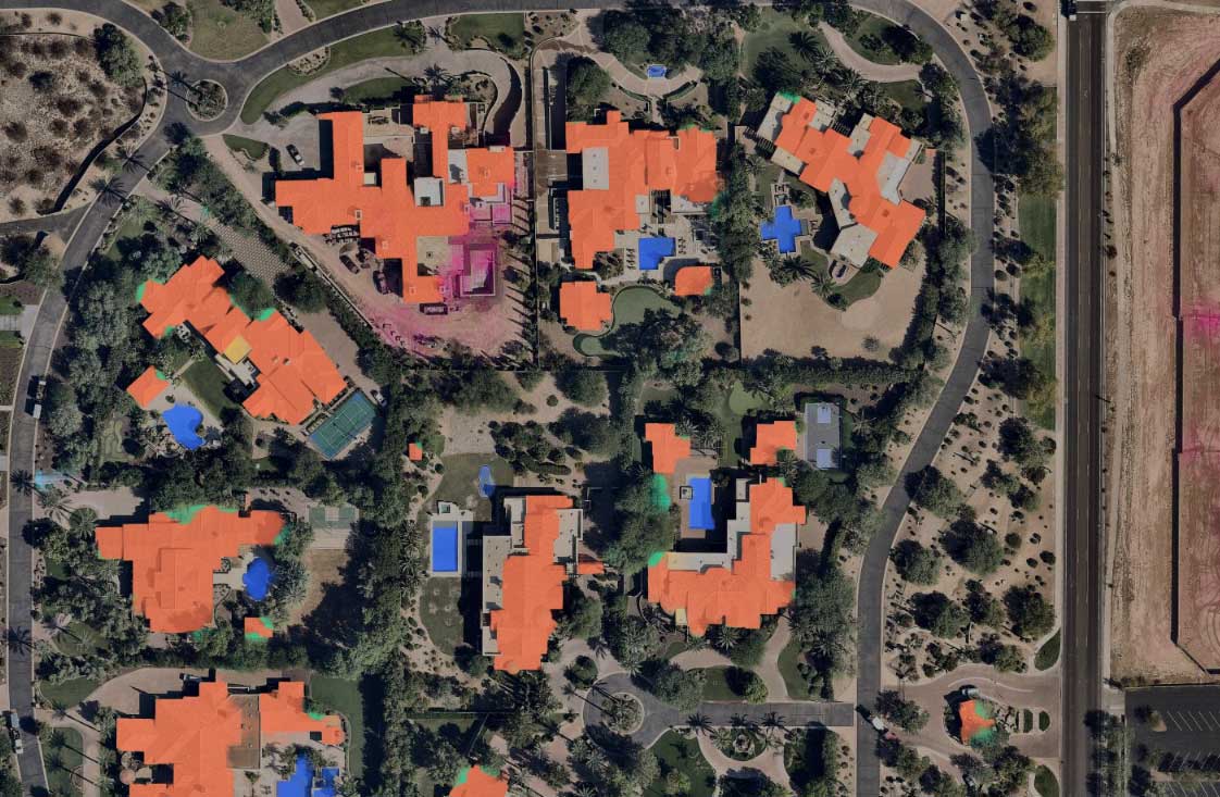
Below is a recent aerial map of Scottsdale, Arizona, and the first thing you’ll notice is a variety of colours dotting the image. The different colours mark common features such as tree overhang (in green), construction sites (magenta), swimming pools (in blue), tile roofs (orange), shingle roofs (light blue), metal roofs (yellow), and solar panels (in red). This quick visualisation of this area is all made possible through Nearmap’s blending of aerial maps with scalable location data science. It helps instantly identify structures, vegetation, and more in less than 10 seconds.
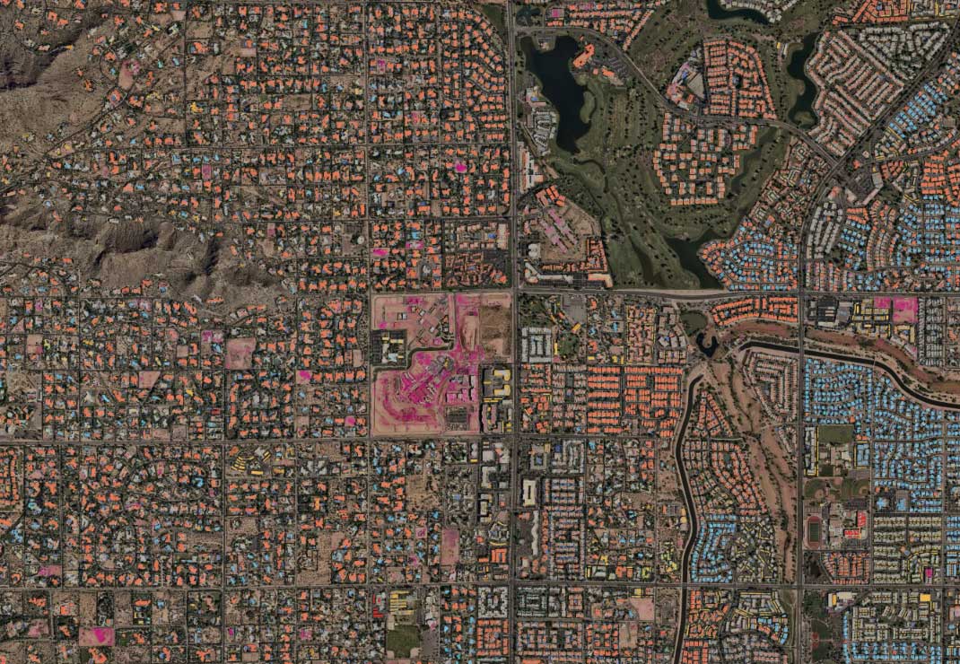
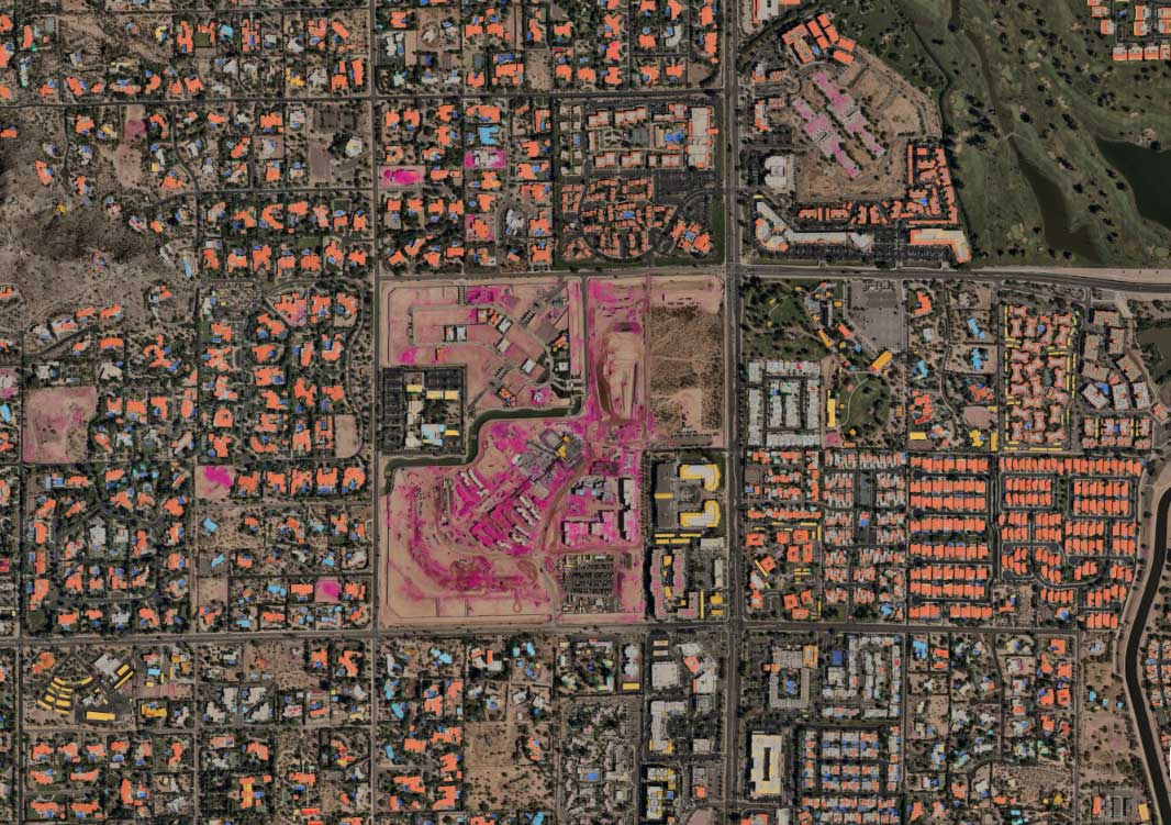
As you start to zoom in closer on the selected location, the image becomes more precise and the AI begins to pop.
 <>
<>
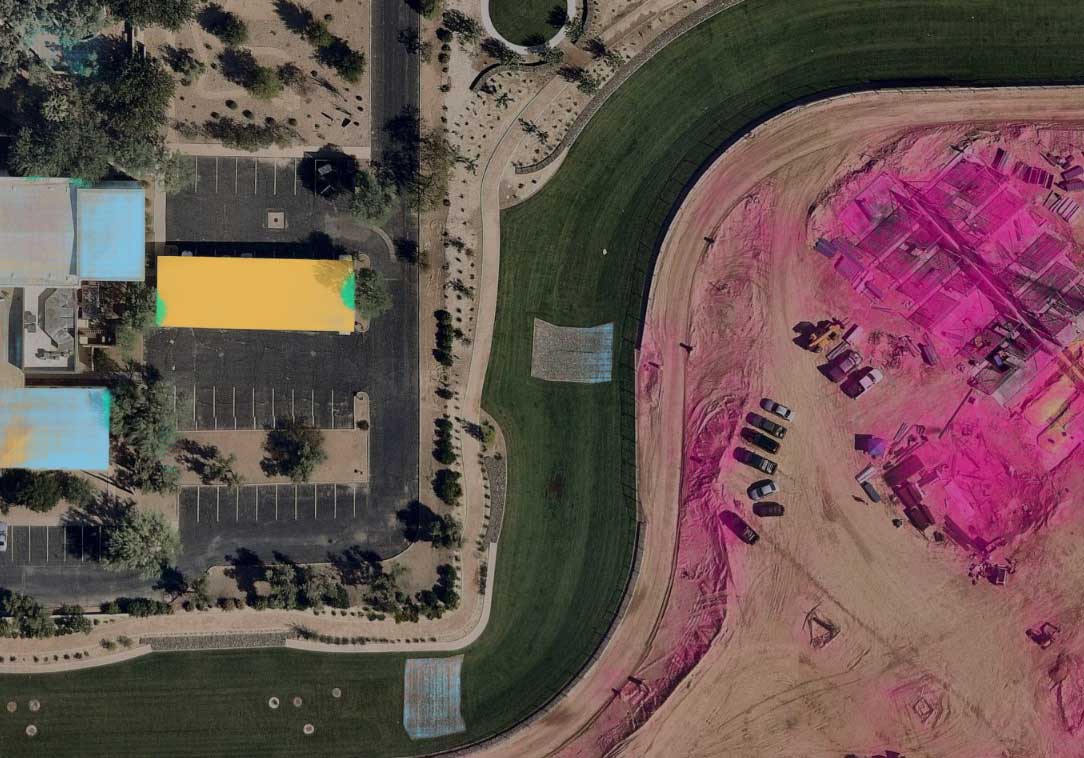
In the selected area below, end users can measure specific areas such as the construction site identified in magenta. Notice there are other identified construction sites that also dot the landscape.
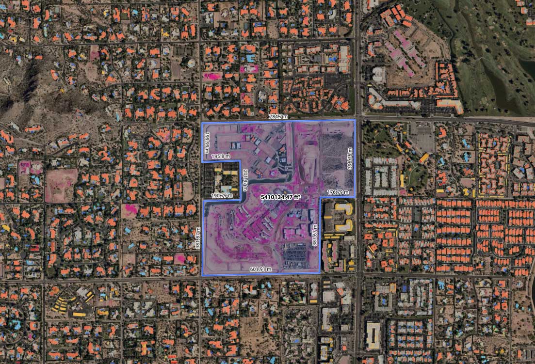
City planners and environmentalists can measure the surrounding area impacted by the construction. They can customise their area measurement in a variety of ways to help better understand the full scale of environmental impact.
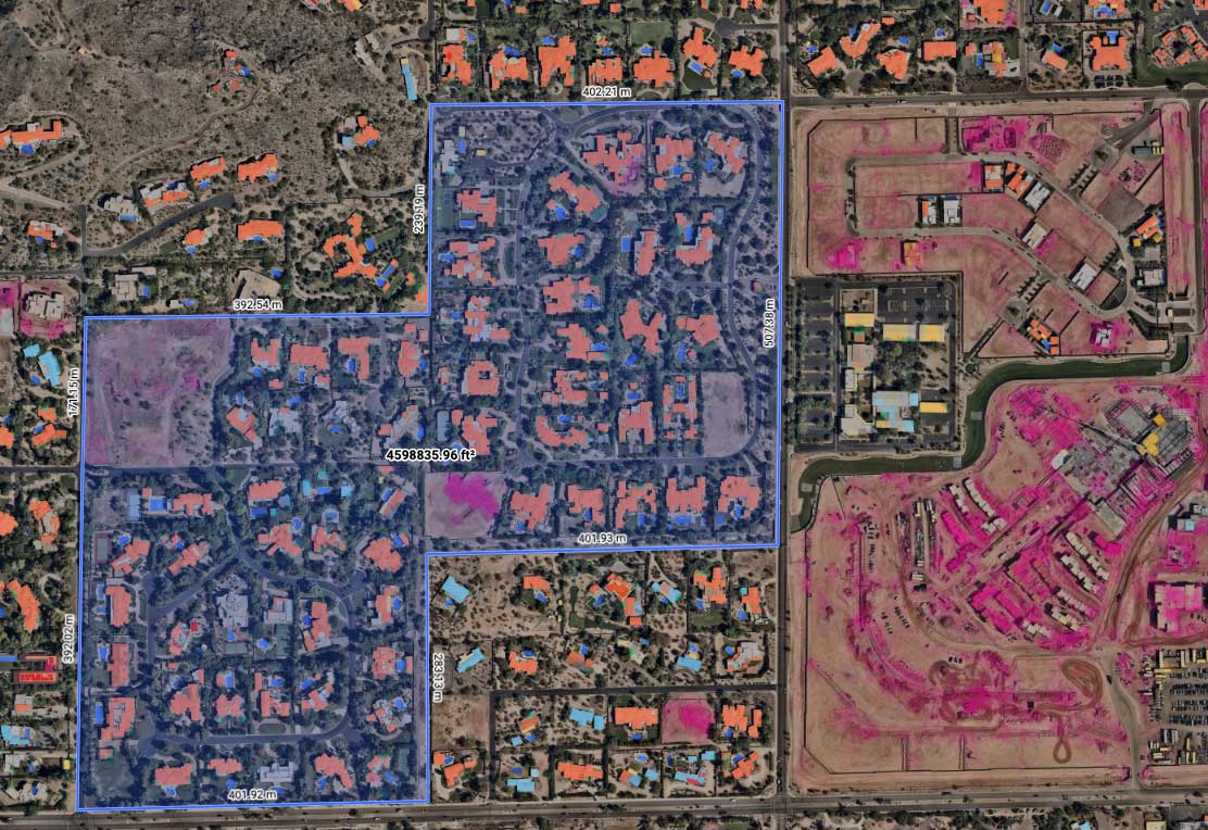
Zoom in even further and road detail, pools, and buildings with solar panels start to come in even greater focus. Some of these identified features may or may not be affected by the construction that is occurring at that location, but unless you have the location data to review it, how could you ever take it into consideration?
A quick pan around the area shows the line of demarcation between construction and green grass. It shows the drainage in the center of the grass and no sign of disturbance from the construction.
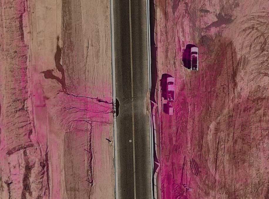
Upon even closer inspection, a water issue is easily and quickly identified. Run-off from the construction site is bleeding onto the road, pooling heavily on the left side with additional impact on the right side of the street.
In a matter of minutes, the use of aerial maps and AI have provided a planner or project manager the ability to quickly size up a site, assess the impact (some good, some bad) and better manage the project. Rich, data-driven insights are at your fingertips and ready to use. High-resolution aerial imagery captures blended with data science can give you—and your stakeholders—the ability to plan, communicate, assess and manage risk.
