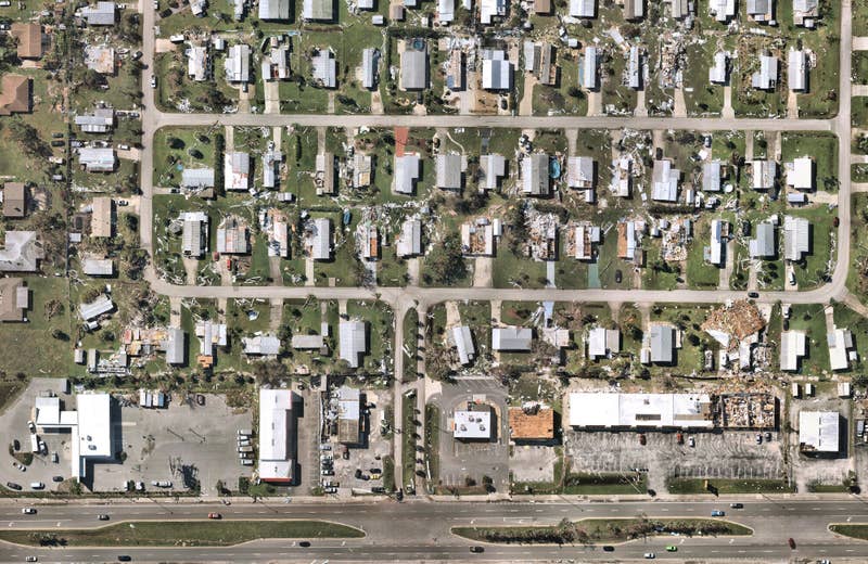
Introducing: Nearmap for Post-catastrophe Response
Post-catastrophe imagery and AI-derived property damage and condition data unite to help insurers process customer claims more efficiently.

Post-catastrophe imagery and AI-derived property damage and condition data unite to help insurers process customer claims more efficiently.
Since our 2007 founding in Perth, Australia, Nearmap has evolved from a small online startup to become a next-gen digital content leader and aerial technology company. We offer businesses instant access to high-resolution aerial imagery, city-scale 3D datasets, and integrated geospatial tools.
Every day, Nearmap helps thousands of users conduct virtual site visits for deep, data-driven insights — enabling informed decisions, streamlined operations, and significant cost savings.
Nearmap was founded with one goal: to empower all kinds of businesses and organizations, no matter what size or industry, with reliable aerial data. Up-to-date, richly detailed location information powers projects for our customers across the globe. If we can change the way people view the world, they can profoundly change the way they work.
Whether you’re an individual or an international brand, a GIS engineer or a construction project manager, we believe you should have access to high quality, beautiful, easy-to-use aerial imagery.
We publish fresh imagery of our coverage areas in the cloud multiple times each year, so you always have a current view of what’s really on the ground.
We're continually capturing aerial data across the country. View multiple sites in reliably spectacular detail, across major urban and regional areas.
Our cloud-based subscription model means you can access our imagery, along with a full suite of web browser measurement and analysis tools – or integrate with leading GIS and CAD platforms.
We are one of the ten largest aerial survey companies in the world by annual data collection volume, and we offer unprecedented access to detailed visualizations that tell stories through context.
Our searchable, imagery archive enables you to view multiple captures for your locations of interest, conduct side-by-side image analysis, and perform advanced change detection.

